|
|
|
|
|

|
Mirrabooka Avenue, Gnangara Road, Wanneroo Road & Whitfords Avenue (State Route 83) |
Statistics:
Route Numbering:


General Information:
State Route 83 is a major connector route in Perth's northern suburbs, especially for the suburbs at its eastern end. It provides a direct connection to several main roads leading to Perth's CBD and also the Mitchell Fwy (SR2), the main north-south route in Perth.
The route contains a mix of 2 lane and 4 lane divided roadway, and passes through farming, residential, industrial, commercial and bushland areas.
Multiplexes along the route include:
History:

Click here for the former alignment between Landsdale and West Swan
| Landsdale to Padbury | Padbury to Landsdale | |||
| Preview: | Description: | Preview: | Description: | |
 |
Trailblazer Assembly: Trailblazer as you approach the intersection with Wanneroo Rd (SR60) at Madeley, April 2016. The trailblazer is incorrect. The top should be a right arrow. Image © Paul Rands |
 |
Intersection Directional Sign: ID sign on Whitfords Av (SR83) at Craigie at the Mitchell Fwy (SR2) interchange, April 2016. Image © Paul Rands |
|
 |
Intersection Directional Sign: ID sign facing Gnangara Road on the Wanneroo Road intersection at Madeley, November 2008. Image © Paul Rands |
 |
Trailblazer Assembly: Trailblazer as you approach the intersection with Wanneroo Rd (SR60) at Woodvale, April 2016. The trailblazer is incorrect. The top should show SR60 and the 'End' plate should be a right arrow. Image © Paul Rands |
|
 |
Intersection Directional Sign: Westbound where Gnangara Road meets Wanneroo Rd (SR60), April 2016. Though not shown, SR83 duplexes SR60 and turns right here continues for 400 metres from this point to the Whitfords Avenue intersection at Kingsley. Click here for a photo of this location by Paul Rands from November 2008. Image © Paul Rands |
 |
Intersection Directional Sign: Northbound ID sign on Wanneroo Road (SR60) at Kingsley. This is where SR83 begins to duplex SR60 for 400m. February 2009. Image © Paul Rands |
|
 |
Whitfords Avenue: Wanneroo Rd (SR60 / SR83) at the junction with Whitfords Av (SR83) at Kingsley, April 2016. SR83 turns left here. Image © Paul Rands |
 |
Trailblazer: SR83 trailblazer under a tree as you head east on Gnangara Rd (SR83) at Madeley. February 2009. Image © Paul Rands |
|
 |
Intersection Directional Sign: ID sign on Whitfords Av (SR83) at Kingsley at the Mitchell Fwy (SR2) interchange, April 2016. Image © Paul Rands |
 |
Approaching Hartman Drive: Approaching the roundabout with Hartman Drive in Wangara, February 2009. Image © Paul Rands |
|
 |
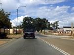
Whitfords Avenue: Typical road conditions of Whitfords Avenue as it passes through Kingsley, November 2008. Image © Paul Rands |
 |
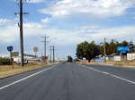
Wangara: SR83 as it passes through the Wangara area. February 2009. Image © Paul Rands |
|
 |
Approaching Kingsley Drive: Westbound on Whitfords Av approaching Kingsley Dr at Kingsley, November 2008. Image © Paul Rands |
|||
 |
Freeway Green Phohibition Sign: Freeway green coloured freeway prohibition sign on Whitfords Av at Kingsley approaching Mitchell Fwy (SR2), November 2008. Image © Paul Rands |
|||
 |
Mitchell Fwy Interchange: Freeway green ID sign on the southbound ramp to the Mitchell Freeway near Whitfords Station at Kingsley, November 2008. Image © Paul Rands |
|||
 |
End SR83: Westbound trailblazer assembly approaching Marmion Avenue (SR71) at Padbury, indicating the end of State Route 83, November 2008. Image © Paul Rands |
|||
1 Main Roads Metropolitan Road Fact Sheet, 30 March 2008
2 City of Joondalup
3 Main Roads Western Australia
Last updated: 16-Jan-2019 19:24
This site © Paul Rands. All rights reserved. Some portions © (copyright) by their respective and credited owners. Permission must be obtained before using any images from this site. For details, please email by clicking here.