|
|
 |
Intersection Directional Sign:
ID sign on West Swan Road at the Gnangara Road intersection at Henley
Brook. This is the eastern terminus of SR83. November 2008.
Image © Paul Rands
|
|
 |
Incorrect Trailblazer:
Incorrect trailblazer on Gnangara Rd (SR83) after the junction with Beechboro Road North (SR53) at Lexia, June 2009.
Image © Paul Rands
|
 |
Henley Brook / Ellenbrook Area:
Westbound along Gnangara Road. Henley Brook is on the left of the
roadway and Ellenbrook on the right. Note the road reservation on the
right, ready for duplication of the route when required. November 2008.
Image © Paul Rands
|
|
 |
Advance Directional Sign:
AD sign at Lexia approaching the entrance to Whiteman Park, June 2009.
Image © Paul Rands
|
 |
Henley Brook / Ellenbrook Area:
Westbound along Gnangara Road. Henley Brook is on the left of the
roadway and Ellenbrook on the right. Note the road reservation on the
right, ready for duplication of the route when required. November 2008.
Image © Paul Rands
|
|
 |
Approaching Gaskell Road:
Gnangara Rd (SR83) at Lexia approaching Gaskell Rd, June 2009.
Image © Paul Rands
|
 |
Approaching Lord Street &
Pinaster Parade:
Warning sign approaching the Lord Street / Pinaster Parade roundabout
at Henley Brook. The proposed Perth-Darwin Highway will pass just west
of this intersection. November 2008.
Image © Paul Rands
|
|
 |
Aircraft Noise Area Sign:
RAAF Base Pearce Aircraft Noise Area sign at Lexia, June 2009.
Image © Paul Rands
|
 |
Trailblazer Assembly:
Trailblazer as you approach the intersection with Beechboro Road North
(SR53) at Whiteman, November 2008.
Image © Paul Rands
|
|
 |
Approaching Drumpellier Drive:
Gnangara Rd (SR83) at Lexia approaching Drumpellier Dr, June 2009.
Image © Paul Rands
|
 |
Trailblazer Assembly:
Trailblazer as you approach the intersection with Alexander Drive
(SR56) at Landsdale, November 2008.
Image © Paul Rands
|
|
 |
Approaching Lord Street & Pinaster Road:
Gnangara Rd (SR83) at Ellenbrook approaching Lord St & Pinaster Rd, June 2009.
Image © Paul Rands
|
 |
Approaching Alexander Drive:
Warning signs for the signalised intersection with Alexander Drive at
Landsdale, November 2008.
Image © Paul Rands
|
|
 |
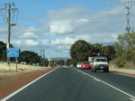
Ellenbrook:
Gnangara Rd (SR83) in the Ellenbrook area, June 2009.
Image © Paul Rands
|
 |
Alexander Drive Intersection:
Westbound through the Alexander Drive junction at Landsdale, November
2008.
Image © Paul Rands
|
|
 |
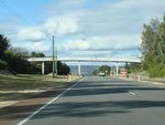
Entering Swan Valley:
Entering the Swan Valley tourism region at Henley Brook, June 2009.
Image © Paul Rands
|
| |
|
|
 |
End State Route 83:
End SR83, at the junction with West Swan Rd (SR52 / TD203) and Henry St at Henley Brook, June 2009.
Image © Paul Rands
|
| |
|
|
 |
Intersection Directional Sign:
ID sign at the junction with West Swan Rd (SR52 / TD203) and Henry St at Henley Brook, June 2009.
Image © Paul Rands
|
