|
|
|
|
|
 |
Coolgardie-Esperance Highway, South Coast Highway, Chester Pass Road, South Western Highway, Robertson Drive, Forrest Highway, Old Coast Road, Mandurah Road, Ennis Avenue, Patterson Road, Rockingham Road, Stock Road, Leach Highway, Kwinana Freeway, Canning Highway, Great Eastern Highway, Great Eastern Highway Bypass, Roe Highway, Great Northern Highway, Brand Highway & North West Coastal Highway (National Route 1) - Walpole to Manjimup |
Statistics:
Route Numbering:


General Information:
National Route 1 is a major route in WA.
The route varies in form from multi-laned arterial road, suburban road, to single carriageway rural highway. It passes through commercial, industrial, residential and agricultural land, and also through state forest and conservation areas.
Click here for photos of the former alignment in the Manjimup area.
| Manjimup to Walpole | Walpole to Manjimup | |||
| Preview: | Description: | Preview: | Description: | |
 |
Supplemental AD Sign: Southbound advance directional sign for the town of Manjimup, February 2008. Image © Paul Rands |
 |
Advance Directional Sign: AD sign at Shannon approaching Middleton Rd (SR10), April 2011. Image © Peter Renshaw |
|
 |
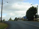
Entering Manjimup: Southbound as you enter Manjimup. February 2008. Image © Paul Rands |
 |
Intersection Directional Sign: ID sign assembly facing Middleton Rd (SR10) at Shannon, September 2008. Image © Paul Rands |
|
 |
Advance Directional Sign & Timber Arch: Southbound entering Manjimup, February 2008. Image © Paul Rands |
 |
Distance Sign: RD sign located after the Middleton Rd intersection in Shannon, April 2011. Click here for a photo of the old version of this sign from September 2008. Image © Peter Renshaw |
|
 |
Directional Sign: Fingerboard assembly on the corner of Graphite and Perup Roads in Manjimup, February 2008. Image © Paul Rands |
 |
Trailblazer: National Route 1 trailblazer in the Shannon area, April 2011. Image © Peter Renshaw |
|
 |
Southbound in Manjimup: Southbound near the Blechynden Street intersection, February 2008. Image © Paul Rands |
 |
Services Sign: Services sign assembly at Quinninup, 1 km south of Wheatley Coast Rd (TD259), September 2008. Image © Paul Rands |
|
 |
Approaching Town Centre Access Road: Southbound approaching the access road to the Manijumup town centre, February 2008. Image © Paul Rands |
 |
Warning Sign: Typical WA warning sign and road name blade assembly as you approach Wheatley Coast Rd in Quinninup, September 2008. Image © Paul Rands |
|
_sr102.jpg) |
Advance Directional Sign: Southbound AD sign as you approach the Muirs Hwy (SR102) intersection in Manjimup, February 2008. Note the missing NR1 shield. Image © Paul Rands |
 |
Advance Directional Sign: AD sign approaching the Wheatley Coast Rd intersection at Quinninup, April 2011. Image © Peter Renshaw |
|
 |
Distance Sign: Southbound RD sign as you leave Manjimup, February 2008. Image © Paul Rands |
 |
Wheatley Coast Road Intersection: Corner of South Western Hwy and Wheatley Coast Rd in Quinninup, Septemer 2008. Image © Paul Rands |
|
 |
Timber Arch: Southern timber arch over the South Western Highway at Manjimup as you approach the intersection with Franklin Street. February 2008. Image © Paul Rands |
 |
Warren River: South Western Hwy as it crosses the Warren River at Quinninup via Rooneys Bridge, September 2008. Image © Paul Rands |
|
 |
AD Sign: Advance directional sign approaching Vasse Hwy at Smith Brook. September 2008. Image © Paul Rands |
 |
Advance Directional Sign: AD sign approaching the unnumbered section of Vasse Hwy at Smith Brook, April 2011. Click here for a photo of the previous version of this sign from September 2008. Image © Peter Renshaw |
|
 |
Vasse Hwy Intersection: Southbound at the junction with Vasse Hwy at Smith Brook. September 2008. Image © Paul Rands |
 |
Vasse Hwy Intersection: South Western Hwy as it approaches the Vasse Hwy intersection at Smith Brook, September 2008. Image © Paul Rands |
|
 |
Distance Sign: Southbound RD sign after the Vasse Hwy intersection at Smith Brook, April 2011. Click here for a photo of the old version of this sign from September 2008. Image © Peter Renshaw |
 |
Advance Directional Sign: AD sign on Vasse Hwy at Smith Brook approaching South Western Hwy (NR1), April 2011. Image © Peter Renshaw |
|
 |
Logging Trucks Warning Sign: Large sign at Smith Brook, warning of the presence of logging trucks along NR1 for the next 100 km, September 2008. Image © Paul Rands |
 |
Distance Sign: RD sign after the Vasse Hwy intersection at Smith Brook, September 2008. Image © Paul Rands |
|
 |
Warren River: South Western Hwy as it crosses the Warren River at Quinninup via Rooneys Bridge, September 2009. Image © Paul Rands |
 |
Advance Directional Sign: Large diagrammatic sign near Manjimup, showing the layout and access points to the Manjimup town centre, which bypassed by the South Western Hwy. September 2008. Image © Paul Rands |
|
 |
Approaching Wheatley Coast Road: Southbound warning sign for the Wheatly Coast Rd (TD259) junction at Quinninup, September 2008. Image © Paul Rands |
 |
Timber Arch: Entering the town of Manjimup. September 2008. Image © Paul Rands |
|
 |
Advance Directional Sign: Southbound AD sign for the Wheatly Coast Rd (TD259) junction at Quinninup, September 2008. Image © Paul Rands |
 |
Advance Directional Sign: AD sign approaching the roundabout with Muirs Hwy (SR102) in Manjimup. September 2008. Image © Paul Rands |
|
 |
Approaching Deeside Coast Road: South Western Hwy (NR1) approaching Deeside Coast Rd at Shannon, September 2009 Image © Paul Rands |
 |
Intersection Directional Sign: ID sign on the roundabout with Muirs Hwy (SR102) in Manjimup. September 2008. Image © Paul Rands |
|
 |
Advance Directional Sign: AD sign at Shannon approaching Middleton Rd (SR10), September 2009 Image © Paul Rands |
 |
Manjimup: South Western Hwy as it skirts around the shopping precinct of Manjimup, September 2008. Image © Paul Rands |
|
 |
Approaching Middleton Road: South Western Hwy (NR1) as it approaches Middleton Rd (SR10) at Shannon, September 2009 Image © Paul Rands |
 |
Approaching Ralston Street: South Western Hwy as it approaches Ralston Street in Manjimup, September 2008. Image © Paul Rands |
|
 |
Distance Sign: Reassurance directional sign on South Western Hwy (NR1) after the Middleton Rd (SR10) junction at Shannon, April 2011. Image © Peter Renshaw |
 |
Timber Arch: Leaving the town of Manjimup. September 2008. Image © Paul Rands |
|
 |
Shannon River: South Western Hwy (NR1) as it crosses the Shannon River at Shannon, September 2009 Image © Paul Rands |
|||
 |
Entering Shannon: South Western Hwy (NR1) as it enters the town of Shannon, September 2009 Image © Paul Rands |
|||
 |
Shannon National Park: South Western Hwy (NR1) at the entrance to Shannon National Park, September 2009 Image © Paul Rands |
|||
 |
Dog Road: Corner of South Western Hwy (NR1) and Dog Rd at Shannon, September 2009 Image © Paul Rands |
|||
 |
Approaching Martin Road: South Western Hwy (NR1) approaching Martin Rd in Shannon, September 2009 Image © Paul Rands |
|||
 |
Approaching Preston Road: South Western Hwy (NR1) as it approaches Preston Rd at North Walpole, September 2009 Image © Paul Rands |
|||
 |
Approaching Beardmore Road: South Western Hwy (NR1) at North Walpole, approaching Beardmore Rd, September 2009 Image © Paul Rands |
|||
 |
Beardmore Road: Intersection directional sign assembly at the Beardmore Rd intersection at North Walpole, September 2009 Image © Paul Rands |
|||
 |
Approaching Broke Inlet Road: South Western Hwy (NR1) approaching Broke Inlet Rd at North Walpole, September 2009 Image © Paul Rands |
|||
 |
Inlet River: South Western Hwy (NR1) as it crosses Inlet River at North Walpole, September 2009 Image © Paul Rands |
|||
 |
Entering Crystal Springs: South Western Hwy (NR1) as it enters the town of Crystal Springs, September 2009 Image © Paul Rands |
|||
 |
Crystal Springs: South Western Hwy (NR1) as it passes through the Crystal Springs area, September 2009 Image © Paul Rands |
|||
 |
Deep River: South Coast Hwy (NR1) as it crosses Deep River at Broke, September 2009 Image © Paul Rands |
|||
 |
Trailblazer: NR1 trailblazer in the Broke area, September 2009 Image © Paul Rands |
|||
 |
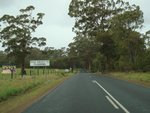
Approaching Tinglewood Road: South Coast Hwy (NR1) at Broke, approaching Tinglewood Rd, September 2009 Image © Paul Rands |
|||
| Click here for the continuation of NR1 between Manjimup and Balingup Click here for the continuation of NR1 between Albany and Walpole |
||||
1 Main Roads Western Australia
Last updated: 08-Jan-2019 21:29
This site © Paul Rands. All rights reserved. Some portions © (copyright) by their respective and credited owners. Permission must be obtained before using any images from this site. For details, please email by clicking here.