Tourist Drive 25, in the northwestern NSW varies in quality from urban arterial road in Tamworth, to rural highway standard south of the Tamworth's urban fringe. It passes by many farms and can provide an alternative route to and from the New England Highway (NH15) at Willow Tree in the Liverpool Plains area between the Hunter and the state's northwest region.
Between Willow Tree and the route to Quirindi is the same used by Surveyor-General, Sir Thomas Mitchell in 1831, in fact, the route from Willow Tree to Tamworth, was once the original route for people travelling to Tamworth. 2
| |
| |
 |
Intersection Directional Sign:
ID sign located on the corner of Marius & Brisbane Streets in Tamworth. September 2004.
Image © Paul Rands |
|
 |
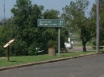
Black Distance Sign:
Northbound black RD sign near the intersection with the Kamilaroi Highway (NR37) at Quirindi, October 2006.
Image © Paul Rands |
 |
Welcome Sign, Currabubula:
Council signage announcing the town of Currabubula. September 2004.
Image © Paul Rands |
|
 |
Werris Creek:
Crossing Werris Creek in the town of Werris Creek, September 2004.
Image © Paul Rands |
 |
Level Crossing Approach, Currabubula:
Looking towards the town centre as you near the railway level crossing. September 2004.
Image © Paul Rands |
|
 |
Distance Sign:
Unusual RD sign located on the northern outskirts of Werris Creek. Normally 'km' is not mentioned on these types of signs. September 2004.
Image © Paul Rands |
 |
Typical scene through Currabubula:
Passing near the memorial hall as you head south towards Quirindi. Note the old wire safety fencing. September 2005.
Image © Paul Rands |
|
 |
Intersection Directional Sign:
ID sign located on the corner of Marius & Brisbane Streets in Tamworth. September 2004.
This sign is placed well back from the intersection.
Image © Paul Rands |
 |
Typical Scene between Currabubula and Werris Creek:
Locally known as Warrigundi, this is typical roadway quality and style for this area. September 2005.
Image © Paul Rands |
|
 |
Intersection Directional Sign:
ID sign located on the corner of Marius & Brisbane Streets in Tamworth. September 2004.
Image © Paul Rands |
 |
Entering Werris Creek:
Crossing the main railway line between Tamworth and the Hunter at Werris Creek, September 2004.
Image © Paul Rands |
|
|
|
 |
Black Distance Sign:
Old black signage just south of the Werris Creek CBD. September 2005.
Image © Paul Rands |
|
|
|
 |
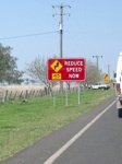
Reduce Speed Sign:
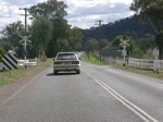
Southbound as the road crosses the railway a second time at Werris Creek, September 2005.
Image © Paul Rands |
|
|
|
 |
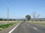
Typical Scene at Quipolly:
Recent resealing works are shown here, however this is your typical scene in the Quipolly area between Werris Creek and Quirindi. September 2005.
Image © Paul Rands |
|
|
|
 |
Quirindi Town Sign:
Sign as you enter from the northern end of Quirindi showing details about the town. September 2005.
Image © Paul Rands |
|
|
|
 |
Heading south into the CBD:
This shows the road heading through the residential sector of the town. September 2005.
Image © Paul Rands |
|
|
|
 |
Station Street Quirindi:
In 2005, remodelling works were completed of the main street of Quirindi. Southbound approaching Pryor Street, September 2005.
Image © Paul Rands |
|
|
|
 |
ANZAC memorial clock, Quirindi:
Looking at the memorial clock on Station Street in Quirindi. It forms part of the roundabout with Pryor Street. September 2005.
Image © Paul Rands |
|
|
|
 |
Advance Directional Sign:
Advance Directional sign on the southbound approaching Henry Street in Quirindi. September 2005.
Image © Paul Rands |
|
|
|
 |
George Street Quirindi:
Typical scene on George Street, in the Quirindi CBD. September 2005.
Image © Paul Rands |
|
|
|
 |
Black Distance Sign:
Old black painted distance sign, George Street Quirindi, September 2005.
Image © Paul Rands |
|
|
|
 |
Approaching Quirindi Creek:
Southbound towards the bridge over Qurindi Creek. September 2005.
Image © Paul Rands |
|
|
|
 |
Advance Directional Sign:
AD sign approaching the intersection with Kamilaroi Hwy (Lennox St) in Quirindi, July 2006.
This is where the NR37 duplex begins.
Image © Paul Rands |
|
|
|
 |
Kamilaroi Hwy Junction:
Southbound at the intersection with Kamilaroi Hwy (Lennox St) in Quirindi, July 2006.
This is where the NR37 duplex begins.
Image © Paul Rands |
|
|
|
 |
Distance Sign:
RD sign as you leave Quirindi, near the Kamilaroi Hwy junction. Note the lack of TD25 shield. September 2005.
Image © Paul Rands |
|
|
|
 |
Braefield:
Travelling through Braefield, located between Quirindi and Willow Tree, July 2006.
Image © Paul Rands |
|
|
|
 |
End TD25 / NR37:
The southern terminus of the Kamilaroi Highway and Tourist Drive 25 at Willow Tree. This is the intersection with the New England Highway (NH15). September 2005.
Image © Paul Rands |
|
|
|
This site ©
Paul
Rands. All rights reserved. Some portions © (copyright) by their
respective and credited owners. Permission must be obtained before using
any images from this site. For details, please email by clicking
here.


