|
|
|
|
|

|
Barton Highway (National Highway 25) (Decommissioned) |
Statistics:
Route Numbering:


General Information:
The Barton Highway is one of two major connectors from Canberra to the Hume Highway, which links Sydney with Melbourne.
The Barton Highway north of the ACT border carries over 10,000 vehicles per day. The route is a significant road freight link between the Hume Highway and the ACT. 1
History:
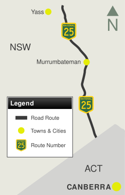
Click here for photos of the former alignment of the Barton Highway.
| ACT Border to Yass | Yass to ACT Border | |||
| Preview: | Description: | Preview: | Description: | |
 |
NSW Welcome Sign: Heading northwest at Wallaroo on the NSW-ACT Border, July 2006. Image © Paul Rands |
 |
Hume Highway Interchange: Westbound on Hume Hwy (NH31) at Yass at the Barton Hwy (NH25) interchange. December 2009. Image © Paul Rands |
|
 |
Distance Sign: RD sign - the first on the NSW border side of the NSW-ACT border at Wallaroo, looking northwest, November 2010. Image © Rob Tilley |
 |
Divided Road For 8km Sign: Sign indicating the distance of divided roadway ahead, Hume Hwy / Barton Hwy interchange at Yass, December 2009. Image © Paul Rands |
|
 |
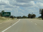
Gooda Creek Road: Barton Hwy (NH25) at Gooda Ck Rd at Jeir, November 2010. Image © Rob Tilley |
 |
Distance Sign: Southbound RD sign at Yass after the Hume Hwy (NH31) interchange. December 2009. Image © Paul Rands |
|
 |
Murrumbateman Road: Barton Hwy (NH25) at Murrumbateman Rd in Murrumbateman, November 2010. Image © Rob Tilley |
 |
Advance Directional Sign: AD sign for the Yass Valley Way interchange (former Hume Highway) at Yass. December 2009. Image © Paul Rands |
|
 |
South Street: Intersection directional sign at South St in Murrumbateman, November 2010. Image © Rob Tilley |
 |
Advance Directional Sign: AD sign for the Yass Valley Way interchange (former Hume Highway) at Yass. December 2009. Image © Paul Rands |
|
 |
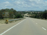
Distance Sign: RD sign leaving Murrumbateman, November 2010. Image © Rob Tilley |
 |
Supplemental Advance Directional Sign: Supplemental AD sign for the Yass Valley Way interchange (former Hume Highway) at Yass. December 2009. Image © Paul Rands |
|
 |
Hillview Drive: Intersection directional sign assembly at the Hillview Dr junction in Murrumbateman, November 2010. Image © Rob Tilley |
 |
Yass Valley Way Interchange: Barton Hwy at the Yass Valley Way interchange at Yass. December 2009. Image © Paul Rands |
|
 |
Advance Directional Sign: AD sign at Yass for the Yass Valley Way interchange, August 2011. Click here for a photo of this location by Rob Tilley from November 2010. Image © Paul Rands |
 |
Yass Valley Way Interchange: Barton Hwy at the Yass Valley Way interchange at Yass. December 2009. Image © Paul Rands |
|
 |
Supplemental Advance Directional Sign: Supplemental AD sign at Yass for the Yass Valley Way interchange, August 2011. Click here for a photo of this location by Rob Tilley from November 2010. Image © Paul Rands |
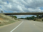 |
Yass Valley Way Interchange: Barton Hwy at the Yass Valley Way interchange at Yass. December 2009. Image © Paul Rands |
|
 |
Tourism / Services Sign: Tourism / services sign for Yass Valley Way interchange, August 2011. Click here for a photo of this location by Rob Tilley from November 2010. Image © Paul Rands |
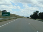 |
Distance Sign: RD sign after the Yass Valley Way interchange at Marchmont. December 2009. Image © Paul Rands |
|
 |
Advance Directional Sign: AD sign at Yass for the Yass Valley Way interchange, August 2011. Click here for a photo of this location by Rob Tilley from November 2010. Image © Paul Rands |
 |
Yass River: Barton Hwy (NH25) as it cross the Yass River at Marchmont. December 2009. Image © Paul Rands |
|
 |
Bypassed Town Sign: Bypassed town signage approaching Yass Valley Way interchange at Yass, November 2010. Image © Rob Tilley |
 |
End Divided Road 800m: Signs warning of the end of divided road conditions at Marchmont. December 2009. Image © Paul Rands |
|
 |
Yass Valley Way: Barton Hwy (NH25) at the Yass Valley Way interchange at Yass, August 2011. Click here for a photo of this location by Rob Tilley from November 2010. Image © Paul Rands |
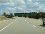 |
End Divided Road: Signs warning of the end of divided road conditions at Marchmont. December 2009. Image © Paul Rands |
|
 |
Advance Directional Sign: AD sign on the exit from Barton Hwy (NH25) onto Yass Valley Way, August 2011. Image © Paul Rands |
 |
End Divided Road and End of Multiple Lanes: The lane merge approaching the end of divided highway at Marchmont. December 2009. Note the short length of dual carriageway to the left of shot, for future upgrade. Image © Paul Rands |
|
 |
Distance Sign: RD sign after the Yass Valley Way interchange at Yass, November 2010. Image © Rob Tilley |
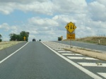 |
Begin Two Way Conditions: The beginning of undivided roadway, which continues to the ACT border, Marchmont. December 2009. Image © Paul Rands |
|
 |
Advance Directional Sign: AD sign on Barton Hwy (NH25) at Yass approaching the Hume Hwy (NH31) interchange, November 2010. Image © Rob Tilley |
 |
Further Road Width Reductions: One lane each way at Marchmont. December 2009. Image © Paul Rands |
|
 |
Advance Directional Sign: AD sign on Barton Hwy (NH25) at Yass approaching the Hume Hwy (NH31) interchange, November 2010. Image © Rob Tilley |
 |
Typical Conditions: Typical highway conditions on the Barton Highway between Marchmont and Murrumbateman. December 2009. Image © Paul Rands |
|
 |
Supplemental Advance Directional Signs: Supplemental AD signs on Barton Hwy (NH25) at Yass approaching the Hume Hwy (NH31) interchange, November 2010. Image © Rob Tilley |
 |
Trailblazer: NH25 trailblazer at Murrumbateman. December 2009. Image © Paul Rands |
|
 |
Hume Highway Interchange: Barton Hwy (NH25) at the interchange with Hume Hwy (NH31) at Yass, November 2010. This is the northern terminus of the route. Image © Rob Tilley |
 |
Welcome to Murrumbateman: Entering the outskirts of Murrumbateman. December 2009. Image © Paul Rands |
|
 |
Hume Highway Interchange: Barton Hwy (NH25) at the interchange with Hume Hwy (NH31) at Yass, November 2010. This is the northern terminus of the route. Image © Rob Tilley |
 |
Hillview Drive Junction: Corner of Barton Hwy and Hillview Dr at Murrumbateman. December 2009. Image © Paul Rands |
|
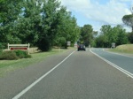 |
Entering Murrumbateman Town Area: Barton Hwy as it enters the town of Murrumbateman. December 2009. Image © Paul Rands |
|||
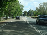 |
Murrumbateman Town Centre: Barton Highway as it passes through the town centre of Murrumbateman, looking south. December 2009. Image © Paul Rands |
|||
 |
Advance Directional Sign: AD sign approaching Murrumbateman Rd in Murrumbateman. December 2009. Image © Paul Rands |
|||
 |
South Street Intersection: Corner of Barton Hwy & South St, Murrumbateman. December 2009. Image © Paul Rands |
|||
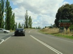 |
Murrumbateman Road Intersection: Corner of Barton Hwy & Murrumbateman Rd. December 2009. Image © Paul Rands |
|||
 |
Advance Directional Sign: AD sign at Jeir approaching Gooda Creek Rd. December 2009. Image © Paul Rands |
|||
 |
Gooda Creek Road Intersection: Corner of Barton Hwy & Gooda Ck Rd at Jeir. December 2009. Image © Paul Rands |
|||
 |
Trailblazer: NH25 trailblazer at Jeir. December 2009. Image © Paul Rands |
|||
 |
Divided Road Ahead: Divided road ahead sign at Spring Range as the Barton Highway closes in on the divided road that lays on the other side of the ACT border. December 2009. Image © Paul Rands |
|||
 |
Divided Road Ahead: Divided road ahead sign at Spring Range as the Barton Highway closes in on the divided road that lays on the other side of the ACT border. December 2009. Image © Paul Rands |
|||
 |
ACT Border: Crossing from NSW into the ACT. December 2009. Image © Paul Rands |
|||
| Click here for the continuation of NH25 in the Australian Capital Territory | ||||
1 Roads & Traffic Authority
2 Department of Main Roads, The Roadmakers, A History of Main Roads in New South Wales, ISBN 0 7240 0439 4
3 Sam Laybutt (OzRoads)
Last updated: 13-Aug-2020 14:28
This site © Paul Rands. All rights reserved. Some portions © (copyright) by their respective and credited owners. Permission must be obtained before using any images from this site. For details, please email by clicking here.