|
|
|
|
|
Statistics:
General Information:
Caswell Drive connects Gungahlin Drive to Glenloch Interchange. It's 2 lanes in each direction, in a dual carriageway configuration.
The road is named after Charles Henry Caswell, who was an engineer and surveyor, and co-designer of an award-winning plan in the competition for a design for the National Capital held in 1911. 1
History:

Click here for construction photos along Caswell Drive
| Glenloch Interchange to Belconnen Way | Belconnen Way to Glenloch Interchange | |||
| Preview: | Description: | Preview: | Description: | |
 |
Glenloch Interchange: Caswell Dr / William Hovell Dr split at the Glenloch Interchange, February 2010. Image © Paul Rands |
 |
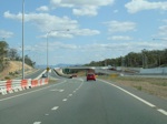
Approaching Bandjalong Crescent Interchange: Caswell Dr, northbound approaching the Bandjalong Crescent Interchange, February 2010. Image © Paul Rands |
|
 |
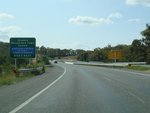
Distance Sign: Northbound RD sign after the Glenloch Interchange at Aranda, August 2011. Note the incorrect road name. Click here for a photo of this location from February 2010. Image © Paul Rands |
 |
Bandjalong Crescent Interchange: Caswell Dr, northbound at the Bandjalong Crescent Interchange, February 2010. Image © Paul Rands |
|
 |
Advance Directional Sign: AD sign at Aranda for the Belconnen Way interchange, February 2010. Image © Paul Rands |
 |
Bandjalong Crescent Interchange: Caswell Dr, northbound at the Bandjalong Crescent Interchange, February 2010. Image © Paul Rands |
|
 |
Supplemental Advance Directional Sign: Supplemental AD sign at Aranda for the Belconnen Way interchange, February 2010. Image © Paul Rands |
 |
Bandjalong Crescent Interchange: Caswell Dr, northbound at the Bandjalong Crescent Interchange, February 2010. Image © Paul Rands |
|
 |
Belconnen Way & Bandjalong Crescent Interchange: Caswell Dr, northbound at the Belconnen Way & Bandjalong Crescent Interchange, February 2010. Image © Paul Rands |
 |
Distance Sign: RD sign at Aranda after the Bandjalong Cr interchange, February 2010. Image © Paul Rands |
|
 |
Belconnen Way & Bandjalong Crescent Interchange: Caswell Dr, northbound at the Belconnen Way & Bandjalong Crescent Interchange, February 2010. Image © Paul Rands |
 |
Advance Directional Sign: AD sign at Aranda approaching Glenloch Interchange, February 2010. Image © Paul Rands |
|
 |
Advance Directional Signs: AD signs at the Bandjalong Cr / Belconnen Way interchange at Aranda, August 2010. Image © Paul Rands |
 |
Supplemental Advance Directional Sign: Supplemental AD sign at Aranda approaching Glenloch Interchange, February 2010. Image © Paul Rands |
|
 |
Advance Directional Sign: AD sign at the Bandjalong Cr / Belconnen Way interchange at Aranda, August 2010. Image © Paul Rands |
 |
Glenloch Interchange: Parkes Way slip lane and signage for the Tuggeranong Pkwy slip lane at the Glenloch Interchange at the base of Black Mountain, February 2010. Image © Paul Rands |
|
 |
Advance Directional Sign: AD sign at the Bandjalong Cr / Belconnen Way interchange at Aranda, August 2010. Image © Paul Rands |
|||
 |
Belconnen Way Junction: Looking northeast at Belconnen Way / Caswell Drive interchange, August 2010. Image © Paul Rands |
|||
 |
Belconnen Way Junction: Advance directional sign acting as and intersection directional signat Belconnen Way / Caswell Drive interchange, August 2010. Image © Paul Rands |
|||
|
Click here for the continuation of the route as Gungahlin Drive Click here for the continuation of the route as Tuggeranong Parkway |
||||
1 ACT Land & Planning Authority, Place Name Search, Caswell Drive
2 Gungahlin Drive Extension Web Site
3 Territory and Municipal Services, Media Release, GDE – Belconnen Way Intersection Opening Soon
4 100 Days - Achievements of the ACT Labor Government, Media Release, Page 6
Last updated: 13-Aug-2020 0:09
This site © Paul Rands. All rights reserved. Some portions © (copyright) by their respective and credited owners. Permission must be obtained before using any images from this site. For details, please email by clicking here.