|
|
|
|
|
Statistics:
Route Numbering:
General Information:
The Tuggeranong Parkway and acts as a major route for the ACT's western and south-western suburbs in the Woden and Tuggeranong Valleys, connecting them to the Belconnen area. The Tuggeranong Parkway is 4 lanes wide and is divided either by a concrete wall.
The word Tuggeranong is an aboriginal word for 'cold plain'. The name was also given to a former parish in the area. 1
History:
Click here for photos of the upgrade of the Glenloch Interchange

| Kambah to Aranda | Aranda to Kambah | |||
| Preview: | Description: | Preview: | Description: | |
 |
Advance Directional Sign: AD sign at Waramanga approaching Hindmarsh Dr, January 2014. Image © Paul Rands |
 |
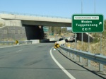
Glenloch Interchange: Intersection directional sign on the Glenloch Interchange at the edit to Tuggeranong Parkway, January 2010. Glenloch Interchange was named after a homestead in the area first selected by Francis Mowatt in 1834. 5 Image © Paul Rands |
|
 |
Hindmarsh Drive Interchange: AD sign acting as an ID sign at the Hindmarsh Dr interchange at Waramanga, August 2010. Image © Paul Rands |
 |
Glenloch Interchange: Intersection directional sign on the Glenloch Interchange at the edit to Tuggeranong Parkway, January 2010. Image © Paul Rands |
|
 |
Tuggeranong Parkway, Weston Creek: Image © Sam Laybutt (ozroads.com.au) |
 |
Glenloch Interchange: Tuggeranong Parkway at the Glenloch Interchange near the base of Black Mountain, January 2010. Image © Paul Rands |
|
 |
Start Speedometer Check Length 400m: Sign at Weston 400 metres from the beginning of the Speedometer Check Length, August 2010. Image © Paul Rands |
 |
Advance Directional Sign: AD sign approaching the Lady Denman Drive (TD2) interchange at Stromlo, January 2010. Image © Paul Rands |
|
 |
Distance Sign: RD sign at Weston after the Hindmarsh Dr interchange, August 2010. Image © Paul Rands |
 |
Lady Denman Drive Interchange: Intersection directional sign at the Lady Denman Dr (TD2) interchange at Stromlo, January 2010. Image © Paul Rands |
|
 |
Speedometer Check Length: Sign at Weston at the beginning of the Speedometer Check Length, August 2010. Image © Paul Rands |
 |
Distance Sign: Southbound RD sign after the Glenloch Interchange, January 2010. Image © Paul Rands |
|
 |
Advance Directional Sign: AD sign for the Cotter Rd (TD5) interchange, Weston, Janaury 2014. Click here for a photo of this location from August 2010. Image © Paul Rands |
 |
Advance Directional Sign: AD sign in the Stromlo area, approaching Cotter Road (TD5), January 2010. Image © Paul Rands |
|
 |
Speedometer Check Length Sign: Speedometer Check Length sign at Weston, August 2010. Image © Paul Rands |
 |
Supplemental Advance Directional Sign: Supplemental AD sign in the Stromlo area, approaching Cotter Road (TD5), January 2010. Image © Paul Rands |
|
 |
Supplemental AD Sign: Supplemental advance directional sign approaching the Cotter Road (TD5) interchange at Weston, January 2014. Image © Paul Rands |
 |
Supplemental Advance Directional Sign: Supplemental AD sign in the Stromlo area, approaching Cotter Road (TD5), January 2010. Image © Paul Rands |
|
 |
Cotter Road Interchange: Tuggeranong Pkwy as it passes under Cotter Rd (TD5) at Weston, August 2010. Image © Paul Rands |
 |
Cotter Road Interchange: Southbound at Curtin at the Cotter Road (TD5) interchange, January 2010. Image © Paul Rands |
|
 |
Advance Directional Sign: AD sign at Weston on the off ramp to Cotter Rd (TD5), January 2014. Image © Paul Rands |
 |
Cotter Road Interchange: Southbound at Curtin at the Cotter Road (TD5) interchange, January 2010. Image © Paul Rands |
|
 |
Speedometer Check Length Sign: Speedometer Check Length sign at Weston Creek, August 2010. Image © Paul Rands |
 |
Distance Sign: Reassurance directional sign after the Cotter Road (TD5) interchange, January 2010. Image © Paul Rands |
|
 |
Distance Sign: Northbound RD sign after the Cotter Rd (TD5) interchange, August 2010. Image © Paul Rands |
 |
Advance Directional Sign: AD sign at Lyons, approaching Hindmarsh Drive, January 2010. Image © Paul Rands |
|
 |
Speedometer Check Length Sign: Speedometer Check Length sign at Weston Creek, August 2010. Image © Paul Rands |
 |
Supplemental Advance Directional Sign: Supplemental AD sign at Lyons, approaching Hindmarsh Drive, July 2016. Click here for a photo of this location from January 2010. Image © Paul Rands |
|
 |
Advance Directional Sign: AD sign approaching Lady Denman Dr (TD2), May 2010. Note Telstra Tower on top of Black Mountain in the distance. Image © Paul Rands |
 |
Hindmarsh Drive Interchange: Southbound at Lyons, at the Hindmarsh Dr interchange, July 2016. Click here for a photo of this location from January 2010. Click here for an ACT Heritage Library photo of this area prior to the construction of this interchange, click here for an ACT Heritage Library photo of this interchange nearing completion. Image © Paul Rands |
|
 |
End Speedometer Check Length: End of the Speedometer Check Length, Weston Creek, August 2010. Image © Paul Rands |
 |
Advance Directional Sign: AD sign on the off ramp to Hindmarsh Dr at Lyons, July 2016. Image © Paul Rands |
|
 |
Advance Directional Sign: AD sign near the aboretum approaching Lady Denman Dr and Glenloch Interchange, July 2016. Note the incorrect A23 route number, the sign should say 'To A25'. Image © Paul Rands |
 |
Entering Tuggeranong: Sign (distant right of shot) indicating Tuggeranong as you enter Kambah, January 2010. Image © Paul Rands |
|
 |
Lady Denman Drive Interchange: Looking northeast at the Lady Denman Drive interchange, May 2010. Image © Paul Rands |
 |
Sulwood Drive Intersection: Southern terminus of Tuggeranong Pkwy, Sulwood Dr at Kambah, January 2010. Image © Paul Rands |
|
 |
Advance Directional Sign: AD sign at the Lady Denman Dr interchange for the Glenloch Interchange, August 2011. Click here for a photo of this location by Paul Rands from May 2010. Image © Paul Rands |
|||
 |
William Hovell Drive Exit: AD sign at the William Hovell Drive exit of Glenloch Interchange, May 2010. Image © Paul Rands |
|||
 |
Supplemental AD sign: Supplemental advance directional sign at the Glenloch Interchange for the 3 way split between William Hovell Drive, Caswell Drive and Parkes Way, May 2010. Image © Paul Rands |
|||
 |
ID signage: Intersection directional signs at the Glenloch Interchange for the 3 way split between William Hovell Drive, Caswell Drive and Parkes Way, August 2011. Click here for a photo of this location by Paul Rands from May 2010 Image © Paul Rands |
|||
 |
ID signage: Intersection directional signs at the Glenloch Interchange for the 2 way split between Caswell Drive and Parkes Way, May 2010 Image © Paul Rands |
|||
1 ACT Planning & Land Authority, Place Name Search, Tuggeranong Parkway
2 ACT Heritage Library, The new bridge over the Molonglo River for the Tuggeranong Parkway, 1972
3 ACT Heritage Library, Concrete beam placed in position on the Tuggeranong Parkway overpass of Hindmarsh Drive, 5 December 1978
4 Australian National Botanic Gardens, News Release, Gardening Australia presenter opens Botanic Gardens feature, 25 October 2002
5 ACT Planning & Land Authority, Place Name Search, Glenloch Interchange
6 Jon Stanhope, Chief Minister Australian Capital Territory, New Traffic Cameras Operational, 10 August 2007
Last updated: 13-Aug-2020 0:26
This site © Paul Rands. All rights reserved. Some portions © (copyright) by their respective and credited owners. Permission must be obtained before using any images from this site. For details, please email by clicking here.