|
|
|
|
|
Ararat lies on the Western Highway between Ballarat and Horsham, at the east end of the Grampians National Park.
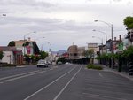
The town's history, like Ballarat dates back to when gold was first discovered in the 1850's, although the area was first settled for farming in the mid 1830's; Ararat is now a centre for grape growing and wool. The main street is lined with old buildings with Copes Hill to the west as a backdrop. Alexandra Gardens, just north of the town centre is a tranquil spot also worth visiting.
| Preview: | Description: |
 |
Town Centre: Ararat-Halls Gap Rd (Barkly St (C222)) as it passes through the Ararat town centre, December 2013. Image © Michael Greenslade |
1 Australian Bureau of Statistics, 2016 Census QuickStats
Last updated: 12-Jan-2020 15:30
This site © Paul Rands. All rights reserved. Some portions © (copyright) by their respective and credited owners. Permission must be obtained before using any images from this site. For details, please email by clicking here.