Australian Towns & Cities
Queensland: Longreach
Incorporating photos and Information
from Michael Greenslade's former Australian Towns, Cities and Highways
site
Established in 1888, Longreach is a service town located on the Tropic of Capricorn in central Queensland. Most of the town's streets are named after birds. The main industries of the area are cattle, sheep, and, more recently, tourism.
Home to the Qantas Founders Museum and Australian Stockmen’s Hall of Fame, the town boasts a number of historic buildings and the Thomson River, where river cruises can be enjoyed. The Iningai people are the indigenous inhabitants of the area.
- Population: 2970 1
- Postcode: 4730
- Location: 1181 km northwest of Brisbane, 687 km west of Rockhampton and 649 km southeast of Mount Isa
- Main Roads: Landsborough Hwy A2 Thomson Developmental Rd

- Radio Stations: FM:
ABC Classic (102.1 MHz), ABC RN (99.1 MHz), Radio TAB (103.7 MHz), Triple J (106.1 MHz), Vision Christian Radio (87.6 MHz) and West FM (104.5 MHz). AM: 4LG (1098 kHz) and ABC Western Queensland (540 kHz)
View Larger Map
 |
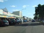
Longreach Town Centre:
Many old buildings line Eagle St in Longreach's town centre, November 2016.
Image © Paul Rands
|
 |
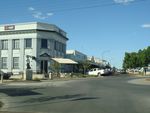
Longreach Town Centre:
Looking northeast along Eagle St at Longreach, November 2016.
Image © Paul Rands |
 |
Eagle & Swan Streets:
View of the Longreach town centre at the roundabou with Eagle St and Swan St, November 2016.
Image © Paul Rands
|
1 Australian Bureau of Statistics, Longreach (SSC), 2016 Census QuickStats
Last updated: 02-Aug-2020 11:09
This site ©
Paul
Rands. All rights reserved. Some portions © (copyright) by their
respective and credited owners. Permission must be obtained before using
any images from this site. For details, please email by clicking
here.
