Australian Towns & Cities
Queensland: Cleveland
Incorporating photos and Information
from Michael Greenslade's former Australian Towns, Cities and Highways
site
Cleveland was the traditional territory of the Koobenpul
people of the Quandamooka. 1 There are conflicting reports as to the
naming of Cleveland; it was either named in 1770 by Captain James Cook in
honour of John Clevland, the Secretary of the Admiralty around the time 2,
or by surveyors in the 1840s, in honour of William Vane, 1st Duke of
Cleveland.
In 1847, the Government planned for the new town, and on
13 December 1850, Cleveland was proclaimed a township. 3
Cleveland features Toondah Harbour, which is the
location of the Stradbroke Island Ferry Terminal used by water taxis and
vehicular ferries to provide access to North Stradbroke Island, plus the
town features and attractive CBD, a number of museums and the lighthouse
at Cleveland Point, with the current light built in 1969. The area was
once popular for growing various food crops and is connected to Brisbane
CBD via rail and an extensive network of arterial roads.
- Population: 14 801 1
- Postcode: 4163
- Location: 25 km east of Brisbane
- Main Roads: Shore St (SR22) and
Bloomfield St (SR47)
- Radio Stations: DAB+:
4KQ Plus, ABC Classic, ABC Country, ABC Grandstand, ABC Jazz,
ABC Kids Listen, ABC Radio Brisbane, ABC RN, Australian Indian Radio,
Chemist Warehouse Remix, Classic Hits Live, Koffee, MBS Light, Mix '80s,
Mix '90s, NovaNation, OldSkool Radio, SBS Chill, SBS PopAsia, smoothfm,
The Edge Digital, Double J, Triple J, Triple J Unearthed and Triple M
Classic Rock Digital. FM: 101.1
FM (101.1 MHz), 4EB (98.1 MHz), 4MBS (103.7 MHz), 4OUR FM (101.5 MHz),
4ZZZ (102.1 MHz), 96five Family FM (96.5 MHz), 97.3 FM (97.3 MHz), 98.9
FM (98.9 MHz), 99.7 Bridge FM (99.7 MHz), ABC Classic (106.1 MHz), B105
FM (105.1 MHz), Bay FM (100.3 MHz), Faith FM (87.8 MHz), Nova 106.9
(106.9 MHz), Planet Radio (88.0 MHz), Rebel FM (90.5 MHz), River 94.9
(94.9 MHz), SBS Radio (93.3 MHz), Triple J (107.7 MHz), Triple M (104.5
MHz), Vision Christian Radio (87.6 MHz, 87.8 MHz & 88.0 MHz). AM:
4BC (1116 KHz), 4KQ (693 KHz), 4RPH (1296 KHz), ABC News on Radio (936
KHz), ABC Radio Brisbane (612 KHz), ABC RN (792 KHz), Arabic Radio (1647
KHz), Macquarie Sports Radio (882 KHz), Radio Brisvaani (1701 KHz),
Radio TAB (1008 KHz), Switch 1197 (1197 KHz), VAC Radio (1656 KHz) and
Vision Christian Radio (1053 KHz)
View
Larger Map
|
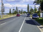
Shore Street North:
View along Shore St North (SR22) at Cleveland, May 2006.
Image © Michael Greenslade
|
|
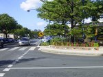
Cleveland CBD:
Middle St in the Cleveland CBD, May 2006.
Image © Michael Greenslade
|
|
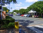
Cleveland CBD:
Middle St in the Cleveland CBD, May 2006.
Image © Michael Greenslade
|
|
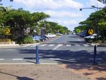
Cleveland CBD:
Bloomfield St in the Cleveland CBD, May 2006.
Image © Michael Greenslade
|
|
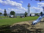
Cleveland Point:
View of the Cleveland Point Light, May 2006.
Image © Michael Greenslade
|
|
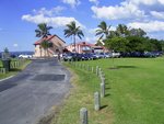
Cleveland Point:
View of Cleveland Point, May 2006.
Image © Michael Greenslade
|
1 John Gladstone
Steele, Aboriginal Pathways: in Southeast Queensland and the Richmond
River. University of Queensland Press. ISBN 978-0-702-25742-1
2 "Cleveland". The Age. 8 February 2004
3 Brie, Kenneth (2001). Latitude
27 - Longitude 153, Moreton Bayside. Erinport Pub., and Sandgate &
District Historical Society. ISBN 978-0-9578064-8-1
4 Australian Bureau of
Statistics, 2016 Census QuickStats
Last updated: 19 Nov 2019 18:45
This site ©
Paul
Rands. All rights reserved. Some portions © (copyright) by their
respective and credited owners. Permission must be obtained before using
any images from this site. For details, please email by clicking
here.