Australian Towns & Cities
Queensland: Brisbane
Incorporating photos and Information
from Michael Greenslade's former Australian Towns, Cities and Highways
site
Brisbane, the capital city of Queensland lies
approximately 20km inland and set on the meandering banks of the Brisbane
River. The city radiates a relaxed feel, yet offers the excitement of a
large city such as Melbourne and Sydney. The city was founded in 1824 when
a convict settlement was established at Redcliffe - however, with the
mosquitoes and sandflies posing a health problem, the settlement was moved
to the current city's position. Brisbane, due to its sub tropical climate
and history offers an interesting mixture of old and new buildings -
ranging from the old sandstone buildings from the colonial days to the
Queenslander timber style homes built on stilts.
Dubbed the "River City" due to the Central Business
District being almost surrounded by the Brisbane River, the city has a
unique geographical position which is aesthetically pleasing despite
gaining problems with accessibility. Due to the Queensland Governments of
the 1980s and 1990s placing more emphasis on protecting and upgrading the
Brisbane River precinct, property having water frontage has since gained
strong land values, which in turn has subsequently attracted high rise
development, complimenting the river setting and providing a great
backdrop. This, along with Brisbane's beautiful parks and gardens, warm
climate, a fantastic shopping precinct and historic buildings such as
Parliament House and the Treasury Casino account for an impressive city
centre.
Southbank, on the southern side of the Brisbane River
was the site of the 1988 World Expo and has since been transformed into a
cultural precinct with several museums, colleges, art galleries, cafes and
tropical gardens. Other highlights in the Brisbane CBD include the Story
Bridge (1930s), Brisbane River cruises, the Brisbane Botanical Gardens,
Queen Street Mall, the Energex Arbour and the Old Windmill Observatory
(Spring Hill). Mount Coot-tha to the west offers more superb tropical
parks and gardens as well as fantastic panoramic city views.
- Population: 2 270 800 1
- Postcode: 4000
- Main Roads: Bruce Highway
(M1), Gateway Motorway (M1) , Pacific Motorway (M1 & M3), Logan
Motorway (M2 & M6), Mt Lindesay Highway (NR13), Ipswich Motorway
(M2), Gympie Road (M3)
- Radio Stations: DAB+:
4KQ Plus, ABC Classic, ABC Country, ABC Grandstand, ABC Jazz,
ABC Kids Listen, ABC Radio Brisbane, ABC RN, Australian Indian Radio,
Chemist Warehouse Remix, Classic Hits Live, Koffee, MBS Light, Mix '80s,
Mix '90s, NovaNation, OldSkool Radio, SBS Chill, SBS PopAsia, smoothfm,
The Edge Digital, Double J, Triple J, Triple J Unearthed and Triple M
Classic Rock Digital. FM: 101.1
FM (101.1 MHz), 4EB (98.1 MHz), 4MBS (103.7 MHz), 4OUR FM (101.5 MHz),
4ZZZ (102.1 MHz), 96five Family FM (96.5 MHz), 97.3 FM (97.3 MHz), 98.9
FM (98.9 MHz), 99.7 Bridge FM (99.7 MHz), ABC Classic (106.1 MHz), B105
FM (105.1 MHz), Bay FM (100.3 MHz), Faith FM (87.8 MHz), Nova 106.9
(106.9 MHz), Planet Radio (88.0 MHz), Rebel FM (90.5 MHz), River 94.9
(94.9 MHz), SBS Radio (93.3 MHz), Triple J (107.7 MHz), Triple M (104.5
MHz), Vision Christian Radio (87.6 MHz, 87.8 MHz & 88.0 MHz). AM:
4BC (1116 KHz), 4KQ (693 KHz), 4RPH (1296 KHz), ABC News on Radio (936
KHz), ABC Radio Brisbane (612 KHz), ABC RN (792 KHz), Arabic Radio (1647
KHz), Macquarie Sports Radio (882 KHz), Radio Brisvaani (1701 KHz),
Radio TAB (1008 KHz), Switch 1197 (1197 KHz), VAC Radio (1656 KHz) and
Vision Christian Radio (1053 KHz)
View
Larger Map

|
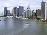
Brisbane River:
View of Brisbane River as it snakes its way through the suburbs,
March 2004.
Image © Michael Greenslade
|
|
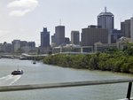
Brisbane Skyline:
Brisbane River and Brisbane skyline viewed from Story Bridge, March
2004.
Image © Michael Greenslade
|
|
Brisbane Skyline:
Brisbane River, Brisbane skyline and Riverside Expressway as viewed
from the Goodwill Bridge, September 2003.
Image © Michael Greenslade
|
|
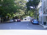
Alice Street:
Alice St in Brisbane which runs along the northern edge of the
Brisbane City Botanic Gardens, September 2003.
Image © Michael Greenslade
|
|
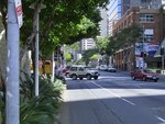
Mary Street:
Mary St in the Brisbane CBD, September 2003.
Image © Michael Greenslade
|
|
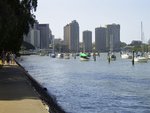
Brisbane River:
View of Brisbane River towards Eagle St Pier from Brisbane City
Botanic Gardens, September 2003.
Image © Michael Greenslade
|
 |
Brisbane City:
Aerial view of Brisbane city, surrounding suburbs and Mt-Coot-Tha to the west, November 2016.
Image © Michael Greenslade |
1 Australian
Bureau of Statistics, 2016 Census QuickStats
Last updated: 21-Aug-2020 23:24
This site ©
Paul
Rands. All rights reserved. Some portions © (copyright) by their
respective and credited owners. Permission must be obtained before using
any images from this site. For details, please email by clicking
here.