Australian Towns & Cities
New South Wales: Wingham
Incorporating photos and Information
from Michael Greenslade's former Australian Towns, Cities and Highways
site
Located on the New South Wales Mid-North Coast, Wingham is named after Wingham in Kent, England.
European settlement took place in 1841, and was chosen as a location for a government settlement because supply boats could not proceed any further up the Manning River and the area was also located on the then road from Raymond Terrace to Port Macquarie.
The town centre features a number of historic buildings and at one stage was the administrative centre for the area before government offices were relocated to the slightly larger town of Taree in the early 1900s.
Industries in the area were initially timber getting, which then made way for dairying and similar rural activities. Tourist attractions include Wingham Brush, an area of lowland tropical rainforest remnant on a floodplain along the Manning River and the town provides easy access to Ellenborough Falls.
- Population: 4532 1
- Postcode: 2429
- Location: 335 km north of Sydney
- Main Roads: Wingham Rd

- Radio Stations: FM:
2BOB Radio (104.7 MHz), 2KY Racing Radio (105.7 MHz), ABC Classic (98.7 MHz), ABC News on Radio (94.7 MHz), ABC RN (97.1 MHz), Great Lakes FM (101.5 MHz), Max FM (107.3 MHz), Ngarralinyi Radio (101.3 MHz) and Triple J (96.3 MHz). AM: 2RE (1557 kHz) and ABC Mid North Coast (756 kHz)
View Larger Map
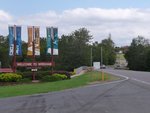 |
Entering Wingham:
Wingham Rd (TD8) as it enters the town of Wingham, December 2013.
Image © Michael Greenslade |
 |
Wingham Town Centre:
Bent St in Wingham, December 2013.
Image © Michael Greenslade |
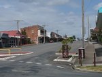 |
Wingham Town Centre:
Isabella St in Wingham, December 2013.
Image © Michael Greenslade |
 |
Wingham Town Centre:
Isabella St in Wingham, December 2013.
Image © Michael Greenslade |
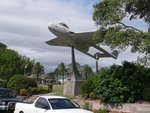 |
Central Park:
A de Havilland Vampire fighter plane (opposite the RSL Club) in Central Park, Wingham, December 2013.
Image © Michael Greenslade |
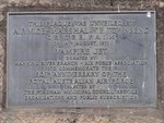 |
Plaque:
Plaque explaining the background of the Vampire fighter plane in Central Park, December 2013.
Image © Michael Greenslade |
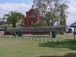 |
The Log:
View of "The Log" in Central Park, a massive log felled in the surrounding countryside which serves as a reminder of the timber driven history of the area, December 2013.
Image © Michael Greenslade |
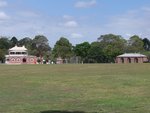 |
Central Park:
View of Central Park, Wingham, December 2013.
Image © Michael Greenslade |
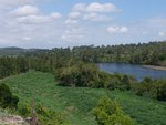 |
Manning River:
Overlooking Manning River from Lobban Rd at Wingham, December 2013.
Image © Michael Greenslade
|
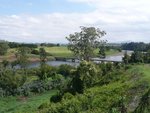 |
Manning River:
Overlooking Manning River from Lobban Rd at Wingham, December 2013.
Image © Michael Greenslade |
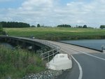 |
Tinonee Road:
View of the low level bridge that carries Tinonee Rd over the Manning River at Wingham, December 2013.
Image © Michael Greenslade
|
1 Australian Bureau of Statistics, 2016 Census QuickStats
Last updated: 12-Jan-2020 12:10
This site ©
Paul
Rands. All rights reserved. Some portions © (copyright) by their
respective and credited owners. Permission must be obtained before using
any images from this site. For details, please email by clicking
here.

