Australian Towns & Cities
New South Wales: Ballina
Incorporating photos and Information
from Michael Greenslade's former Australian Towns, Cities and Highways
site
Ballina is located on the north coast of New South Wales
and is located at the mouth of the Richmond River, Ballina is a popular
tourist destination. While the area was discovered in the early 1820's, it
wasn't until 1840 that the area was used for logging and Ballina was
surveyed as a port to ship timber to Sydney. By the end of the 1800's,
sugar plantations had also been established.
Nowadays, the area is dominated by sugar cane, with
tourism, dairying and fishing the other prominent industries. Ballina is
pleasant to visit - has a busy main street with a strong shopping
precinct, warm climate and many great long beaches. The town is renowned
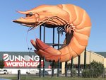
for the Big Prawn (southern entrance to town), various cycleways
(extremely flat terrain), the Naval & Maritime Museum and the
Macadamia Castle (10km north at Knockrow).
The name Ballina is of Aboriginal origin meaning "place
where oysters are plentiful".
- Population: 16 506 1
- Postcode: 2478
- Location: 779km north of Sydney,
198km south of Brisbane
- Main Roads: Pacific Hwy M1 and
Bruxner Hwy B60
- Radio Stations: FM:
2KY Racing (88.0 MHz), ABC North Coast (94.5 MHz), ABC Classic
(95.3 MHz), ABC Radio National (96.9 MHz), ABC News on Radio (98.5 MHz),
Paradise FM (101.9 MHz), Three Angels Broadcasting Network (87.6 MHz)
Triple J (96.1 MHz) and ZZZ FM (100.9 MHz). AM:
2LM (900 KHz)
View
Larger Map
|
Big Prawn:
The big prawn on River St (former Pacific Hwy) at West Ballina,
October 2018. The Big Prawn used to be on top of the Caltex
Roadhouse that once stood in this location, and at one point was at
risk of being demolished. Eventually Bunnings restored it and
incorporated it into their then new store.
Image © Paul Rands
|
|
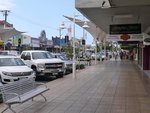
Ballina CBD:
River Street in the Ballina CBD, October 2014.
Image © Michael Greenslade
|
|
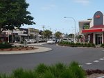
River Street & Cherry Street:
Ballina CBD from the River St and Cherry St roundabout, October
2014.
Image © Michael Greenslade
|

|
River Street & Cherry Street:
Ballina CBD from the River St and Cherry St roundabout, October
2014.
Image © Michael Greenslade
|
|
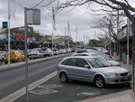
Ballina CBD:
River Street in the Ballina CBD, October 2014.
Image © Michael Greenslade
|
|
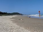
Shelly Beach:
Northerly view of Shelly Beach and Pacific Ocean to the northeast of
Ballina town centre, October 2014.
Image © Michael Greenslade
|
|
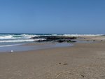
Shelly Beach:
View of Shelly Beach and Pacific Ocean to the northeast of Ballina
town centre, October 2014.
Image © Michael Greenslade
|
|
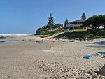
Shelly Beach:
Southerly view of Shelly Beach to the northeast of Ballina town
centre, October 2014.
Image © Michael Greenslade
|
1 Australian
Bureau of Statistics, 2016 Census QuickStats
Last updated: 21-Aug-2020 23:35
This site ©
Paul
Rands. All rights reserved. Some portions © (copyright) by their
respective and credited owners. Permission must be obtained before using
any images from this site. For details, please email by clicking
here.