| |
| |
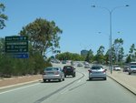 |
Advance Directional Sign:
AD sign on East Pde (SR66) at Mt Lawley approaching Graham Farmer Fwy (SR8) interchange, December 2012.
Image © Paul Rands |
|
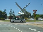 |
Public Art:
Sculpture in the roundabout of East Parade (SR66), Plain Street (SR66) and Brook Street in East Perth, December 2012.
Image © Paul Rands |
 |
Graham Farmer Freeway Interchange:
ID sign assembly at the Graham Farmer Fwy (SR8) interchange at Mt Lawley, December 2012.
Image © Paul Rands |
|
 |
Advance Directional Sign:
AD sign on East Pde (SR66) at East Perth approaching Graham Farmer Fwy (SR8) interchange, December 2012.
Image © Paul Rands |
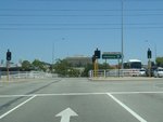 |
Graham Farmer Freeway Interchange:
ID sign assembly at the Graham Farmer Fwy (SR8) interchange at East Perth, December 2012.
Image © Paul Rands |
|
 |
Graham Farmer Freeway Interchange:
ID sign assembly at the Graham Farmer Fwy (SR8) interchange at East Perth, December 2012.
Image © Paul Rands |
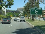 |
Advance Directional Sign:
AD sign on East Parade (SR66) approaching Plain St (SR66) and Brook St in East Perth, December 2012.
Image © Paul Rands |
|
 |
Graham Farmer Freeway Interchange:
ID sign assembly at the Graham Farmer Fwy (SR8) interchange at Mt Lawley, December 2012.
Image © Paul Rands |
 |
Public Art:
Sculpture in the roundabout of East Parade (SR66), Plain Street (SR66) and Brook Street in East Perth, December 2012.
Image © Paul Rands |
|
 |
Mt Lawley:
East Parade (SR66) approaching Guildford Rd (SR51) and Whatley Cr, Mt Lawley, December 2012.
Image © Paul Rands |
 |
Intersection Directional Sign:
ID sign on the roundabout with Brook St, December 2012. SR66 changes from East Parade to Brook Street at this intersection.
Image © Paul Rands |
|
 |
Trailblazer:
SR51 trailblazer approaching Guildford Rd (SR51) and Whatley Cr, Mt Lawley, December 2012. The arrow on the top should be pointing both left and right.
Image © Paul Rands |
 |
Trailblazer:
SR65 trailblazer approaching Plain Street (SR65), Wellington St (SR65) and Waterloo Cr, East Perth, December 2012.
Image © Paul Rands |
|
|
|
 |
Intersection Directional Sign:
AD sign at the southern terminus of SR66: Plain Street (SR65), Wellington St (SR65) and Waterloo Cr, East Perth, December 2012.
Image © Paul Rands |
|
|
|


