|
|
 |
Approaching Scarborough Beach Road & Angove Street:
Warning sign on Fitzgerald Street for the signalised junction with Scarborough Beach Road (unnumbered section) and Angove Street in North Perth. February 2009.
Image © Paul Rands
|
|
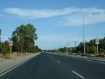 |
Landsdale Area:
Southbound after the Gnangara Rd (SR83) intersection, April 2009.
Image © Paul Rands
|
 |
Approaching Green Street, Walcott Street & Alexander Drive:
Warning sign on Fitzgerald St, North Perth approaching the signalised intersection with Green & Walcott Streets (SR75) and Alexander Dr (SR56). February 2009.
Image © Paul Rands
|
|
 |
Approaching Kingsway & Park Street:
Alexander Dr (SR56) at Landsdale approaching Kingsway and Park St, April 2009.
Image © Paul Rands
|
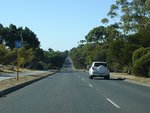 |
Trailblazer:
SR56 trailblazer at Alexander Heights, April 2009.
Image © Paul Rands
|
|
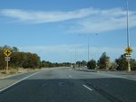 |
Approaching Kingsway & Park Street:
Alexander Dr (SR56) at Landsdale approaching Kingsway and Park St, April 2009.
Image © Paul Rands
|
 |
Approaching Hepburn Avenue:
Alexander Dr (SR56) approaching the unnumbered section of Hepburn Av in Alexander Heights, April 2009.
Image © Paul Rands
|
|
 |
Landsdale Road:
Corner of Alexander Dr (SR56) and Landsdale Rd at Landsdale, April 2009.
Image © Paul Rands
|
 |
Approaching Kingsway:
Alexander Dr (SR56) approaching Kingsway and Park St at Landsdale, April 2009.
Image © Paul Rands
|
|
 |
Approaching Hepburn Avenue:
Alexander Dr (SR56) at Landsdale approaching Hepburn Av, April 2009.
Image © Paul Rands
|
 |
Approaching Gnangara Road:
Alexander Drive (SR56) approaching the intersection with Gnangara Drive (SR83) and the unnumbered section of Alexander Drive at Landsdale, April 2009.
Image © Paul Rands
|
|
 |
Approaching Illawarra Crescent:
Alexander Dr (SR56) approaching Illawarra Cr at Ballajura, April 2009.
Image © Paul Rands
|
 |
End SR56:
End of State Route 56 at the junction with Gnangara Rd (SR83), April 2009.
Image © Paul Rands
|
|
 |
Approaching Marangaroo Road:
Alexander Dr (SR56) approaching Marangaroo Rd (SR81) at Ballajura, April 2009.
Image © Paul Rands
|
|
|
|
 |
Marangaroo Drive:
Corner of Alexander Dr (SR56) and Marangaroo Rd (SR81) at Ballajura, April 2009.
Image © Paul Rands
|
|
|
|
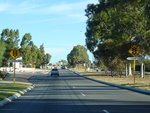 |
Approaching Illawarra Crescent:
Alexander Dr (SR56) approaching Illawarra Cr at Ballajura, April 2009.
Image © Paul Rands
|
|
|
|
 |
Approaching Beach Road:
Alexander Dr (SR56) approaching Beach Rd at Malaga, April 2009.
Image © Paul Rands
|
|
|
|
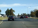 |
Beach Road:
Alexander Dr (SR56) at the junction with Beach Rd at Malaga, April 2009.
Image © Paul Rands
|
|
|
|
 |
Approaching Victoria Road:
Corner of Alexander Dr (SR56) and Victoria Rd at Malaga, April 2009.
Image © Paul Rands
|
|
|
|
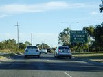 |
Advance Directional Sign:
AD sign at Malaga approaching Reid Hwy (SR3), April 2009.
Image © Paul Rands
|
|
|
|
 |
Trailblazer Assembly:
Trailblazer assembly approaching Reid Hwy (SR3) at Malaga, April 2009.
Image © Paul Rands
|
|
|
|
 |
Reid Highway Intersection:
Corner of Alexander Dr (SR56) and Reid Hwy (SR3) at Malaga, April 2009.
Image © Paul Rands
|
|
|
|
 |
Reid Hwy Intersection:
Westbound on Reid Hwy (SR3) at Noranda at the intersection with Alexander Drive. February 2008.
Image © Paul Rands
|
|
|
|
 |
Trailblazer:
SR56 trailblazer at Noranda after the Reid Hwy (SR3) junction, April 2009.
Image © Paul Rands
|
|
|
|
 |
Approaching Widgee Road & Hellenic Drive:
Alexander Dr (SR56) at Noranda approaching Widgee Rd and Hellenic Dr, April 2009.
Image © Paul Rands
|
|
|
|
 |
Approaching Yirrigan Drive:
Alexander Dr (SR56) at Dianella approaching Yirrigan Dr, April 2009.
Image © Paul Rands
|
|
|
|
 |
Yirrigan Drive Intersection:
Corner of Alexander Dr (SR56) and Yirrigan Dr at Dianella, April 2009.
Image © Paul Rands
|
|
|
|
 |
Trailblazer:
SR56 trailblazer at Dianella, after Yirrigan Dr, April 2009.
Image © Paul Rands
|
|
|
|
 |
Advance Directional Sign:
Southbound approaching the intersection with Morley Drive (SR76) at Dianella. February 2008.
Image © Paul Rands
|
|
|
|
 |
Morley Drive Intersection:
Southbound through the intersection with Morley Drive in Dianella. February 2008.
Image © Paul Rands
|
|
|
|
 |
Morley Drive Intersection:
Southbound through the intersection with Morley Drive in Dianella. February 2008.
Image © Paul Rands
|
|
|
|
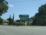 |
Grand Promenade Intersection:
Southbound intersection directional sign on the corner of Alexander Dr and Grand Prom (SR55) at Dianella, February 2008.
Image © Paul Rands
|
|
|
|
 |
Menora:
Southbound as you pass through the suburb of Menora, near Central Av. February 2008.
Image © Paul Rands
|
|
|
|
 |
Lane Allocation Sign:
Southbound signage approaching the intersection with Walcott St (SR75) at Menora, February 2008.
Image © Paul Rands
|
|
|
|
 |
North Perth:
Looking southwest in the shopping precinct in North Perth near Forrest Street, February 2008.
Image © Paul Rands
|
|
|
|
 |
North Perth:
SR56 trailbalzer on Fitzgerald St near Chelmsford St in North Perth, April 2009.
Image © Paul Rands
|
|
|
|
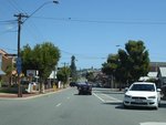 |
End SR56 Sign:
Looking southwest in North Perth at the southern terminus of SR56 near Glendower Street, February 2008.
Image © Paul Rands
|

