 |
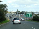
Intersection Directional Sign:
ID sign on Canning Hwy (SR6) at Como at the interchange with Kwinana Fwy (SR2), July 2009.
Image © Paul Rands
|
 |
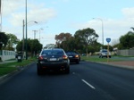
Kwinana Fwy / Manning Rd Interchange:
Southbound at Como, at the Kwinana Freeway interchange, where it splits with Manning Road (SR26), July 2009.
Image © Paul Rands
|
 |
Kwinana Fwy / Manning Rd Interchange:
Southbound at Como, at the Kwinana Freeway interchange, where it splits with Manning Road (SR26), July 2009.
Image © Paul Rands
|
 |
Approaching Ley Street:
Manning Road (eastbound) at Como, approaching Ley Street, July 2009.
Image © Paul Rands
|
 |
SR26 Trailblazer:
SR26 trailblazer at Manning approaching Bickley Crescent and Wellwyn Avenue, July 2009.
Image © Paul Rands
|
 |
SR26 Trailblazer:
SR26 trailblazer at Manning, July 2009.
Image © Paul Rands
|
 |
Elderfield Road Intersection:
Manning Rd approaching Elderfield Rd in Karawara, July 2009.
Image © Paul Rands
|
 |
Approaching Waterford Avenue & Kent Street:
Manning Rd (eastbound) approaching Waterford Av and Kent St in Karawara, July 2009.
Image © Paul Rands
|
 |
Approaching Curtin University:
Manning Rd approaching the Curtin University entrance at Bentley, July 2009.
Image © Paul Rands
|
 |
AD Sign:
Advance directional sign approaching Centenary Av at Waterford, July 2009.
Image © Paul Rands
|
 |
Approaching Centenary Avenue:
Manning Rd approaching Centenary Av at Waterford, July 2009.
Image © Paul Rands
|
 |
Centenary Avenue Intersection:
Corner of Manning Rd and Centenary Av in Waterford, July 2009.
Image © Paul Rands
|
 |
Intersection Directional Signs:
ID signs facing Centenary Avenue at Waterford, July 2009.
Image © Paul Rands
|
 |
Approaching Lawson Street:
Manning Rd approaching Lawson St at Bentley, July 2009.
Image © Paul Rands
|
 |
Approaching Wyong Road:
Manning Rd approaching Wyong Rd at Bentley, July 2009.
Image © Paul Rands
|
 |
Vehicle Restriction Sign:
Sign prohibiting trucks longer than 19 metres in length along Leach Hwy (SR7), Bentley, July 2009.
Image © Paul Rands
|
 |
Approaching Leach Highway:
Manning Rd approaching Leach Hwy (SR7) at Bentley, July 2009.
Image © Paul Rands
|
 |
Advance Directional Sign & Trailblazers:
Trailblazer assembly and advance directional sign on Manning Rd approaching Leach Hwy (SR7), July 2009. Note the incorrect route numbers on the AD sign.
Image © Paul Rands
|
 |
Leach Highway Intersection:
Corner of Manning Rd (SR26) and Leach Hwy (SR7) at Bentley, July 2009.
Image © Paul Rands
|
 |
Approaching Albany Highway & Mallard Way:
Manning Rd approaching its eastern terminus, Albany Hwy (SR30) and Mallard Way at Cannington, July 2009.
Image © Paul Rands
|
 |
End State Route 26:
Trailblazer assembly indicating the end of SR26, at the junction with Albany Hwy (SR30) and Mallard Way at Cannington, July 2009.
Image © Paul Rands
|


