| |
| |
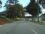 |
Trailblazer:
SR14 trailblazer at Armadale after the Albany Hwy (SR30) and South Western Hwy (SR20) intersection, June 2009.
Image © Paul Rands
|
|
 |
Intersection Directional Sign:
Northbound ID sign at the corner of Cockburn Rd (SR12) and Spearwood Av (SR14) at Spearwood, December 2012.
Image © Paul Rands |
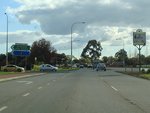 |
Church Avenue Intersection:
Southbound ID sign at the corner of Armadale Rd (SR14) and Church Av in Armadale, June 2009.
Image © Paul Rands
|
|
 |
Intersection Directional Sign:
ID sign at the corner of Cockburn Rd (SR12) and Spearwood Av (SR14) at Spearwood, December 2012.
Image © Paul Rands |
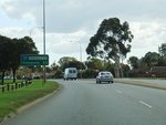 |
Distance Sign:
RD sign at Armadale after the Church Av intersection, June 2009.
Image © Paul Rands
|
|
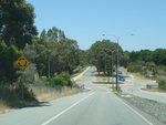 |
Approaching Hamilton Road:
Spearwood Av (SR14) approaching Hamilton Rd, Spearwood, December 2012.
Image © Paul Rands |
 |
Level Crossing:
Railway level crossing at Armadale on Armadale Rd (SR14), June 2009.
Image © Paul Rands
|
|
 |
Approaching Rockingham Road:
Spearwood Av (SR14) as it approaches the unnumbered section of Rockingham Rd at Spearwood, December 2012.
Image © Paul Rands |
 |
Advance Directional Sign:
AD sign on the off ramp from the Kwinana Fwy (SR2) at Success, approaching Beeliar Rd & Armadale Rd (SR14), June 2009.
Image © Paul Rands
|
|
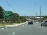 |
Advance Directional Sign:
AD sign approaching Stock Rd (NR1) at Spearwood, December 2012.
Image © Paul Rands |
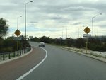 |
Approaching Beeliar Road & Armadale Road:
The off ramp from the Kwinana Fwy (SR2) at Success, approaching Beeliar Rd & Armadale Rd (SR14), June 2009.
Image © Paul Rands
|
|
 |
Stock Road:
Corner of Spearwood Av (SR14) and Stock Rd (NR1) at Spearwood, December 2012.
Image © Paul Rands |
 |
Trailblazers:
Trailblazers on the off ramp from the Kwinana Fwy (SR2) at Success, approaching Beeliar Rd & Armadale Rd (SR14), June 2009.
Image © Paul Rands
|
|
 |
Stock Road:
Corner of Spearwood Av (SR14) and Stock Rd (NR1) at Spearwood, December 2012.
Image © Paul Rands |
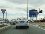 |
Intersection Directional Sign Assembly:
ID sign facing the off ramp from Kwinana Fwy (SR2) at the junction with Beeliar Dr & Armadale Rd (SR14) at Success, June 2009.
Image © Paul Rands
|
|
 |
Port Kembla Road:
Spearwood Av (SR14) at the junction with Port Kembla Rd in Bibra Lake, December 2012.
Image © Paul Rands |
 |
Trailblazers:
SR14 trailblazers near the off ramp from the Kwinana Fwy (SR2) at Success, on Beeliar Rd, December 2012.
Image © Paul Rands
|
|
 |
Advance Directional Sign:
Diagrammatic AD sign approaching the roundabout with the unnumbered sections of Spearwood Dr and Beeliar Dr at Bibra Lake, December 2012.
Image © Paul Rands |
 |
Intersection Directional Sign:
ID sign assembly at the junction of Beeliar Dr (SR14) and Linkage Av in Success, December 2012.
Image © Paul Rands |
|
 |
Intersection Directional Sign:
ID sign at the roundabout with the unnumbered sections of Spearwood Dr and Beeliar Dr at Bibra Lake, December 2012.
Image © Paul Rands |
 |
Approaching North Lake Road & Cockburn Gateway Shopping Centre:
Beeliar (SR14) approaching North Lake Road & Cockburn Gateway Shopping Centre at Success, December 2012. SR14 used to turn right at this junction and follow North Lake Rd.
Image © Paul Rands |
|
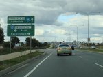 |
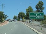
Advance Directional Sign:
AD sign approaching Kwinana Fwy (SR2) at Cockburn Central, June 2009.
Image © Paul Rands
|
 |
Advance Directional Sign:
Diagrammatic AD sign approaching the roundabout with the unnumbered sections of Spearwood Dr and Beeliar Dr at Beeliar, December 2012.
Image © Paul Rands |
|
 |
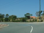
Approaching Kwinana Freeway:
Beeliar Dr (SR14) approaching Kwinana Fwy (SR2) at Cockburn Central, June 2009.
Image © Paul Rands
|
 |
Intersection Directional Sign:
ID sign at the roundabout with the unnumbered sections of Spearwood Dr and Beeliar Dr at Beeliar, December 2012.
Image © Paul Rands |
|
 |
Trailblazers:
SR14 and SR2 trailblazer assemblies, on Beeliar Dr (SR14) approaching Kwinana Fwy (SR2) at Cockburn Central, June 2009.
Image © Paul Rands
|
 |
Intersection Directional Sign:
ID sign at the roundabout with the unnumbered sections of Spearwood Dr and Beeliar Dr at Beeliar, December 2012.
Image © Paul Rands |
|
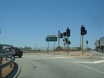 |
Kwinana Freeway interchange:
Beeliar Dr (SR14) at the interchange with Kwinana Fwy (SR2) at Cockburn Central, December 2012. SR14 changes to Armadale Rd at this interchange.
Image © Paul Rands
|
 |
Intersection Directional Sign:
ID sign at the roundabout with the unnumbered sections of Spearwood Dr and Beeliar Dr at Beeliar, December 2012.
Image © Paul Rands |
|
 |
Supplemental Advance Directional Sign:
Supplemental AD sign near the Kwinana Fwy (SR2) interchange at Cockburn Central, December 2012.
Image © Paul Rands |
 |
Approaching Barrington Street:
Spearwood Av (SR14) approaching Barrington St in Bibra Lake, December 2012.
Image © Paul Rands |
|
 |
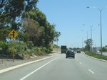
Trailblazer:
SR14 trailblazer on Armadale Rd (SR14) after Kwinana Fwy (SR2) at Jandakot, June 2009.
Image © Paul Rands
|
 |
Approaching Howson Way:
Spearwood Av (SR14) approaching Howson Way in Bibra Lake, December 2012.
Image © Paul Rands |
|
 |
Solomon Road:
ID sign at the corner of Armadale Rd and Solomon Rd in Jandakot, June 2009.
Image © Paul Rands
|
 |
Approaching Cocos Drive:
Spearwood Av (SR14) approaching Cocos Dr in Bibra Lake, December 2012.
Image © Paul Rands |
|
 |
Approaching Tapper Road & North Lake Road:
Armadale Rd (SR14) in Jandakot, approaching Tapper Rd & North Lake Rd, June 2009.
Image © Paul Rands
|
 |
Approaching Sudlow Road:
Spearwood Av (SR14) approaching Sudlow Rd, Bibra Lake, December 2012.
Image © Paul Rands |
|
 |
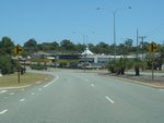
Approaching Nicholson Road:
Flashing warning sign for the traffic lights at the junction with Nicholson Rd (SR31) at Piara Waters, June 2009.
Image © Paul Rands
|
 |
Approaching Port Kembla Road:
Spearwood Av (SR14) approaching Pt Kembla Rd at Bibra Lake, December 2012.
Image © Paul Rands |
|
 |
Trailblazers:
Trailblazer assembly approaching Nicholson Rd (SR31) at Piara Waters, June 2009.
Image © Paul Rands
|
 |
Advance Directional Sign:
AD sign approaching Stock Rd (NR1) at Bibra Lake, December 2012.
Image © Paul Rands |
|
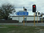 |
Intersection Directional Sign:
ID sign at the corner of Armadale Rd (SR14) and Nicholson Rd (SR31) at Piara Waters, June 2009.
Image © Paul Rands
|
 |
Stock Road:
Corner of Spearwood Av (SR14) and Stock Rd (NR1) at Bibra Lake, December 2012.
Image © Paul Rands |
|
 |
Approaching Anstey Road & Weld St:
Armadale Rd (SR14) approaching the roundabout with Anstey Rd and Weld St in Forrestdale, June 2009.
Image © Paul Rands
|
 |
Intersection Directional Sign:
ID sign at the corner of Spearwood Av (SR14) and Stock Rd (NR1) at Bibra Lake, December 2012.
Image © Paul Rands |
|
 |
Trailblazer:
SR14 traliblazer at Forrestdale, June 2009.
Image © Paul Rands
|
 |
Approaching Rockingham Road:
Spearwood Av (SR14) approaching Rockingham Rd at Spearwood, December 2012.
Image © Paul Rands |
|
 |
Approaching Tonkin Highway:
Armadale Rd (SR14) approaching Tonkin Hwy (SR4) at Forrestdale, June 2009.
Image © Paul Rands
|
 |
Advance Directional Sign:
AD sign at Spearwood approaching Cockburn Rd (SR12), December 2012.
Image © Paul Rands |
|
 |
Tonkin Hwy Intersection:
Corner of Armdale Rd and Tonkin Hwy at Forrestdale, June 2009.
Image © Paul Rands
|
 |
End State Route 14:
Western terminus of State Route 14: Cockburn Rd at Spearwood, December 2012.
Image © Paul Rands |
|
 |
Tonkin Hwy Intersection:
Corner of Armdale Rd and Tonkin Hwy at Forrestdale, June 2009.
Image © Paul Rands
|
| |
|
|
 |
Lake Road & Twelfth Avenue Junctions:
Armadale Rd (SR14) at the junction with Lake Rd (SR13) and approaching the roundabout with Twelfth Av in Forrestdale, June 2009.
Image © Paul Rands
|
| |
|
|
 |
Entering Armadale:
Armadale Rd (SR14) entering the town of Armadale, June 2009.
Image © Paul Rands
|
| |
|
|
 |
Railway Avenue Intersection:
Corner of Armadale Rd and Railway Av in Armadale, June 2009.
Image © Paul Rands
|
| |
|
|
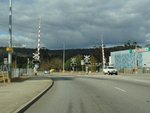 |
Level Crossing:
Railway level crossing on Armadale Rd (SR14) at Armadale, June 2009.
Image © Paul Rands
|
| |
|
|
 |
Advance Directional Sign:
AD sign approaching Albany Hwy (SR30) and South Western Hwy (SR20) at Armadale, June 2009.
Image © Paul Rands
|
| |
|
|
 |
Albany Highway & South Western Highway Junction:
Armadale Rd (SR14) at its eastern terminus in Armadale, June 2009.
Image © Paul Rands
|
| |
|
|
 |
Albany Highway & South Western Highway Junction:
Armadale Rd (SR14) at its eastern terminus in Armadale, June 2009.
Image © Paul Rands
|


