|
|
|
|
|
 |
Northam-Pithara Road (State Route 115) |
Statistics:
Route Numbering:


General Information:
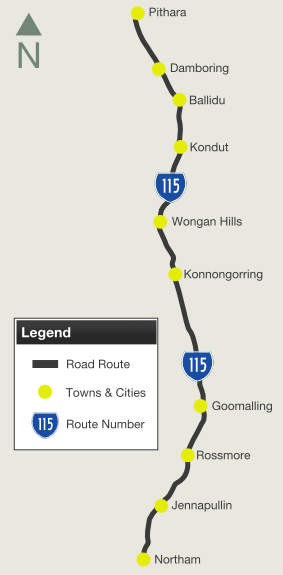
State Route 115 is a rural connector route which connects the wheatbelt town of Northam with the northern wheatbelt town of Pithara, which lies on the Great Northern Highway (NH95).
The route consists of single carriageway rural highway which passes through several small towns and farms, plus several saltpans at the northern extremities of the route. During harvest times, the route is frequented by trucks carrying loads of wheat to be processed or shifted by rail to other destinations.
The naming of the route reverts to local naming in Northam, but is referred to in its entirety by Main Roads Western Australia as Northam-Pithara Road.
Multiplexes along the route include:
| Northam to Pithara | Pithara to Northam | |||
| Preview: | Description: | Preview: | Description: | |
 |
Black Advance Directional Sign: Black AD sign on Fitzgerald St in Northam, approaching Forrest St, Peel Tce and Taylor St (SR115) (Northam-Pithara Rd). April 2009. Image © Paul Rands |
 |
Intersection Directional Sign: ID sign on the corner Great Northern Hwy (NH95) and Northam-Pithara Rd (SR115) at Pithara. April 2009. Image © Paul Rands |
|
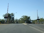 |
Level Crossing: The level crossing on Taylor Street, just after the Forrest Street and Peel Terrace intersection in Northam. April 2009. Image © Paul Rands |
 |
Heavy Vehicle Detour Sign: Older style heavy vehicle detour sign at Malabaine approaching the link road to Great Eastern Hwy (NH94), April 2018. Image © Paul Rands |
|
 |
Mortlock River: SR115 as it crosses the Mortlock River in Northam. April 2009. Image © Paul Rands |
 |
Great Eastern Highway: Northam-Pithard Rd (SR115) at the junction with the link road to Great Eastern Hwy (NH94) at Malabaine, April 2018. Image © Paul Rands |
|
 |
Approaching Old York Road & Katrine Road: Taylor Street (SR115) approaching Old York Road and Katrine Road in Northam. April 2009. Image © Paul Rands |
 |
Intersection Directional Sign: ID sign facing the link road to Great Eastern Hwy (NH94) at Malabaine, April 2018. Image © Paul Rands |
|
 |
Intersection Directional Sign: Corner of Old York Rd and Katrine Rd (TD254) at Northam. April 2009. Image © Paul Rands |
 |
Reassurance Directional Sign: Distance sign at Malabaine, April 2018. Image © Paul Rands |
|
 |
Withers Street: Goomalling Road (Northam-Pithara Road) at the junction with Withers Street in Northam. April 2009. Image © Paul Rands |
 |
AD Sign: Advance directional sign in Northam, approaching Forrest St, Peel Tce and Fitzgerald St. April 2009. Image © Paul Rands |
|
 |
Advance Directional Sign: AD sign at Northam approaching Great Eastern Hwy (NH94). April 2009. Image © Paul Rands |
 |
End SR115: Southern terminus of SR115. Corner of Forrest St, Peel Tce and Fitzgerald St in Northam. April 2009. Image © Paul Rands |
|
 |
Great Eastern Highway Junction: Great Eastern Hwy & Northam-Pithara Rd intersection, Northam. April 2018. Click here for a photo of this location by Paul Rands from April 2009. Image © Paul Rands |
|||
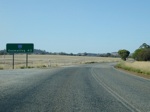 |
Distance Sign: RD sign on the outskirts of Northam, after Great Eastern Hwy. April 2009. Image © Paul Rands |
|||
 |
Mortlock River North: Northam-Pithara Rd as it crosses Mortlock River at Northam. April 2009. Image © Paul Rands |
|||
 |
Jennapullin Brook: SR115 as it crosses Jennapullin Brook. April 2009. Image © Paul Rands |
|||
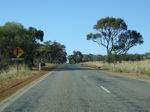 |
Approaching Jennapullin Road: Northam-Pithara Rd as it approaches Jennapullin Rd in Jennapullin. April 2009. Image © Paul Rands |
|||
 |
Jennapullin Road Junction: Fingerboards at Jennapullin Rd in Jennapullin. April 2009. Image © Paul Rands |
|||
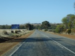 |
Entering Goomalling Shire: SR115 as it enters the Goomalling Shire at Jennapullin. April 2009. Image © Paul Rands |
|||
 |
Kilometre Plate: Typical kilometre plate at Rossmore, with the distance to Goomalling. April 2009. Most kilometre plates in WA use a 2 or 3 letter abbreviation for the town they mention. Image © Paul Rands |
|||
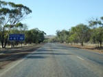 |
Services Sign: Services sign on the outskirts of Goomalling. April 2009. Image © Paul Rands |
|||
 |
Tourism Sign: North-Pithara Road as it enters Goomalling. April 2009. Image © Paul Rands |
|||
 |
Entering Goomalling: North-Pithara Road as it enters Goomalling. April 2009. Image © Paul Rands |
|||
 |
Corner of Northam-Pithara Road & Wolyam Street: Goomalling town centre. April 2009. Image © Paul Rands |
|||
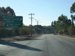 |
Advance Directional Sign: AD sign at Goomalling approaching Railway Terrace. April 2009. Image © Paul Rands |
|||
 |
Advance Directional Sign: AD sign at Goomalling on Railway Terrace approaching Northam-Pithara Road (Throssell Street). April 2009. Image © Paul Rands |
|||
 |
Intersection Directional Sign: ID sign at Goomalling on Railway Terrace at the junction with Northam-Pithara Road (Throssell Street). April 2009. Image © Paul Rands |
|||
 |
Advance Directional Sign: AD sign at Goomalling approaching Kallandgin Road. April 2009. Image © Paul Rands |
|||
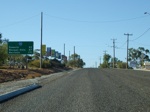 |
Reassurance Directional Sign: RD sign at Goomalling after the junction with Kallandgin Road. April 2009. Image © Paul Rands |
|||
 |
Advance Directional Sign: AD sign at Goomalling approaching Goomalling-Wyalkatchem Road. April 2009. SR115 turns left at this junction. Image © Paul Rands |
|||
 |
Corner of Northam-Pithara Rd & Goomalling-Wyalkatchem Rd: Corner of Northam-Pithara Road and Goomalling-Wyalkatchem Road at Goomalling . April 2009. SR115 turns left at this junction. Image © Paul Rands |
|||
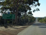 |
Reassurance Directional Sign: RD sign with topknot at Goomalling after the junction with Goomalling-Wyalkatchem Road. April 2009. Image © Paul Rands |
|||
 |
Entering Konnongorring: Entering the small town of Konnongorring. April 2009. Image © Paul Rands |
|||
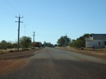 |
Konnongorring Town Centre: Northam-Pithara Road as it passes through Konnongorring. April 2009. Image © Paul Rands |
|||
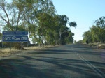 |
Services Sign: Services sign on the outskirts of Wongan Hills. April 2009. Image © Paul Rands |
|||
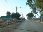 |
Entering Wongan Hills: Entering the town of Wongan Hills. April 2009. Image © Paul Rands |
|||
 |
Moore Street Intersection: Corner of Northam-Pithara Rd and Moore St in Wongan Hills. April 2009. Image © Paul Rands |
|||
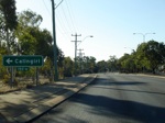 |
AD Sign: Advance directional sign at Wongan Hills approaching Calingiri-Wongan Hills Road. April 2009. Image © Paul Rands |
|||
 |
Calingiri-Wongan Hills Road Intersection: Corner of Northam-Pithara Road and Calingiri-Wongan Hills Road at Wongan Hills. April 2009. Image © Paul Rands |
|||
 |
AD Sign: Advance directional sign at Wongan Hills approaching Quinlan Street. April 2009. Image © Paul Rands |
|||
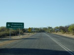 |
AD Sign: Advance directional sign at Wongan Hills approaching Waddington-Wongan Hills Road. April 2009. Image © Paul Rands |
|||
 |
RD sign: Reassurance directional sign as you leave Wongan Hills. April 2009. Image © Paul Rands |
|||
 |
Korraling Area: Northam-Pithara Road as it passes through the Korraling area. April 2009. Image © Paul Rands |
|||
 |
Old Kilometre Plate: Old black kilometre plate at Korralong, with the distance to Dalwallinu, which is not on Northam-Pithara Rd, but the Great Northern Hwy (NH95) instead. April 2009. Image © Paul Rands |
|||
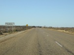 |
Kondu Area: Typical conditions near Kondut. April 2009. Image © Paul Rands |
|||
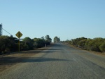 |
Approaching Kondut Southeast Road: Northam-Pithara Rd at Kondut, approaching the intersection with Kondut Southeast Rd. April 2009. Image © Paul Rands |
|||
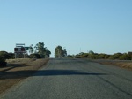 |
Kondut Southeast Road: Northam-Pithara Rd at Kondut, at the intersection with Kondut Southeast Rd. April 2009. Image © Paul Rands |
|||
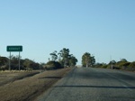 |
Entering Kondut: Northam-Pithara Rd as it enters the town of Kondut. April 2009. Image © Paul Rands |
|||
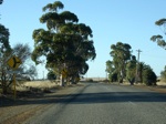 |
Kondut East Road: Northam-Pithara Rd at Kondut, approaching the intersection with Kondut East Rd. April 2009. Image © Paul Rands |
|||
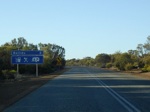 |
Services Sign: Services sign as you enter Ballidu. April 2009. Image © Paul Rands |
|||
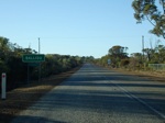 |
Entering Ballidu: Northam-Pithara Rd as it enters Ballidu. April 2009. Image © Paul Rands |
|||
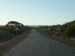 |
Speed Derestriction Sign: Open speed limit signs on the edge of Ballidu. These days, these denote the maximum state speed limit, which in WA is 110 km/h. Also note the single lane wide pavement. April 2009. Image © Paul Rands |
|||
 |
SR115 Trailblazer: SR115 trailblazer at Damboring. April 2009. Image © Paul Rands |
|||
 |
Approaching Damboring Road & Damboring East Road: Northam-Pithara Rd in Damboring, approaching the intersection with Damboring Rd and Damboring East Rd. April 2009. Image © Paul Rands |
|||
 |
Approaching Great Northern Hwy: Northam-Pithara Road as it approaches the intersection with Great Northern Hwy at Pithara. April 2009. Image © Paul Rands |
|||
 |
Advance Directional Sign: AD sign approaching Great Northern Hwy (NH95) in Pithara. April 2009. Image © Paul Rands |
|||
 |
End SR115: Intersection directional sign facing Northam-Pithara Rd at the Great Northern Hwy junction, Pithara. April 2009. Image © Paul Rands |
|||
1 List of Roads Controlled by Main Roads Western Australia
Last updated: 28-Jul-2020 12:33
This site © Paul Rands. All rights reserved. Some portions © (copyright) by their respective and credited owners. Permission must be obtained before using any images from this site. For details, please email by clicking here.