|
|
|
|
|
 |
|
Coolgardie-Esperance Highway, Roe Highway, Great Eastern Highway Bypass & Great Eastern Highway (National Highway 94) - Perth to Sawyers Valley |
Statistics:
Route Numbering:


General Information:
National Highway 94 is a major route in WA, directly linking the capital city of Perth with the mining and goldfield regions in the eastern part of the state, such as Kalgoorlie and Norseman, it also connects to National Highway 1, the Eyre Highway, which is the major link, via the Nullarbor Plain between the east and west coasts of Australia.
Outside of Perth, the route is bitumen paved single carriageway roadway. Some overtaking lanes exist along the route between Coolgardie and Perth's outer suburbs. Inside the metropolitan area, the route varies from mutli-lane arterial road to expressway standard.
The highway generally runs parallel with the Mundaring to Kalgoorlie water pipeline, which pipes drinking water drawn from Mundaring Weir near Perth to Kalgoorlie.
Multiplexes along the route include:
History:
Click here for the former alignment between Perth and Sawyers Valley
| Sawyers Valley To Perth | |
Perth to Sawyers Valley | ||
| Preview: | Description: | |
Preview: | Description: |
 |
Entering
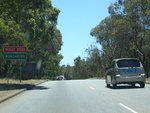
Mundaring: Sign announcing the suburb of Mundaring, December 2007. Image © Paul Rands |
|
 |
Supplemental
AD Sign: Directional sign for the upcoming Graham Farmer Fwy (SR8). Eastbound at Victoria Park McCallum Park approaching Causeway (SR5). December 2007. Image © Paul Rands |
 |
Approaching
Stoneville Road: Flashing warning sign as you approach the traffic signals for Stoneville Road at Mundaring. December 2007. Image © Paul Rands |
|
 |
Intersection
Directional Sign: ID sign for the Causeway intersection, at Victoria Park, near the official terminus of NH94. December 2007. Image © Paul Rands |
 |
Mundaring
Shopping Precinct: Traveling thru the shopping area in the suburb of Mundaring, December 2007. Image © Paul Rands |
|
 |
Advance
Directional Sign: AD sign for Shepperton Road (SR30) at Burswood. December 2007. Image © Paul Rands |
 |
Flashing Steep Descent
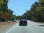
Sign: Sign warning of steep decent at Greenmount Hill. December 2007. Image © Paul Rands |
|
 |
Advance
Directional Sign: AD sign at Burswood near the Burswood Casino approaching Bolton Av, July 2009. Image © Paul Rands |
 |
Flashing Sign: Sign near Bilgoman Road at Glen Forrest directing trucks to use low gear to descend Greenmount Hill. December 2007. Image © Paul Rands |
|
 |
Victoria
Park Drive Intersection: Corner of Great Eastern Hwy (NH94 / NR1) and Victoria Park Dr at Burswood, July 2009. Image © Paul Rands |
 |
Heavy Vehicle Speed
Limit Sign: Sign detailing maximum speed for heavy vehicles down Greenmount Hill. December 2007. Image © Paul Rands
|
|
 |
Graham Farmer Fwy /
Orrong Road Interchange: Intersection with Graham Farmer Freeway and Orrong Road at Burswood. December 2007. Image © Paul Rands |
 |
Heavy Vehicle Speed
Limit Sign: Sign detailing maximum speed for heavy vehicles down Greenmount Hill. December 2007. Image © Paul Rands
|
|
 |
Graham
Farmer Fwy / Orrong Road Interchange: Intersection with Graham Farmer Freeway and Orrong Road at Burswood, July 2009. Image © Paul Rands |
 |
Greenmount Hill: Looking towards Perth at Greenmount as the highway drops towards the Swan Coastal Plain from the Darling Scarp at Greenmount. December 2007. Image © Paul Rands |
|
 |
Distance
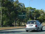
Sign: RD sign after the SR8, Graham Farmer Fwy / Orrong Rd interchange. Rivervale, December 2007. Image © Paul Rands |
 |
Truck Arrester Bed
Sign: AD sign for the truck arrester bed on Great Eastern Hwy (NH94) at Greenmount. December 2007. Image © Paul Rands |
|
 |
Reassurance
Sign: Sign assembly showing the NR1 / NH94 duplex at Rivervale approaching Belmont Avenue. December 2007. Image © Paul Rands |
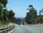 |
Greenmount Hill: Looking towards Perth at Greenmount. December 2007. Image © Paul Rands
|
|
 |
Approaching
Brighton Road & Kooyong Road: Great Eastern Hwy at Rivervale approaching Brighton Rd & Kooyong Rd, July 2009. Image © Paul Rands |
 |
Truck Arrester Bed: The westbound truck arrester bed at Greenmount. December 2012. A fatal crash in 1993 at the intersection with Roe Highway occurred where a truck lost control coming down hill and failed to stop. This crash led to the construction of this truck arrester bed near the bottom of Greenmount Hill. Image © Paul Rands |
|
 |
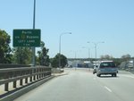
Advance Directional
Sign: AD sign at Belmont approaching Belgravia St (SR55) and Stoneham St (SR55), April 2016. Image © Paul Rands |
 |
Supplemental Advance
Directional Sign: AD sign for the Roe Highway intersection, Bellevue. December 2012. Image © Paul Rands |
|
 |
Belgravia Street &
Stoneham Street: Great Eastern Hwy (NH94 / NR1) at the junction with Belgravia St (SR55) and Stoneham St (SR55) at Belmont, April 2016. Image © Paul Rands |
 |
Reassurance Marker: Image © Paul Rands |
|
 |
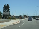
Belgravia Street &
Stoneham Street: Great Eastern Hwy (NH94 / NR1) at the junction with Belgravia St (SR55) and Stoneham St (SR55) at Belmont, April 2016. Image © Paul Rands |
 |
End Heavy
Vehicle Speed Zone: Sign at Bellevue indicating the end of special speed limit for heavy vehicles, December 2012. Image © Paul Rands |
|
 |
Supplemental Advance
Directional Sign: Supplemental AD sign at Ascot, approaching Tonkin Hwy (SR4) and Brearley St, April 2016. Image © Paul Rands |
 |
Advance Directional
Sign: AD sign for the Roe Highway intersection, at Bellvue. Note all the multiplexed route numbers here. December 2012. Click here for a photo of this location from December 2007. Image © Paul Rands |
|
 |
Advance Directional
Sign: AD sign at Ascot, approaching Tonkin Hwy (SR4), April 2016. Image © Paul Rands |
 |
Directional Sign: ID sign at Bellevue directing NH94 to duplex along SR3.December 2012. Click here for a photo of this location from December 2007. Image © Paul Rands |
|
 |
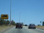
Tonkin Highway: Great Eastern Hwy (NH94 / NR1) at the Tonkin Hwy (SR4) interchange at Ascot, April 2016. Image © Paul Rands |
 |
Truck Route Sign: Sign indicating that this section of Roe Highway is a designated truck route. December 2007. Image © Paul Rands |
|
 |
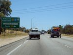
Tonkin Highway: Great Eastern Hwy (NH94 / NR1) at the Tonkin Hwy (SR4) interchange at Ascot, April 2016. Image © Paul Rands |
 |
Advance
Directional Sign: AD sign for the Great Eastern Highway Bypass at Hazelmere. December 2007. The NH94 shield showing the route extending straight ahead is in error. Image © Paul Rands |
 |
Trailblazer: Trailblazer assembly at Ascot, January 2020. Image © Paul Rands |
|
 |
Flashing
Signals Warning Sign: Warning sign for traffic signals as you approach the Great Eastern Highway Bypass intersection at Hazelmere. December 2007. Image © Paul Rands |
|
 |
Trailblazer: Trailblazer assembly at Ascot, April 2016. Image © Paul Rands |
 |
Great
Eastern Highway Bypass Junction: NH94 leaves SR3 here and turns right and heads west towards the Perth CBD. Hazelmere, December 2007. Image © Paul Rands |
|
 |
Advance Directional
Sign: AD sign approaching Gt Eastern Hwy (unnumbered) at Ascot, April 2016 Image © Paul Rands |
 |
Trailblazer: NH94 trailblazer on Great Eastern Hwy Bypass approaching Stirling Cr at Hazelmere, April 2016. Image © Paul Rands |
|
 |
Advance
Directional Sign: AD sign for the Great Eastern Highway / Great Eastern Highway Bypass split at South Guildford. December 2007. The NR1 duplex ends here. Image © Paul Rands |
 |
Trailblazer: NH94 trailblazer on Great Eastern Hwy Bypass approaching Abernethy Rd (SR55) at Hazelmere, April 2016. Image © Paul Rands |
|
 |
South
Guildford: Looking eastbound down NH94 at South Guildford. April 2016. Click here for a photo of this location by Paul Rands from December 2007. The NR1 duplex ends here. Image © Paul Rands |
 |
Advance
Directional Sign: AD sign for the Abernethy Road intersection, Hazelmere. April 2016. Image © Paul Rands |
|
 |
Advance
Directional Sign: AD sign at South Guildford approaching Kalamunda Rd, July 2009. Image © Paul Rands |
 |
Abernethy
Road: Facing the sign assembly at the signalised intersection with Abernethy Road at Hazelmere. April 2016. Image © Paul Rands |
|
 |
Approaching
Kalamunda Road: Great Eastern Hwy Bypass at South Guildford approaching Kalamunda Rd, April 2016. Click here for a photo of this location by Paul Rands from July 2009. Image © Paul Rands |
 |
Advance
Directional Sign: AD sign for the Great Eastern Highway / Great Eastern Highway Bypass intersection at South Guildford. April 2016. Note the incorrect NR94 shield, this should be NH94. The NR1 duplex starts here. Image © Paul Rands |
|
 |
Kalamunda
Road Intersection: ID sign assembly at the junction with Kalamunda Dr in South Guildford, July 2009. Image © Paul Rands |
 |
Great
Eastern Highway: The location where NH94 reverts back to Great Eastern Hwy, South Guildford, April 2016. Image © Paul Rands |
|
 |
South
Guildford Area: Great Eastern Hwy Bypass at South Guildford approaching the railway overpass, July 2009. Image © Paul Rands |
 |
Great
Eastern Highway: Corner of Great Eastern Hwy Bypass (NH94 / NR1) and Great Eastern Hwy (NH94 and unnumbered) at South Guildford. April 2016. The NR1 duplex starts here. Image © Paul Rands |
|
 |
Advance
Directional Sign: AD sign at Hazelmere approaching Abernethy Rd, July 2009. SR55 is a remnant, it's no longer routed along Abernethy Road. Image © Paul Rands |
 |
Advance
Directional Sign: AD sign gantry approaching Tonkin Hwy (SR4) interchange at Redcliffe, April 2016. Click here for a photo of this location by Paul Rands from December 2012. Image © Paul Rands |
|
 |
Approaching
Abernethy Road: Great Eastern Hwy Bypass at Hazelmere approaching Abernethy Rd, July 2009. Image © Paul Rands |
 |
Tonkin
Highway: Great Eastern Hwy (NH94 / NR1) at the Tonkin Hwy (SR4) interchange at Redcliffe, December 2012. Image © Paul Rands |
|
 |
Intersection
Directional Sign: ID sign at Hazelmere at the junction with Abernethy Rd, July 2009. Image © Paul Rands |
 |
Advance
Directional Sign: AD sign near Kimberley St at Belmont, approaching Hardey Rd and Resolution Dr, April 2016. Image © Paul Rands |
|
 |
Approaching
Stirling Crescent: Great Eastern Hwy Bypass at Hazelmere approaching Stirling Cr, July 2009. Image © Paul Rands |
 |
Advance
Directional Sign: AD sign at Belmont approaching Belgravia St (SR55) and Stoneham St (SR55), April 2016. Image © Paul Rands |
|
 |
Advance
Directional Sign: AD sign at Hazelmere approaching Roe Hwy (SR3), December 2012. NH94 duplexes with SR3 from this junction. Image © Paul Rands |
 |
Belgravia
Street & Stoneham Street: Great Eastern Hwy (NH94 / NR1) at the junction with Belgravia St (SR55) and Stoneham St (SR55) at Belmont, April 2016. Image © Paul Rands |
|
 |
Intersection
Directional Sign: ID sign assembly at the corner of Great Eastern Hwy Bypass (NH94) and Roe Hwy (SR3) at Hazelmere, December 2012. Image © Paul Rands |
 |
Belgravia
Street & Stoneham Street: Great Eastern Hwy (NH94 / NR1) at the junction with Belgravia St (SR55) and Stoneham St (SR55) at Belmont, April 2016. Image © Paul Rands |
|
 |
Roe
Highway Junction: Corner of Great Eastern Hwy Bypass and Roe Hwy at Hazelmere, July 2009. Image © Paul Rands |
 |
Supplemental
Advance Directional Sign: Supplemental AD sign at Rivervale for the Orrong Rd / Graham Farmer Fwy (SR8) interchange, June 2009. Image © Paul Rands |
|
 |
Traliblazer
Assembly: Trailblazer assembly at Hazelmere, April 2009. Image © Paul Rands |
 |
Advance
Directional Sign: AD sign at Rivervale for the Orrong Rd / Graham Farmer Fwy (SR8) interchange, June 2009. Image © Paul Rands |
|
 |
Advance
Directional Sign: AD sign near the overpass with Bushmead Rd and Helena Valley Rd at Hazelmere for the interchange with Clayton St, December 2012. Click here for a photo of this location from April 2009. Image © Paul Rands |
 |
Orrong
Rd / Graham Farmer Fwy Interchange: Great Eastern Hwy (NH94 / NR1) at the Orrong Rd & Graham Farmer Fwy (SR8) interchange at Rivervale, June 2009. Image © Paul Rands |
|
 |
Advance Directional
Sign: AD sign on Roe Hwy (NH94 / NR1 / SR3) at Bellevue, approaching Clayton St and Great Eastern Hwy (NH95 and SR51), April 2016. Image © Paul Rands |
 |
Orrong
Rd / Graham Farmer Fwy Interchange: Great Eastern Hwy (NH94 / NR1) at the Orrong Rd & Graham Farmer Fwy (SR8) interchange at Lathlain, April 2016. Image © Paul Rands |
|
 |
Clayton
Street Interchange: Roe Highway (NH94 / SR3) at the Clayton Street interchange at Bellevue, December 2012. Image © Paul Rands |
 |
Distance
Sign: RD sign at after the Orrong Rd & Graham Farmer Fwy (SR8) interchange at Lathlain, June 2009. Image © Paul Rands |
|
 |
Trailblazer
Assembly: Trailblazer assembly at the Clayton St interchange at Bellevue, April 2009. Image © Paul Rands |
 |
Advance
Directional Sign: AD sign at Lathlain approaching Bolton Av & Victoria Pk Dr, July 2009. Image © Paul Rands |
|
 |
Advance
Directional Sign: AD sign at Bellevue, approaching the interchange with Great Eastern Hwy (SR51), Great Eastern Hwy (NH94) and Roe Hwy (NH95 / NR1 / SR3), December 2012. Click here for a photo of this location from April 2009. Image © Paul Rands |
 |
Advance
Directional Sign: AD sign with lane allocations at Burswood approaching Craig Street, June 2009. Image © Paul Rands |
|
 |
Great
Eastern Highway & Roe Highway interchange: The interchange of Great Eastern Hwy (SR51), Great Eastern Hwy (NH94) and Roe Hwy (NH95 / NR1 / SR3) at Bellevue, December 2012. Click here for a photo of this location from April 2009. Image © Paul Rands |
 |
Shepperton
Road, Causeway & Canning Highway Interchange: Great Eastern Hwy approaching the interchange with Shepperton Rd (SR30), Causeway (SR5) and Canning Hwy (SR6), June 2009. Image © Paul Rands |
|
 |
Intersection
Directional Sign: ID sign at Midvale at the interchange of Great Eastern Hwy (SR51), Great Eastern Hwy (NH94) and Roe Hwy (NH95 / NR1 / SR3) at Bellevue, December 2012. Click here for a photo of this location from April 2009. Image © Paul Rands |
 |
Shepperton
Road, Causeway & Canning Highway Interchange: Great Eastern Hwy at the interchange with Shepperton Rd (SR30), Causeway (SR5) and Canning Hwy (SR6), June 2009. Image © Paul Rands |
|
 |
Intersection
Directional Sign: ID sign at the interchange with Great Eastern Hwy (NH94 and SR51) and Roe Hwy (SR3) at Midvale, December 2012. Image © Paul Rands |
| |
 |
Approaching
Farrall Road & Horace Street: Great Eastern Hwy (NH94) at Midvale approaching Farrall Rd and Horace St, April 2009. Image © Paul Rands |
||
| |
|
|
 |
Distance
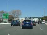
Sign: Reassurance directional sign at Midvale, just after the Roe Hwy interchange, December 2012. Image © Paul Rands |
| |
|
|
 |
Entering
The Perth Hills: Great Eastern Hwy at Greenmount as it enters the Perth Hills district, April 2009. Image © Paul Rands |
| |
|
|
 |
Approaching
Old York Road: Great Eastern Hwy as it approaches Old York Rd at Greenmount, April 2009. Image © Paul Rands |
| |
|
|
 |
Darlington
Road & Park Road Junction: Great Eastern Hwy at Darlington at the junction with Darlington Rd and approaching Park Rd (TD201), April 2009. Image © Paul Rands |
| |
|
|
 |
Park Road
Intersection: Corner of Great Eastern Hwy and Park Rd at Darlington, April 2009. Image © Paul Rands |
| |
|
|
 |
Approaching
Homestead Road: Great Eastern Hwy (NH94) at Parkerville approaching Homestead Rd, April 2009. Image © Paul Rands |
| |
|
|
 |
Entering
Mundaring: Great Eastern Hwy as it enters the town of Mundaring, April 2009. Image © Paul Rands |
| |
|
|
 |
Mundaring
Town Centre: Great Eastern Hwy as it passes through the town centre of Mundaring, April 2009. Image © Paul Rands |
| To continue along the route between Northam and Sawyers Valley, click here. | ||||
1 UBD Concise
Motoring Atlas of Australia, 3rd Edition, published by Universal
Publishers Pty Ltd. ISBN 978-0-7319-2081-5.
2 State Library of WA
3 Main Roads WA
Last updated: 18-Jul-2020 15:30
This site © Paul Rands. All rights reserved. Some portions © (copyright) by their respective and credited owners. Permission must be obtained before using any images from this site. For details, please email by clicking here.