|
|
|
|
|
 |
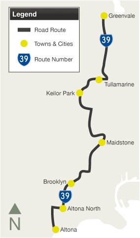
Maidstone Street, Kororoit Creek Road, Grieve Parade, Princes Highway, Geelong Road, McDonald Road, Somerville Road, Paramount Road, Dempster Street, Sredna Street, Ashley Street, Churchill Avenue, Hampstead Road, Wests Road, Cordite Avenue, Canning Street, Military Road, Milleara Road, Keilor Park Drive, Sharps Road, Melrose Drive & Mickleham Road (Metropolitan Route 39) |
Statistics:
Route Numbering:


General Information:
Metropolitan Route 39 is in Melbourne's western and northwestern suburbs. It's a mix of divided and undivided roads, passing through residential, commercial, industrial and semi-rural zones.
Multiplexes along the route include:
History:

1 Viseth Uch
2 Victorian Government, Ministerial Media Releases, Next Stage Of Mickleham Road Duplication Announced, 27 April 2006
Last updated: 17-Dec-2019 0:55
This site © Paul Rands. All rights reserved. Some portions © (copyright) by their respective and credited owners. Permission must be obtained before using any images from this site. For details, please email by clicking here.