|
|
|
|
|
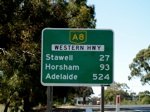
| M8 A8 | Western Freeway & Western Highway (M8 / A8) - Stawell To Ballarat |
Statistics:
Route Numbering:


General Information:
The Western Highway is the principal road link between Melbourne and Adelaide. The carries substantial interstate and interregional freight and tourist traffic. The traffic volume between Ballarat and Ararat is around 6000 vehicles per day, with 25 per cent being commercial vehicles. Between Ararat and Stawell the traffic volume is around 6500 vehicles per day, with approximately 20 per cent being commercial vehicles. 2 As such it falls under Auslink funding from the Federal Government. The route is a mix of divided and undivided highway and also freeway standard roadway.
The M8 designation runs from the junction with Sunraysia Highway (B220) at Mitchell Park and runs through to the interchange with Western Ring Road (M80) at Deer Park. The A8 designation runs from the SA Border to Burrumbeet.
History:
| Stawell to Ballarat | Ballarat to Stawell | |||
| Preview: | Description: | Preview: | Description: | |
 |
Great Western: Western Hwy as it passes through the Great Western town centre. September 2009. Image © Paul Rands |
 |
ID Sign: Intersection directional sign on the corner of Western Hwy (A8) and Alfred St in Ararat. October 2006. Image © Rob Tilley |
|
 |
Great Western: Western Hwy as it passes through the Great Western town centre. September 2009. Image © Paul Rands |
 |
Advance Directional Sign: AD sign approaching Vincent St (B180) (Pyrenees Hwy / Mortlake-Ararat Rd) in Ararat. October 2006. Image © Rob Tilley |
|
 |
Advance Directional Sign: AD sign at Great Western approaching the entrance to Grampians Estate winery. September 2009. Image © Paul Rands |
 |
ID Sign: Westbound ID sign on the corner of Vincent St and Pyrenees Hwy (B180) in Ararat showing the direction to Western Hwy (A8). October 2006. Image © Rob Tilley |
|
 |
Intersection Directional Sign: ID sign at the entrance to Grampians Estate winery. September 2009 at Great Western. Image © Paul Rands |
 |
Intersection Directional Sign: ID sign on the corner of Ingor St in Ararat outside the Safeway supermarket. October 2006. Image © Rob Tilley |
|
 |
Kimburra Road Intersection: Corner of Kimburra Rd and Western Hwy (A8) at Great Western. September 2009. Image © Paul Rands |
 |
ID Sign: Intersection directional sign on the corner of Ingor St and Barkly St East (C222) in Ararat. October 2006. The sign should be prefixed with the word 'To'. Image © Rob Tilley |
|
 |
Services Sign: Services sign at Armstrong for the town of Ararat. September 2009. Image © Paul Rands |
 |
Distance Sign: RD sign as you leave Ararat. December 2006. Image © Rob Tilley |
|
 |
Golden Gully Road Intersection: Corner of Western Hwy and Golden Gully Rd in Armstrong. September 2009. Image © Paul Rands |
 |
Distance Sign: RD sign leaving the town of Great Western. December 2006. Image © Rob Tilley |
|
 |
Military Bypass Road Intersection: Corner of Western Hwy and Military Bypass Rd in Armstrong. September 2009. Image © Paul Rands |
|||
 |
Entering Ararat: Western Hwy as it enters the town of Ararat. September 2009. Image © Paul Rands |
|||
 |
Entering Ararat Town Centre: Western Hwy as it enters the town centre of Ararat. September 2009. Image © Paul Rands |
|||
 |
AD Sign: Advance directional sign as you head southeast on Western Hwy in Ararat approaching Ingor St, September 2009. Click here for a context shot from October 2006 by Rob Tilley. Image © Paul Rands |
|||
 |
Supplemental Advance Directional Sign: Supplemental AD sign at the Ingor Street intersection in Ararat, October 2006. Image © Rob Tilley |
|||
 |
Advance Directional Sign: AD sign on Ingor St approaching Barkly St East (C222) in Ararat. October 2006. Image © Rob Tilley |
|||
 |
ID Sign Assembly: Intersection directional signs on Barkly St East in Ararat facing Ingor St traffic, October 2006. Image © Rob Tilley |
|||
 |
Advance Directional Sign: AD sign approaching Pyrenees Hwy and Mortlake-Ararat Rd (B180) at Ararat. September 2009. Image © Paul Rands |
|||
 |
Advance Directional Sign: AD sign approaching Ararat-Pomonal Rd (C222) at Ararat. September 2009. Image © Paul Rands |
|||
 |
Ararat-Pomonal Road Junction: Western Hwy (A8) at the roundabout with Ararat-Pomonal Rd (C222). In this shot the roundabout is still yet to be paved. September 2009. Image © Paul Rands |
|||
 |
Ararat-Pomonal Road Junction: Western Hwy (A8) at the roundabout with Ararat-Pomonal Rd (C222). September 2009. Image © Paul Rands |
|||
 |
Distance Sign: RD sign as you leave Ararat. September 2009. Image © Paul Rands |
|||
 |
Advance Directional Sign: AD sign on the outskirts of Ararat approaching the Service Centre. September 2009. Image © Paul Rands |
|||
 |
Service Centre: Western Hwy (A8) at the junction with the Service Centre in Ararat. September 2009. Image © Paul Rands |
|||
 |
Supplemental AD Sign: Tourism based advance directional sign indicating a scenic route near Ararat at the bridge over Green Hill Creek. December 2006. Image © Rob Tilley |
|||
 |
Advance Directional Sign: Eastbound advance directional sign at Buangor approaching the intersection with Buangor-Ben Nevis Road. December 2006. Image © Rob Tilley |
|||
 |
Advance Directional Sign: Eastbound AD sign at Beaufort approaching Eurambeen-Streatham Rd. December 2006. Image © Rob Tilley |
|||
 |
Advance Directional Sign: AD sign in Beaufort approaching Skipton Rd (C172), December 2006. Image © Rob Tilley |
|||
 |
Distance Sign: RD sign leaving the town of Beaufort, February 2014. Click here for a photo of this location by Rob Tilley from December 2006. Image © Rob Tilley |
|||
 |
Advance Directional Sign: Eastbound approaching the intersection with Beaufort-Carngham Rd at Beaufort, December 2006. Image © Rob Tilley |
|||
 |
Trailblazer: A8 trailblazer, northbound on Beaufort-Carngham Rd at Beaufort, approaching the intersection with Western Hwy (A8). December 2006. Image © Rob Tilley |
|||
 |
Fingerboard Assembly: Old style fingerboards on the corner of Western Hwy (A8) and Beaufort-Carngham Rd in Beaufort, December 2006. Image © Rob Tilley |
|||
 |
Approaching Antill Street: Eastbound advance directional sign for the Langi Kal Kal Rd & Trawalla Rd intersection at Trawalla, February 2014. Image © Rob Tilley |
|||
 |
Supplemental AD Sign: Supplemental advance directional sign at Burrumbeet showing C805, the former Western Hwy alignment through Ballarat. December 2006. Image © Rob Tilley |
|||
 |
Advance Directional Sign: Eastbound AD signage at Burrumbeet approaching Avenue of Honour / Old Western Highway (C805), February 2014. Image © Rob Tilley |
|||
 |
Supplemental AD Sign: Supplemental advance directional sign at Burrumbeet showing distances to Ballarat CBD via M8 and C805, February 2014. Image © Rob Tilley |
|||
 |
ID sign: Intersection directional sign facing Avenue of Honour / Old Western Highway (C805) traffic at Burrumbeet, December 2006. Image © Rob Tilley |
|||
 |
Advance Directional Sign: AD sign approaching Carpenter Rd at Windermere, February 2014. Image © Rob Tilley |
|||
 |
Advance Directional Sign: AD sign approaching the staggered junction with Windermere Sulky Rd at Windermere, February 2014. Image © Rob Tilley |
|||
 |
Advance Directional Sign: AD sign at Windermere approaching Powells Rd, February 2014. Image © Rob Tilley |
|||
 |
Powells Road: Western Fwy (M8) at the junction with Powells Rd at Windermere, February 2014. Image © Rob Tilley |
|||
 |
Advance Directional Sign: AD sign approaching Draffins Rd at Mitchell Park, February 2014. Image © Rob Tilley |
|||
 |
Advance Directional Sign: AD sign approaching Dowling Rd at Mitchell Park, February 2014. Image © Rob Tilley |
|||
 |
Sunraysia Highway: Western Fwy (M8) at the Sunraysia Hwy (B220) interchange at Miners Rest, February 2014. Image © Rob Tilley |
|||
 |
Distance Sign: Reassurance directional sign at Miners Rest, February 2014. Image © Rob Tilley |
|||
 |
Advance Directional Sign: AD sign at Miners Rest for Learmonth Rd (C287) interchange, February 2014. Image © Rob Tilley |
|||
 |
Supplemental Advance Directional Sign: Supplemental AD sign at Miners Rest for Learmonth Rd (C287) interchange,, February 2014. Image © Rob Tilley |
|||
 |
Learmonth Road: Western Fwy (M8) at the Learmonth Rd (C287) interchange at Miners Rest, February 2014. Image © Rob Tilley |
|||
 |
Learmonth Road: Western Fwy (M8) at the Learmonth Rd (C287) interchange at Miners Rest, February 2014. Image © Rob Tilley |
|||
 |
Supplemental Advance Directional Sign: Supplemental AD sign for the Midland Hwy (A300) interchange at Miners Rest, February 2014. Image © Rob Tilley |
|||
 |
Gillies Road: Western Fwy (M8) as it passes under Gillies Rd at Miners Rest, February 2014. Image © Rob Tilley |
|||
 |
Advance Directional Sign: AD sign for the Midland Hwy (A300) interchange at Mt Rowan, February 2014. Image © Rob Tilley |
|||
 |
Advance Directional Sign: AD sign for the Midland Hwy (A300) interchange at Mt Rowan, February 2014. Image © Rob Tilley |
|||
 |
Midland Highway: Western Fwy (M8) at the interchange with Midland Hwy (A300) at Mt Rowan, February 2014. Image © Rob Tilley |
|||
 |
Advance Directional Signs: AD signs on the off ramp to Midland Hwy (A300) at Mt Rowan, February 2014. Image © Rob Tilley |
|||
 |
Advance Directional Sign: AD sign on the off ramp to Midland Hwy (A300) at Mt Rowan, February 2014. Image © Rob Tilley |
|||
 |
Intersection Directional Sign: ID sign assembly at the end of the off ramp to Midland Hwy (A300) at Mt Rowan, February 2014. Image © Rob Tilley |
|||
 |
Intersection Directional Sign: ID sign at the end of the off ramp to Midland Hwy (A300) at Mt Rowan, February 2014. Image © Rob Tilley |
|||
 |
Advance Directional Sign: Eastbound carriageway of the Western Fwy as it approaches the junction with Brewery Tap Rd & Old Melbourne Rd (C803) at Gong Gong, December 2006. Image © Rob Tilley |
|||
| Click here for the continuation of the route as M8 from Ballarat to Deer Park Click here for the continuation of the route as A8 from Stawell to Dadswell Bridge |
||||
1 VicRoads
2 Victorian Department of Transport
3 City of Ballarat
4 Viseth Uch
Last updated: 15:51:16 11/4/2015.
This site © Paul Rands. All rights reserved. Some portions © (copyright) by their respective and credited owners. Permission must be obtained before using any images from this site. For details, please email by clicking here.