|
|
|
|
|
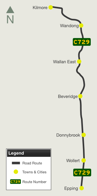
| C729 | Wandong Road, Epping-Kilmore Road, Merriang Road, Epping Road and High Street (C729) |
Statistics:
Route Numbering:
General Information:
C729 is a mostly rural route, connecting the outer northern outskirts of Melbourne with several small rural towns and the Hume Freeway (M31). The route is mainly undivided, with 1 lane in each direction.

1 Vicroads Road Management Plan, 30 October 2004
Last updated: 12-Feb-2019 19:14
This site © Paul Rands. All rights reserved. Some portions © (copyright) by their respective and credited owners. Permission must be obtained before using any images from this site. For details, please email by clicking here.