Road Photos & Information: Victoria
| C444 |
|
Meeniyan-Promontory Road (C444) |
Statistics:
- Length:
- Northern Terminus: South Gippsland Hwy (A440) at Meeniyan
- Southern Terminus: Wilsons Promontory
National Park at Tidal River 1
- Suburbs, Towns & Localities Along Route: Meeniyan, Buffalo, Fish Creek and Yanakie
Route Numbering:
- Former:

- Multiplexes: C445
- Road Authority Internal Classification: 5591 1
General Information:
C444 is a rural route used as the main
access route to the Wilsons Promontory National Park, which is renowned
for its breathtaking scenery. The road also acts as a connector for the
small communities to the South Gippsland Highway, which eventually
connects to routes leading to Leongatha, Sale and Melbourne.
Multiplexes along the route include:
- C445 (Waratah Rd / Fish Creek-Foster Rd) at Fish Creek for
2 km

| |
| |
 |
Advance Directional Sign:
AD sign at Fish Creek approaching Old Waratah Rd and Falls Rd, August 2012.
Image © Rob Tilley
|
|
 |
Intersection Directional Sign:
ID sign at Buffalo at the junction with Buffalo-Tarwin Lower Rd, August 2012.
Image © Rob Tilley
|
 |
Reassurance Directional Sign:
Distance sign on the outskirts of Fish Creek town centre, August 2012.
Image © Rob Tilley
|
|
 |
Intersection Directional Sign:
ID sign at the junction with Fish Creek-Foster Rd (C445), August 2012.
Image © Rob Tilley
|
 > > |
Advance Directional Sign:
AD sign approaching Buffalo-Tarwin Lower Rd at Buffalo, August 2012.
Image © Rob Tilley
|
|
 |
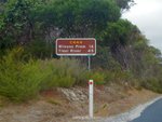
Reassurance Directional Sign:
Distance sign as you head
southbound from the town of Fish Creek, March 2008.
Image © Michael Gill
|
 |
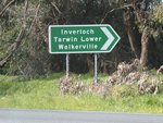
Intersection Directional Sign:
ID sign at Buffalo at the junction with Buffalo-Tarwin Lower Rd, August 2012.
Image © Rob Tilley
|
|
|
|
 |
Intersection Directional Sign:
ID sign assembly facing Buffalo-Tarwin Rd at Buffalo, August 2012.
Image © Rob Tilley
|
|
|
|
 |
Intersection Directional Sign:
ID sign at the northern terminus of C444: the junction with South Gippsland Hwy (A440) at Meeniyan, August 2012. Note the B440 route marker. A440 was once numbered B440 and this sign has been missed in the replacement or coverplating.
Image © Rob Tilley
|
|
|
|
1 VicRoads
Road Management Plan, October 2004
Last updated: 12-Feb-2019 18:55
This site ©
Paul Rands. All rights reserved. Some portions © (copyright) by their
respective and credited owners. Permission must be obtained before using
any
images from this site. For details, please email by clicking
here.

