Road Photos & Information: Victoria
| C345 |
|
Bendigo-Murchison Road & Murchison-Violet Town Road (C345) |
Statistics:
- Length: 108 km
- Eastern
Terminus: Hume Fwy (M31), Violet Town
- Western
Terminus: Midland Hwy (A300), Goornong
- Suburbs, Towns
& Localities Along The Route: Goornong, Colbinabbin, Rushworth, Murchison, Moorilim and Violet Town
Route Numbering:
- Former:

- Multiplexes: C357
- Road Authority Internal Classification: 5376 (Bendigo-Murchison Road) and 5414 (Murchison-Violet Town Road) 1
General Information:
C345 is a rural route which as a connector between Bendigo and the Hume Freeway. It passes through mostly rural areas, with a few pockets of residential and commercial. The section between Murchison East and Moorilim was once National Route 39.
Multiplexes along the route include:
- C357 for 2 km at Murchison
History:
- 1939: Country Roads Board constructed
Fergusons Bridge, which is a four-span composite timber and steel road bridge with curving timber deck. It crosses over the Campaspe River, approximately 4 kilometres east of the Midland Highway. The deck 56 metres long and 7.1 metres wide. Span lengths between timber piers average 13.8 metres. 2

| |
| |
 |
Intersection Directional Sign:
ID sign assembly at the junction of Murchison-Violet Town Rd (C345), Hume Fwy (M31) and Harrys Creek Rd at Violet Town, August 2015.
Image © Paul Rands
|
|
 |
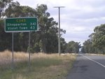
Distance Sign:
RD sign at Murchsion, heading eastbound, April 2006.
Image © Rob Tilley
|
 |
Intersection Directional Sign:
ID sign at the junction of Murchison-Violet Town Rd (C345), Hume Fwy (M31) and Harrys Creek Rd at Violet Town, August 2015.
Image © Paul Rands |
|
 |
Intersection Directional Sign:
ID sign on the corner of Murchison-Violet Town Rd (C345) and Lily St (C365) in Violet Town, August 2015.
Image © Paul Rands
|
 |
Reassurance Directional Sign:
Distance sign at Violet Town near Hume Fwy (M31), August 2015.
Image © Paul Rands
|
|
 |
Intersection Directional Sign:
ID sign on the corner of Murchison-Violet Town Rd (C345) and Lily St (C365) in Violet Town, August 2015.
Image © Paul Rands |
 |
Level Crossing:
Murchison-Violet Town Rd (C345) as it crosses the railway line in Violet Town, August 2015.
Image © Paul Rands |
|
 |
Level Crossing:
Murchison-Violet Town Rd (C345) as it crosses the railway line in Violet Town, August 2015.
Image © Paul Rands
|
 |
Violet Town:
Murchison-Violet Town Rd (C345) as it passes through the Violet Town CBD, August 2015.
Image © Paul Rands
|
|
|
|
 |
Intersection Directional Sign:
ID sign on the corner of Murchison-Violet Town Rd (C345) and Lily St (C365) in Violet Town, August 2015.
Image © Paul Rands |
|
|
|
1 Vicroads Road Management Plan, 30 October 2004
2 Heritage Victoria, Victorian Hertiage Database, Fergusons Bridge
Last updated: 12-Feb-2019 17:56
This site © Paul Rands. All rights reserved. Some portions © (copyright) by their respective and credited owners. Permission must be obtained before using any images from this site. For details, please email by clicking here.

