Road Photos & Information: Victoria
| C107 |
|
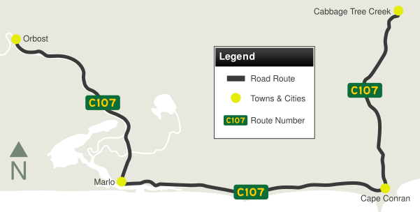
Marlo Road, Marlo-Conran Road & Cabbage Tree-Conran Road (C107) |
Statistics:
- Length: 46 km
- Eastern Terminus: Princes Hwy (A1) at Cabbage Tree Creek
- Western Terminus: Nicholson St (C612) and Lochiel St (C612) at Orbost
- Suburbs, Towns & Localities Along Route: Orbost, Marlo, Cape Conran and Cabbage Tree Creek
Route Numbering:
- Current: C107
- Road Authority Internal Classification: 4011 (Orbost to Cape Conran 1
General Information:
C107 is a rural route that follows the Snowy River between Orbost and Marlo. It services a handful of small towns in the eastern part of the Gippsland region.

| |
| |
 |
Princes Highway:
Marlo Rd (C107) as it passes under Princes Hwy (A1) at Orbost, May 2011.
Image © Paul Rands
|
|
 |
Intersection Directional Sign:
Marlo Rd (C107) at the junction with Nicholson St (C612) and Lochiel St (C612) at Orbost, May 2011. This is the western terminus of C107.
Image © Paul Rands
|
 |
Trailblazer:
C107 trailblazer on Marlo Rd (C107) at Orbost, May 2011.
Image © Paul Rands
|
|
|
|
1 Victorian Government, VicRoads Road Maintenance Category - Road List Version 1, September 2012
Last updated: 18-Aug-2020 12:36
This site © Paul Rands. All rights reserved. Some portions © (copyright) by their respective and credited owners. Permission must be obtained before using any images from this site. For details, please email by clicking here.
