|
|
|
|
|
| B23 | Monaro Highway (B23) |
Statistics:
Route Numbering:

General Information:
The major north-south route in the East Gippland are is the Monaro Highway link to Canberra. It's a single carriageway rural highway, and features a few large sections of windy roadway. It passes through a hadful of villages and national parks.
History:

| Cann River to NSW Border | NSW Border to Cann River | |||
| Preview: | Description: | Preview: | Description: | |
 |
Supplemental Advance Directional Sign: Supplemental AD sign on Princes Hwy (A1) at Cann River approaching the Monaro Hwy (B23) junction, January 2017. |
 |
Victoria Border: The beginning of B23, the NSW-Vic Border at Chandlers Creek, January 2010. Image © Paul Rands |
|
 |
Advance Directional Sign: AD sign on Princes Hwy (A1) at Cann River approaching the Monaro Hwy (B23) junction, January 2017. Image © Huang Milton Collection |
 |
Distance Sign: RD sign just inside the Victorian border at Chandlers Creek, January 2010. Image © Paul Rands |
|
 |
Corner of Princes Highway & Monaro Highway: Intersection directional sign on the corner of Princes Hwy & Monaro Hwy in Cann River, January 2017. Image © Huang Milton Collection |
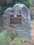 |
Plaque: Plaque on a stone next to the RD sign at Chandlers Creek, commemorating the sealing of the then Cann Valley Highway, February 2010. Image © Paul Rands |
|
 |
Distance Sign: RD sign at Cann River as you leave the town, February 2010. Image © Paul Rands |
 |
Road Safety Camera and Urban Speed Limit Sign: Sign indicating the default urban speed limit as well as a sign to indicate the use road safety cameras in Victoria. Chandlers Creek, January 2010. Image © Paul Rands |
|
 |
Advance Directional Sign: AD sign for the historical school at Noorinbee, February 2010. Image © Paul Rands |
 |
Drug Tests Sign: Sign to indicate random driver drug tests are conducted in Victoria. Chandlers Creek, January 2010. Image © Paul Rands |
|
 |
Entering Noorinbee: Council sign for the town of Noorinbee, January 2017. Image © Huang Milton Collection |
 |
National Parks Signage: Sign to indicate that motorists are entering the Southern Ark eco system, Chandlers Creek, January 2010. Image © Paul Rands |
|
 |
Intersection Directional Sign: ID sign outside the historical school at Noorinbee, February 2010. Image © Paul Rands |
 |
Workzone Speed Limit Enforcement Sign: Sign indicating police speed checks are conducted in Victoria in roadworks zones, Chandlers Creek, January 2010. Image © Paul Rands |
|
 |
Warning Sign: Warning sign for dangerous curves for trucks, Noorinbee North, February 2010. Image © Paul Rands |
 |
Warning Sign: Warning sign for dangerous curves for trucks, Chandlers Creek, February 2010. Image © Paul Rands |
|
 |
Cann River: Monaro Hwy as it crosses Cann River at Noorinbee North, February 2010. Image © Paul Rands |
 |
Fiddlers Green Creek: Monaro Hwy at Chandlers Creek as it crosses Fiddlers Green Creek, February 2010. Image © Paul Rands |
|
 |
Kates Creek: Monaro Hwy as it crosses Kates Creek at Noorinbee North, February 2010. Image © Paul Rands |
 |
Tourism Sign: Tourism orientated sign at Chandlers Creek welcoming visitors to the area, February 2010. Image © Paul Rands |
|
 |
Cann River: Monaro Hwy as it crosses Cann River at Chandlers Creek, February 2010. Image © Paul Rands |
 |
Chandlers Creek: Monaro Hwy as it crosses Chandlers Creek in town of Chandlers Creek, February 2010. Image © Paul Rands |
|
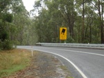 |
Warning Sign: Warning sign for dangerous curves for trucks, Chandlers Creek, February 2010. Image © Paul Rands |
 |
Buldah Road Intersection: Corner of Monaro Hwy & Buldah Rd in Chandlers Ck, February 2010. Image © Paul Rands |
|
 |
Entering Chandlers Creek: The Monaro Hwy as it enters the small town of Chandlers Creek, February 2010. Image © Paul Rands |
 |
B23 Trailblazer: B23 trailblazer at Chandlers Creek, February 2010. Image © Paul Rands |
|
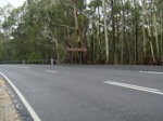 |
WB Line Junction: Corner of Monaro Hwy & WB Line at Chandlers Creek, February 2010. This is the entrance to Coopracambra National Park. Image © Paul Rands |
 |
WB Line Junction: Corner of Monaro Hwy & WB Line at Chandlers Creek, February 2010. This is the entrance to Coopracambra National Park. Image © Paul Rands |
|
 |
Fingerboard: Old fingerboard at the junction with Buldah Road in Chandlers Creek, February 2010. Image © Paul Rands |
 |
Warning Sign: Warning sign for dangerous curves for trucks, Chandlers Creek, February 2010. Image © Paul Rands |
|
 |
Chandlers Creek: Monaro Hwy as it crosses Chandlers Creek in town of Chandlers Creek, February 2010. Image © Paul Rands |
 |
Cann River: Monaro Hwy as it crosses Cann River at Chandlers Creek, February 2010. Image © Paul Rands |
|
 |
Flat Rock Creek: Monaro Hwy as it crosses Flat Rock Creek at Chandlers Creek, February 2010. Image © Paul Rands |
 |
Cann River: Monaro Hwy as it crosses Cann River at Noorinbee North, February 2010. Image © Paul Rands |
|
 |
NR23 Trailblazer: Old NR23 trailblazer at Chandlers Creek from before the conversion to alphanumeric route numbering, January 2010. It's possible it was kept as the Monaro Hwy changes to NR23 in NSW, of which, the border is in the distance. The sign is dated September 1986. Image © Paul Rands |
 |
B23 Trailblazer: B23 trailblazer at Noorinbee North, February 2010. Image © Paul Rands |
|
 |
New South Wales Border: Monaro Hwy as it crosses from Victoria to New South Wales at Chandlers Creek, January 2010. Image © Paul Rands |
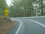 |
Unusual Warning Sign: Customised warning sign approaching some obscured driveways on a curve at Noorinbee, February 2010. Image © Paul Rands |
|
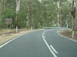 |
Advance Directional Sign: AD sign for the historical school at Noorinbee, February 2010. Image © Paul Rands |
|||
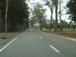 |
Intersection Directional Sign: ID sign outside the historical school at Noorinbee, February 2010. Image © Paul Rands |
|||
 |
Tourist Directional Sign: Tourist orientated AD sign on the outskirts of Cann River, February 2010. Image © Paul Rands |
|||
 |
Services Sign: Services sign on white painted timber posts, as you enter Cann River, February 2010. Image © Paul Rands |
|||
 |
Services Sign: Services sign as you enter Cann River, February 2010. Image © Paul Rands |
|||
 |
Entering Cann River: Monaro Hwy as it enters Cann River, February 2010. Image © Paul Rands |
|||
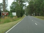 |
Advance Directional Sign: AD sign approaching the entrance to a local winery and art gallery, Cann River, February 2010. Image © Paul Rands |
|||
 |
Advance Directional Sign: AD sign at Cann River appoaching the Princes Hwy (A1) & Tamboon Rd, February 2010. Image © Paul Rands |
|||
 |
Advance Directional Sign: Services orientated AD sign at Cann River, just before the Princes Hwy & Tamboon Rd junction, February 2010. Image © Paul Rands |
|||
 |
B23 Southern Terminus: End B23, the junction of Princes Hwy (A1) and Tamboon Rd in Cann River, February 2010. Image © Paul Rands |
|||
| Click here for the continuation of B23 in New South Wales | ||||
1 Vicroads Maps of Declared Roads
2 Vicroads Road Management Plan, 30 October 2004, page 11
3 Victoria Government Gazette, G43, 31 October 1996, page 2837
Last updated: 11-Feb-2019 17:40
This site © Paul Rands. All rights reserved. Some portions © (copyright) by their respective and credited owners. Permission must be obtained before using any images from this site. For details, please email by clicking here.