|
|
|
|
|
| B110 | Bellarine Highway, Point Nepean Road & Nepean Highway (B110) |
Route Numbering:
General Information:
B110 has quite a few different road conditions along its routing. Some of the route is freeway standard, multi-lane arterial road standard, single carriageway 2-laned undivided and it has a ferry in the route as well.
The route is in 2 segments the western segment acts as a connector from the city of Geelong to its eastern suburbs. The eastern segment is a connector to the farthest southern reaches of Melbournes suburbs. From Queenscliffe to Sorrento, there is a ferry, which carries vehicles and passengers. It acts more as a scenic ferry that crosses the mouth of Port Phillip Bay, instead of an everyday commuter ferry for cars. The costs to use it also reflect this. The ferry ride takes around 40 minutes.
Multiplexes along the route include:
History:

| Mornington to Geelong | Geelong to Mornington | |||
| Preview: | Description: | Preview: | Description: | |
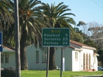 |
Distance Sign: RD sign at Dromana after the Nepean Hwy (B110) / Marine Dr (C783) intersection. September 2006. Image © Rob Tilley |
 |
Advance Directional Sign: AD sign on La Trobe Tce (former Princes Hwy) (A10) in Geelong. September 2006. M1 was replaced by A10 in January 2009, coinciding with the opening of the Geelong Bypass. Image © Rob Tilley |
|
 |
Old AD Sign: Old advance directional sign showing SR3 / Nepean Highway on Lonsdale St (looking northwest) in McCrae. September 2006. This sign has since been replaced with a B110 / Point Nepean Road sign. Image © Rob Tilley |
 |
Advance Directional Sign: AD sign on Moorabool St in Geelng, approaching Bellarine Hwy (McKillop St) (B110), June 2016. Image © Rob Tilley |
|
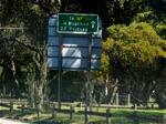 |
Distance Sign: RD sign on Lonsdale Street in McCrae, looking northwest approaching Point Nepean Road (B110). September 2006. Image © Rob Tilley |
 |
Intersection Directional Sign: ID sign facing ferry terminal on The Esplanade at Sorrento. September 2006. Image © Rob Tilley |
|
 |
Advance Directional Sign: AD sign approaching Jetty Rd in Rosebud, September 2006. Image © Rob Tilley |
 |
Elizabeth Avenue: Point Nepean Rd (B110) at the Elizabeth Av junction, Rosebud West, June 2016. Image © Rob Tilley |
|
 |
Jetty Road Intersection: ID sign on the corner of Jetty Rd in Rosebud, September 2006. Image © Rob Tilley |
 |
Elizabeth Avenue: Point Nepean Rd (B110) at the Elizabeth Av junction, Rosebud West, June 2016. Image © Rob Tilley |
|
 |
Advance Directional Sign: AD sign approaching Boneo Rd (C777) in Rosebud. September 2006. Image © Rob Tilley |
 |
Advance Direcitonal Sign: AD sign approaching Boneo Road (C777) in Rosebud. June 2016. Click here for a photo by Rob Tilley of this location from September 2006. Image © Rob Tilley |
|
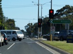 |
Boneo Rd Intersection: ID sign on the corner of Boneo Road (C777) in Rosebud, September 2006. Image © Rob Tilley |
 |
Boneo Road Intersection: Pt Nepean Rd as it passes Boneo Rd (C777) in Rosebud. June 2016. Click here for a photo by Rob Tilley of this location from September 2006. Image © Rob Tilley |
|
 |
Intersection Directional Sign: ID sign assembly facing Boneo Rd traffic in Rosebud, September 2006. Image © Rob Tilley |
 |
Distance Sign: RD sign after the Boneo Rd intersection in Rosebud, June 2016. Image © Rob Tilley |
|
 |
Distance Sign: RD sign and general view along Pt Nepean Rd after the Boneo Rd intersection, Rosebud West, June 2016. Image © Rob Tilley |
 |
Approaching Ninth Avenue: Advance directional sign for the Ninth Av intersection in Rosebud, September 2006. Image © Rob Tilley |
|
 |
Advance Directional Sign: AD sign approaching Elizabeth Av at Rosebud West, June 2016. Image © Rob Tilley |
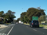 |
Advance Directional Sign: AD sign approaching Jetty Rd in Rosebud. September 2006. Image © Rob Tilley |
|
 |
Advance Directional Sign: AD sign at Rosebud West pointing the direction to Portsea, June 2016. Image © Rob Tilley |
 |
Jetty Road Intersection: Looking northeast at Rosebud through the Jetty Rd junction, September 2006. Image © Rob Tilley |
|
 |
Approaching Truman Road: AD sign assembly at Rosebud West approaching Truemans Road, June 2016. Image © Rob Tilley |
 |
Distance Sign: Remnant SR3 Nepean Hwy reassurance directional sign on what is now known at Pt Nepean Rd (B110) at Rosebud after the Jetty Rd intersection, September 2006. Image © Rob Tilley |
|
 |
Trailblazer: Remnant MR3 trailblazer facing Truemans Rd at Rosebud West, June 2016. Image © Rob Tilley |
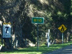 |
B110 Trailblazer: B110 route shield near Adams Rd in Rosebud just before the divided road ends, September 2006. Image © Rob Tilley |
|
 |
Intersection Directional Sign: ID sign for the Dundas St intersection, Rye. September 2006. Image © Rob Tilley |
 |
Diagrammatic AD Sign: Advance directional sign at McCrae approaching Lonsdale Street, September 2006. Image © Rob Tilley |
|
 |
Distance Sign: RD sign after Dundas St in Rye, September 2006. Image © Rob Tilley |
 |
ID Sign: Intersection directional sign at the Lonsdale St intersection, September 2006. Image © Rob Tilley |
|
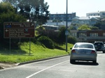 |
AD Sign: Advance directional sign approaching The Esplanade in Sorrento, September 2006. Image © Rob Tilley |
 |
Intersection Directional Sign: ID sign facing Lonsdale St traffic in McCrae, September 2006. Image © Rob Tilley |
|
 |
Trailblazer: Route number trailblazer, facing northbound traffic on Yarra Street in Geelong. September 2006. Image © Rob Tilley |
 |
Point Nepean Hwy at Dromana: B110 as it passes through the Anthony's Nose area. September 2006. Image © Rob Tilley |
|
 |
Point Nepean Hwy at Dromana: B110 as it passes through the Anthony's Nose area. September 2006. Image © Rob Tilley |
|||
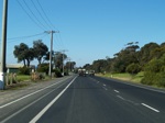 |
Dromana: B110 in the Dromana area near Latrobe Reserve. September 2006. Image © Rob Tilley |
|||
 |
Advance Directional Sign: AD sign approaching McCulloch St (C789) in Dromana, September 2006. Image © Rob Tilley |
|||
 |
McCulloch St Intersection: Intersection directional sign at the McCulloch St (C789) junction in Dromana. September 2006. Image © Rob Tilley |
|||
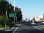 |
Distance Sign: RD sign after the McCulloch St intersection in Dromana, September 2006. Image © Rob Tilley |
|||
 |
Advance Directional Sign: AD sign for the Marine Drive (C783) and Nepean Highway (B110) intersection, Dromana. September 2006. Image © Rob Tilley |
|||
 |
Corner of Marine Dr & Nepean hwy: The ID sign assembly on the corner of Marine Drive (C783) and Nepean Highway (B110), September 2006. Since this photo was taken, traffic signals have been added to this intersection. Image © Rob Tilley |
|||
1 Alex Csar
2 VicRoads Road Maintenance Category - Road List Version 1, September 2012
3 Department of
Sustainability and Environment
4 Viseth Uch
5 Office
for the Minister for Transport
Last updated: 11-Feb-2019 17:12
This site © Paul Rands. All rights reserved. Some portions © (copyright) by their respective and credited owners. Permission must be obtained before using any images from this site. For details, please email by clicking here.