|
|
|
|
|
| A20 | Sturt Highway (A20) |
Statistics:
Route Numbering:


General Information:
The Sturt Highway spans 3 states: New South Wales, Victoria and South Australia, and is named after Charles Sturt, who explored south western New South Wales, the Murrumbidgee and Murray rivers and also parts of the deserts of central Australia in the 1820s and 1830s.
The route consists of mostly 2 lane single carriageway, except in Mildura, which varies from 2 lane arterial standard and 4 lane dual carriageway.
A79 (Calder Highway) duplexes the Sturt Highway through Mildura for 2 kilometres.

| NSW Border to SA Border | |
SA Border to NSW Border | ||
| Preview: | Description: | |
Preview: | Description: |
 |
Victoria
Tourism Welcome Sign: Crossing from NSW into Victoria, heading southwest over the Murray River. November 2016. Click here for a photo of this location by Jamie Scuglia from 2003. |
|
 |
South Australia / Victoria Border: Sturt Hwy (A20) as it enters Victoria from South Australia at Morkalla, December 2003. Image © Michael Greenslade |
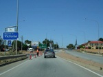 |
Victoria
Welcome Sign: Crossing from NSW into Victoria, heading southwest over the Murray River. December 2007. Image © Paul Rands |
|
 |
Reassurance
Directional Sign: Distance sign at Morkalla, December 2003. Image © Michael Greenslade |
 |
Advance
Directional Sign: Travelling southwest on Sturt Highway approaching Seventh Street in Mildura. December 2007. Image © Paul Rands |
|
 |
Reassurance
Directional Sign: Distance sign at Meringur, July 2019. Image © Ben Winkler |
 |
Intersection
Directional Sign: ID sign on the Sturt Highway and Seventh Avenue roundabout at Mildura, December 2007. Image © Paul Rands |
|
 |
Services Sign: Services sign at Neds Corner, July 2019. Image © Ben Winkler |
 |
Advance
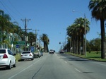
Directional Sign: Travelling northwest on Sturt Highway (Seventh Avenue) in Mildura as you approach the intersection with Deakin Avenue (Sturt Highway), December 2007. Image © Paul Rands |
|
 |
Advance Directional
Sign: AD sign at Merrinee approaching Meridian Rd, July 2019. Image © Ben Winkler |
 |
Intersection
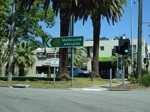
Directional Sign: ID sign on the corner of Seventh Street and Deakin Avenue (Sturt Highway) in the Mildura CBD. December 2007. Image © Paul Rands |
|
 |
Reassurance Directional
Sign: Distance sign at Merrinee, July 2019. Image © Ben Winkler |
 |
Deakin
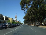
Street: Heading southwest on Deakin Street (Sturt Highway) in Mildura's CBD, December 2007. Image © Paul Rands |
|
 |
Advance Directional Sign: AD sign at Mildura approaching Calder Hwy (A79) and Fifteenth Av, January 2004. The A79 duplex ends at this junction. Image © Michael Greenslade |
 |
AD
Sign: Advance directional sign on Deakin Av (Sturt Hwy) as you approach Eleventh Street (Ranfurly Way (C256)) at Mildura, December 2007. Image © Paul Rands |
|
 |
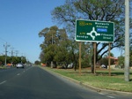
Reassurance Directional
Sign: Distance sign at Mildura as Sturt Hwy (A20) crosses the Murray River and NSW Border, 2003. Image © Jamie Scuglia |
 |
Advance
Directional Sign: AD sign on Deakin Avenue as you approach the roundabout with the Calder Highway (Fifteenth Street) in Mildura, December 2007. Image © Paul Rands |
|
||
 |
Distance
Sign: RD sign as Deakin Avenue travels southwest in Mildura, December 2007. Image © Paul Rands |
|
||
 |
AD
Sign: Advance directional sign approaching the Calder Highway (Seventeenth Street) intersection in Mildura, December 2007. Image © Paul Rands |
|
||
 |
Calder
Highway Intersection: Corner of Sturt Hwy and Calder Hwy (A79) in Mildura, December 2007. Image © Paul Rands |
|
||
 |
RD
Sign: Distance sign after the Calder Highway (Seventeenth Street) junction. December 2007. Image © Paul Rands |
|
||
 |
Sturt
Highway Split: Sturt Highway as it splits from Deakin Avenue in Mildura, December 2007. Image © Paul Rands |
|
||
 |
AD
Sign: Advance directional sign approaching Walnut Avenue and the Mildura Airport. December 2007. Image © Paul Rands |
|
||
 |
Dow
Avenue Intersection: Looking northwest on the Dow Avenue Intersection at Mildura. December 2007. Image © Paul Rands |
|
||
 |
Distance
Sign: RD sign located after the Dow Avenue intersection on the outskirts of Mildura. December 2007. Image © Paul Rands |
|
||
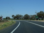 |
Mallee
/ River Avenue Intersection: Sturt Highway as it turns westbound at Merbein South, December 2007. Image © Paul Rands |
|
||
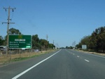 |
Distance
Sign: RD sign after the Mallee / River Avenue junction in Merbein South, December 2007. Image © Paul Rands |
|
||
 |
Distance
Sign: RD sign after the Paschendale Av intersection in Merbein South. December 2007. Image © Paul Rands |
|
||
 |
Distance
Sign: Heading southwest after the Meridian Road intersection in Wargan, December 2007. Image © Paul Rands |
|
||
 |
110
Zone: The beginning of a rare Victorian 110 km/h zone as you travel through Wargan, December 2007. Image © Paul Rands |
|
||
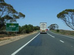 |
Distance
Sign: Travelling southwest as you leave Wargan, December 2007. Image © Paul Rands |
|
||
 |
Entering
Lake Cullulleraine: Westbound on the Sturt Highway as you head into Lake Cullulleraine, December 2007. Image © Paul Rands |
|
||
 |
Entering
Lake Cullulleraine: Westbound on the Sturt Highway as you head into Lake Cullulleraine, where the speed limit drops to 80 km/h, December 2007. Image © Paul Rands |
|
||
 |
Distance
Sign: Westbound RD sign as you leave Lake Cullulleraine, December 2007. Image © Paul Rands |
|
||
 |
Distance
Sign: RD sign as you travel through Neds Corner. December 2007. Image © Paul Rands |
|
||
 |
Kilometre
Plate: Westbound at Neds Corner, with kilometre plate indicating the distance to Renmark in South Australia, December 2007. Image © Paul Rands |
|
||
 |
Quarantine
Sign: Quarantine restrictions signage as you get closer to the Vic-SA Border at Neds Corner, December 2007. Image © Paul Rands |
|
||
| Click
here for the Sturt Highway (A20) between the Victorian / South
Australian border and Adelaide Click here for the Sturt Highway (A20) in New South Wales |
||||
Last updated: 09-Dec-2020 0:28
This site © Paul Rands. All rights reserved. Some portions © (copyright) by their respective and credited owners. Permission must be obtained before using any images from this site. For details, please email by clicking here.