|
|
|
|
|
| B23 | Main South Road, North Terrace, Howard Drive, Hog Bay Road, Playford Highway, Kohinoor Road & Telegraph Road (B23) |
Statistics:
Route Numbering:

General Information:
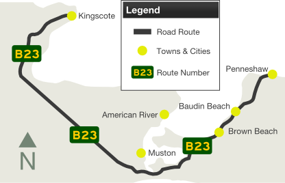
B23 is the main route from the mainland to Kangaroo Island. It is also the only numbered highway route on Kangaroo Island.
Cape Jervis, on the tip of the Fleurieu Peninsula is the point for daily car and passenger ferry services to Kangaroo Island. It's a 45 minute journey.
The route forms part of the Fleurieu Way, a themed tourist route that traverses the Fleurieu Peninsula.
History:
| Kangaroo Island | Old Noarlunga to Cape Jervis |
 |
 |
| Old Noarlunga to Kingscote (Kangaroo Island) | Kingscote (Kangaroo Island) to Old Noarlunga | |||
| Preview: | Description: | Preview: | Description: | |
 |
Reassurance Directional Sign: Distance sign without route number, Main South Rd (B23) at Old Noarlunga, July 2004. Image © Michael Greenslade |
 |
AD sign: Advance directional sign for the Emu Bay Road junction, at Brownlow, July 2004. Image © Darrin Smith |
|
 |
Advance Directional Sign: AD sign approaching Aldinga Beach Rd at Aldinga, July 2014. Image © Michael Greenslade |
 |
Advance Directional Sign: AD sign on Emu Bay Road at Brownlow as you approach Playford Hwy (B23). July 2004. Image © Darrin Smith |
|
 |
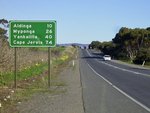
Reassurance Directional Sign: Distance sign at Aldinga after Aldinga Bch Rd, December 2003. Image © Michael Greenslade |
 |
Playford Hwy / Emu Bay Rd Junction: ID signage and fingerboard facing traffic from Emu Bay Road at Brownlow, July 2004. Image © Darrin Smith |
|
 |
Advance Directional Sign: Unusual AD sign on Main South Rd (B23) at Aldinga Beach approaching Hahn Rd and Cox Rd, July 2004. Image © Michael Greenslade |
 |
Distance Sign: RD sign at Muston, near the Muston Road intersection. July 2004. Image © Darrin Smith |
|
 |
Advance Directional Sign: AD sign approaching Pages Flat Rd (B34) at Myponga, July 2014. Click here for a photo of this location by Michael Greenslade, featuring black signs, from July 2004. Image © Michael Greenslade |
 |
Advance Directional Sign: AD sign approaching Bessell Drive at Baudin Beach. July 2004. Image © Darrin Smith |
|
 |
Advance Directional Sign: AD sign at Normanville, approaching Main Rd, July 2014. Image © Michael Greenslade |
 |
Reassurance Directional Sign: Distance sign at Cape Jervis, July 2014. Image © Michael Greenslade |
|
 |
Main Road: Corner of Main South Rd (B23) and Main Rd, Normanville, July 2014. Image © Michael Greenslade |
 |
Caption Title: Caption, December 2003. Image © Michael Greenslade |
|
 |
Reassurance Directional Sign: Distance sign at Normanville, July 2014. Image © Michael Greenslade |
 |
Black kilometre Plate: Old black kilometre plate at Delamere, July 2014. Image © Michael Greenslade |
|
 |
Reassurance Directional Sign: Distance sign at Second Valley, July 2014. Image © Michael Greenslade |
 |
Advance Directional Sign: AD sign approaching Cole Road (B37) at Delamere, December 2003. Image © Michael Greenslade |
|
 |
Distance Sign: RD sign located in the Delamere area. July 2004. Image © Darrin Smith |
 |
Reassurance Directional Sign: Distance sign at Second Valley, July 2014. Image © Michael Greenslade |
|
 |
Cape jervis: Main South Rd (B23) overlooking Cape Jervis, July 2014. Image © Michael Greenslade |
 |
Advance Directional Sign: AD sign at Normanville approaching Main Rd, December 2003. Image © Michael Greenslade |
|
 |
Entering Cape Jervis: Main South Rd (B23 / TD52) as it enters the town of Cape Jervis, July 2014. Image © Michael Greenslade |
 |
Advance Directional Sign: AD sign on Main Rd at Normaville approaching Main South Rd (B23), December 2003. Note the missing route numbers. Image © Michael Greenslade |
|
 |
Cape Jervis: Main South Rd (B23 / TD52) as it passes through Cape Jervis, July 2014. Image © Michael Greenslade |
 |
Tourism Sign: Attractions sign at Yankalilla, December 2003. Image © Michael Greenslade |
|
 |
Advance Directional Sign: Looking south east on Kangaroo Island at Baudin Beach approaching Bessell Drive. July 2004. Image © Darrin Smith |
 |
Black Reassurance Directional Sign: Black distance sign at Yankalilla, December 2003. Image © Michael Greenslade |
|
 |
Advance Directional Sign: AD sign for Muston Road at Muston. July 2004. Image © Darrin Smith |
 |
Black Intersection Directional Sign: Black ID sign at the corner of Main South Rd (B23) and Pages Flat Rd (B34) at Myponga, December 2003. Image © Michael Greenslade |
|
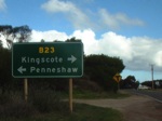 |
Advance Directional Sign: AD sign located on Muston Road at Muston as you approach the intersection with Hogs Bay Road (B23), July 2004. Image © Darrin Smith |
|||
1 Location SA Map Viewer
2 Transport SA
3 Government of South Australia, Department of Planning, Transport & Infrastructure, Completed Projects, Victor Harbor Road / Main South Road Junction
4 Government of South Australia, Department of Planning, Transport & Infrastructure, News, Road safety improvements for 2014/15 27 Aug 2014
5 Government of South Australia, Department of Planning, Transport & Infrastructure, Road Projects, Main South Road Upgrade - Old Coach Road To Malpas Road
Last updated: 03-Dec-2020 12:44
This site © Paul Rands. All rights reserved. Some portions © (copyright) by their respective and credited owners. Permission must be obtained before using any images from this site. For details, please email by clicking here.