|
|
|
|
|
| A8 | Dukes Highway (A8) - Tailem Bend to Coonalpyn |
Statistics:
Route Numbering:


General Information:
The Dukes Highway forms part of the main route between Adelaide and Melbourne, and is funded under the Federal Government's Auslink road funding scheme. 2
The Dukes Highway is heavily trafficked by more than 2000 vehicles daily. Around 45 per cent of vehicles are commercial and articulated vehicles. 3
The route is mostly undivided single carriageway with 1 lane in each direction, except for some overtaking lanes.History:
| Preview: | Description: |
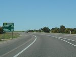 |
Distance Sign: RD sign at Tailem Bend after the Princes Hwy (A1 / B1) intersection. This is the first distance sign on the route heading southeast, October 2009. Image © Paul Rands |
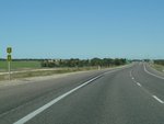 |
National Highway 8 Trailblazer: Remnant trailblazer from the former route numbering system at Tailem Bend, October 2009. Image © Paul Rands |
 |
Advance Directional Sign: AD sign approaching Mallee Hwy (B12) at Tailem Bend, October 2009. Image © Paul Rands |

|
Mallee Highway Intersection: ID sign at the junction with Mallee Hwy (B12) in Tailem Bend, October 2009. Image © Paul Rands |
|
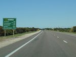
Distance Sign: RD sign located after the Mallee Hwy intersection in Tailem Bend, October 2009. Image © Paul Rands |

|
Advance Directional Sign: AD sign at Cooke Plains for the Darwin Rd junction. October 2009. Image © Paul Rands |

|
Darwin Road Intersection: Intersection directional sign at the junction with Darwin Road in Cooke Plains, October 2009. Image © Paul Rands |
|
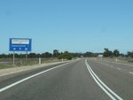
Services Sign: Services sign at Coomandook, October 2009. Image © Paul Rands |
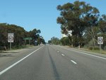
|
Entering Coomandook: Speed limit change as you enter the town of Coomandook. October 2009. Image © Paul Rands |
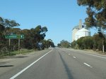
|
Supplemental AD Sign: AD sign acting as a reassurance marker in Coomandook. October 2009. Image © Paul Rands |
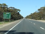
|
Distance Sign: RD sign as you leave the Coomandook town area, October 2009. Image © Paul Rands |

|
Advance Directional Sign: AD sign for the Tynan Rd intersection at Yumali, October 2009. Image © Paul Rands |
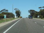
|
Entering Yumali: Entering the town of Yumali, October 2009. Image © Paul Rands |

|
Tynan Road Intersection: ID sign at the junction with Tynan Rd in Yumali, October 2009. Image © Paul Rands |
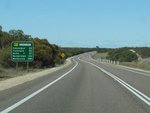
|
Distance Sign: RD sign as you leave Yumali, October 2009. Image © Paul Rands |
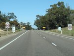
|
Entering Ki Ki: Speed limit reduction as you enter Ki Ki, October 2009. Image © Paul Rands |
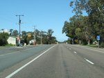
|
Ki Ki Village Centre: Dukes Hwy as it passes through Ki Ki, October 2009. Image © Paul Rands |
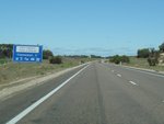
|
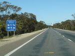
Services Sign: Services sign on the outskirts of Coonalpyn, October 2009. Image © Paul Rands |
|
Services Sign: Services sign at Coonalpyn, October 2009. Image © Paul Rands |

|
Advance Directional Sign: AD sign at Coonalpyn approaching Railway Tce, October 2009. Image © Paul Rands |
|
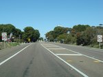
Entering Coonalpyn: Change in speed as you enter the town of Coonalyn, October 2009. Image © Paul Rands |

|
Railway Terrace Intersection: Corner of Dukes Hwy & Railway Tce in Coonalpyn, October 2009. Image © Paul Rands |
|
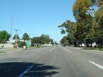
Coonalpyn: Dukes Hwy as it passes through Coonalpyn, October 2009. Image © Paul Rands |
|
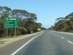
Distance Sign: RD sign as you leave the town of Coonalpyn, October 2009. Image © Paul Rands |
| Click here for the continuation of A8 between Coonalpyn and Keith | |
1 Transport SA State Route Numbers
Map, May 2003
2 South Australian Public Works Committee, Dukes Highway Rehabilatation Bordertown to the
Victorian Border report
3 Transport SA News & Media Releases, Stage 2 of $15 Million Dukes Highway upgrade to start,
25 August 2005
7 Government of South Australia, Department of Planning, Transport and Infrastructure, News, Safety improvements along Dukes Highway, 12 Sep 2011
8 Government of South Australia, Department of Planning, Transport and Infrastructure, News, State's first 'audio lines' on Dukes Highway, 06 Dec 2011
9 Government of South Australia, Department of Planning, Transport and Infrastructure, News, 85km of audible strips installed along Dukes, 15 Jul 2013
10 Government of South Australia, Department of Planning, Transport and Infrastructure, News, Upgrade works on Dukes Hwy, Tailem Bend overpass 30 Jan 2014
11 Government of South Australia, Department of Planning, Transport and Infrastructure, News, New point to point speed cameras explained, 08 Jul 2014
12 Government of South Australia, Department of Planning, Transport and Infrastructure, News, Safety to be Improved at the Dukes Highway Junction with the Princes Highway
Last updated: 01-May-2019 11:48
This site © Paul Rands. All rights reserved. Some portions © (copyright) by their respective and credited owners. Permission must be obtained before using any images from this site. For details, please email by clicking here.