|
|
|
|
|
 |
Peak Downs Highway (State Route 70) |
Statistics:
Route Numbering:

General Information:
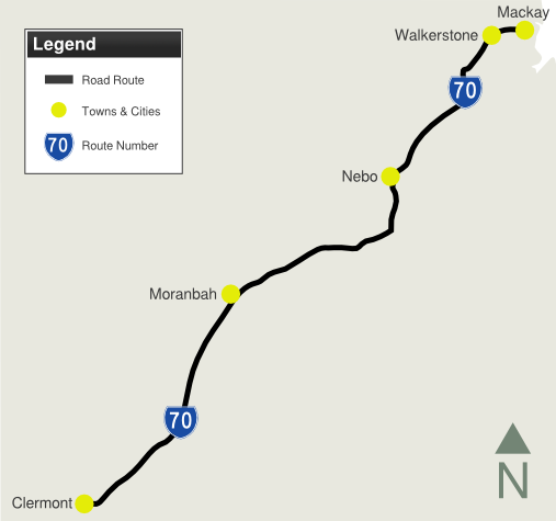
State Route 70 is an undivided rural highway linking the Bowen Basin mining regions with the coast. It passes through bushland, industrial, rural, commercial and residential areas. Towns along the route lessen as the route travels further from the coast and crosses the Great Dividing Range.
History:

1 Queensland
Government, The State Road Network of Queensland Map, 30 June 2010
2 Department of the Premier and
Cabinet, Media Statements, Peak Downs Highway upgrades to improve safety, 9 May
2008
3 Department of the Premier and
Cabinet, Media Statements, Peak Downs Highway upgrade to improve safety, 29
September 2008
4 Department of the Premier and
Cabinet, Media Statements, Overtaking lane to increase safety and capacity on Peak
Downs Highway, 21 May 2009
5 Department of the Premier and
Cabinet, Media Statements, Peak Downs Highway realignment to open soon, 18 June
2009
6 Department of the Premier and
Cabinet, Media Statements, Motorists benefit from double upgrade on Peak Downs
Highway, 2 October 2009
7 Department of the Premier and
Cabinet, Media Statements, Peak Downs Highway intersection complete, 23
November 2010
8 Operation Queenslander, Works Update,
Peak Downs Highway, Walkerston, November 2012
Last updated: 8:4:10 22/3/2015.
This site © Paul Rands. All rights reserved. Some portions © (copyright) by their respective and credited owners. Permission must be obtained before using any images from this site. For details, please email by clicking here.