| |
| |
 |
Distance
Sign:
Reassurance directional sign on Gympie Rd
(SR57) at Tinana, December 2003.
Image © Michael Greenslade
|
|
 |
Intersection
Directional Sign:
ID sign at the corner Ferry St (SR57) and
Alice St (SR86) at Maryborough, December 2009.
Image © Rob Tilley
|
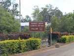 |
Start
Tourist Drive 12:
Sign on Gympie Rd at Tinana showing the start
of TD12, December 2009.
Image © Rob Tilley
|
|
 |
Advance Directional
Sign:
AD sign placed in the wrong spot, at the
junction of Ferry St (SR57) and Alice St (SR86) in Maryborough,
December 2009.
Image © Rob Tilley
|
 |
Mary Bridge:
Gympie Rd (SR57/TD12) as it becomes Ferry St
at Lamington Bridge over Mary River, October 2004.
Image © Michael Greenslade
|
|
 |
Intersection
Directional Sign:
ID sign at the corner Ferry St (SR57) and
Alice St (SR86) at Maryborough, December 2009.
Image © Rob Tilley
|
 |
Trailblazer:
TD12 trailblazer along Ferry St in
Maryborough, December 2009.
Image © Rob Tilley
|
|
 |
Intersection
Directional Sign:
ID sign at the corner Ferry St (SR57) and
Alice St (SR86) at Maryborough, December 2009.
Image © Rob Tilley
|
 |
Advance Directional
Sign:
AD sign on Ferry St (SR57/TD12) in
Maryborough approaching Ann St (TD12), December 2009.
Image © Rob Tilley
|
|
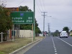 |
Distance
Sign:
Reassurance directional sign on Ferry St
(SR57) at Maryborough, October 2004.
Image © Michael Greenslade
|
 |
Intersection
Directional Sign:
ID sign at the corner Ferry St (SR57) and Ann
St (TD12) in Maryborough, December 2009. The TD12 duplex ends at
this junction.
Image © Rob Tilley
|
|
 |
End State Route 57:
End SR57 trailblazer on Gympie Rd (SR57) at
Tinana approaching the junction with Bruce Hwy (A1), December
2009.
Image © Rob Tilley
|
 |
Advance Directional
Sign:
AD sign on Ferry St (SR57) approaching Alice
St (SR86) in Maryborough, December 2009.
Image © Rob Tilley
|
|
 |
Bruce Highway:
Gympie Rd (SR57) at the Bruce Hwy (A1) interchange, Tinana, December 2003.
Image © Michael Greenslade |
 |
Intersection
Directional Sign:
ID sign at the corner Ferry St (SR57) and
Alice St (SR86) at Maryborough, December 2009.
Image © Rob Tilley
|
|
|
|
 |
Intersection
Directional Sign:
ID sign at the corner Ferry St (SR57) and
Alice St (SR86) at Maryborough, December 2009.
Image © Rob Tilley
|
|
|
|
 |
Advance Directional
Sign:
AD sign placed in the wrong spot, at the
junction of Ferry St (SR57) and Alice St (SR86) in Maryborough,
December 2009.
Image © Rob Tilley
|
|
|
|
 |
Advance Directional
Sign:
AD sign on Ferry St (SR57) approaching the
unnumbered sections of Walker St and Ferry St, plus the SR57
segment of Walker St, March 2006.
Image © Paul Rands
|
|
|
|
 |
Walker Street &
Ferry Street:
Corner of Walker St (SR57) and Ferry St
(SR57) at Maryborough, March 2006. SR57 turns right at this
junction. When the Bruce Hwy was routed through town, it turned
left here.
Image © Paul Rands
|
|
|
|
 |
Walker Street &
John Street:
Corner of Walker St and John St in
Maryborough, March 2006. SR57 turns left at this junction.
Image © Paul Rands
|
|
|
|
 |
Advance Directional
Sign:
AD sign on Walker St approaching Ferry St in
Maryborough. SR57 should have 'To' prefixed on it, and also be
included in the bottom panel. January 2014.
Image © Terry Siva
|
|
|
|
 |
Advance Directional
Sign:
AD sign on Saltwater Creek Rd (SR57)
approaching Pallas St at Maryborough, March 2006.
Image © Paul Rands
|
|
|
|
 |
Saltwater Creek:
State Route 57 as it crosses Saltwater Creek
via Campbells Bridge, March 2006. This is where Saltwater Creek Rd
becomes Maryborough-Hervey Bay Rd.
Image © Paul Rands
|
|
|
|
 |
Distance Sign:
RD sign on Maryborough-Hervey Bay Rd (SR57)
at Walligan, March 2006.
Image © Paul Rands
|
|
|
|
 |
Distance Sign:
RD sign on Maryborough-Hervey Bay Rd (SR57)
at Urraween, December 2002.
Image © Michael Greenslade |
|
|
|
 |
Advance Directional
Sign:
AD sign on Maryborough-Hervey Bay Rd (SR57)
approaching Pialba-Burrum Heads Rd at Eli Waters, December 2002.
Image © Michael Greenslade
|
|
|
|
 |
Advance Directional
Sign:
AD sign on Maryborough-Hervey Bay Rd (SR57)
approaching Old Maryborough Rd (TD12) at Eli Waters, March 2006.
SR57 becomes Boat Harbour Rd from this junction.
Image © Paul Rands
|
|
|
|
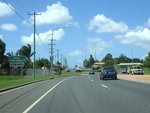 |
Reassurance
Directional Sign:
Distance sign on Boat Harbour Dr (SR57) at
Pialba, near Picnic St roundabout, March 2006. Note the missing
SR57 shield.
Image © Paul Rands
|
|
|
|
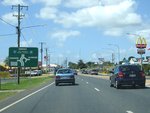 |
Advance Directional
Sign:
AD sign on Boat Harbour Dr (SR57) approaching
Main St at Pialba, March 2006. The Esplanade patch on the sign
should be prefixed with 'To' and the CBD and marine terminal
destinations should be blue patches.
Image © Paul Rands
|
|
|
|
 |
Intersection
Directionl Sign:
ID sign on the roundabout of Boat Harbour Dr
(SR57) and Main St in Piabla, March 2006.
Image © Paul Rands
|
|
|
|
 |
Advance Directional
Sign:
AD sign on Boat Harbour Dr (SR57) approaching
Bideford St at Torquay, March 2006.
Image © Paul Rands
|
|
|
|
 |
Advance Directional
Sign:
AD sign on Boat Harbour Dr approaching
Elizabeth St (TD12) at Urangan, March 2006. The Esplanade patch
should be prefixed with 'To'.
Image © Paul Rands
|
|
|
|
 |
End State Route 57:
End SR57 trailblazer at the roundabout with
the unnumbered section of Boat Harbour Dr and Elizabeth St (TD12)
at Urangan, March 2006.
Image © Paul Rands
|
|
|
|


