Road Photos &
Information: Queensland
| A4 |
|
Capricorn Highway (A4) |
Statistics:
- Length: 575 km
- Eastern Terminus: Bruce Hwy (A1), Fairy Bower
- Western Terminus: Landsborough Hwy (A2),
Barcaldine
- Suburbs, Towns & Localities Along Route: Fairy
Bower (Rockhampton), Gracemere, Kabra, Stanwell, Bushley, Wycarbah,
Westwood, Gogango, Duaringa, Dingo, Bluff, Blackwater, Comet, Emerald,
Anakie, Alpha, Jerico and Barcaldine
Route Numbering:
- Former:

- Multiplexes: A7
- Road Authority Internal Classification: 16A
(Rockhampton-Duaringa), 16B (Duaringa-Emerald), 16C (Emerald-Alpha) 1
and 16D (Alpha-Barcaldine) 2
General Information:
Capricorn Highway is an important route in the
Queensland highway system, linking farming and mining interests of Central
Queensland with the coast and Bruce Highway at Rockhampton.
Tracing the Tropic of Capricorn and crossing the Great
Dividing Range, the route is rural highway standard, consisting mostly of
1 lane in each direction, and services residential, rural and industrial
areas.
Multiplexes along the route include:
- A7 (Gregory Hwy), for 1.5 km, at Emerald
History:
- April 2007: Work began on a $5.5 million project to re-seal and widen
a 13 kilometre section of the Capricorn highway, east of Emerald. 3
- 2010: Work on upgrading the junction of Capricorn Hwy and Comet River
Rd at Comet. Work included several safety improvements. 4
A new set of traffic signals were switched on at the entrance to
Gracemere on the Capricorn Highway. Signals were installed in Emerald at
the Ruby Street (Capricorn Highway) and Egerton Street intersection. 5
- June 2011: Work commenced on upgrading Capricorn Hwy between Emerald
and Rockhampton. Work included reconstruction works to sealed pavements
including repairs, pavement replacement, stabilisation and bitumen
resurfacing. 6
- February 2012: The installation of a set of traffic signals in Emerald
at the intersection of Clermont Street (Gregory Highway) and Ruby Street
(Capricorn Highway). 7
- April 2012: Work started on five new overtaking lanes on the Capricorn
Highway, between Rockhampton and Emerald. The overtaking lane sites are
west of Kabra, with one in both directions, one east of Gogango, one
west of Dingo and one at Bluff. Safety improvements made to the junction
with O’Shannesy Street at Gracemere. 7
- February 2019: Work commences on duplication of Capricorn Hwy between
Rockhampton and Gracemere. 8

| |
| |
 |
Advance Directional Sign:
AD sign at Barcaldine, approaching Barcaldine-Aramac Rd (SR19), November 2016.
Image © Paul Rands |
|
 |
Shakespeare Street:
Intersection directional signs and advance directional sign on
Shakespeare St, Alpha, approaching Capricorn Hwy (A4) and
Clermont-Alpha Rd (SR41), September 2018.
Image © Richard Wardle |
 |
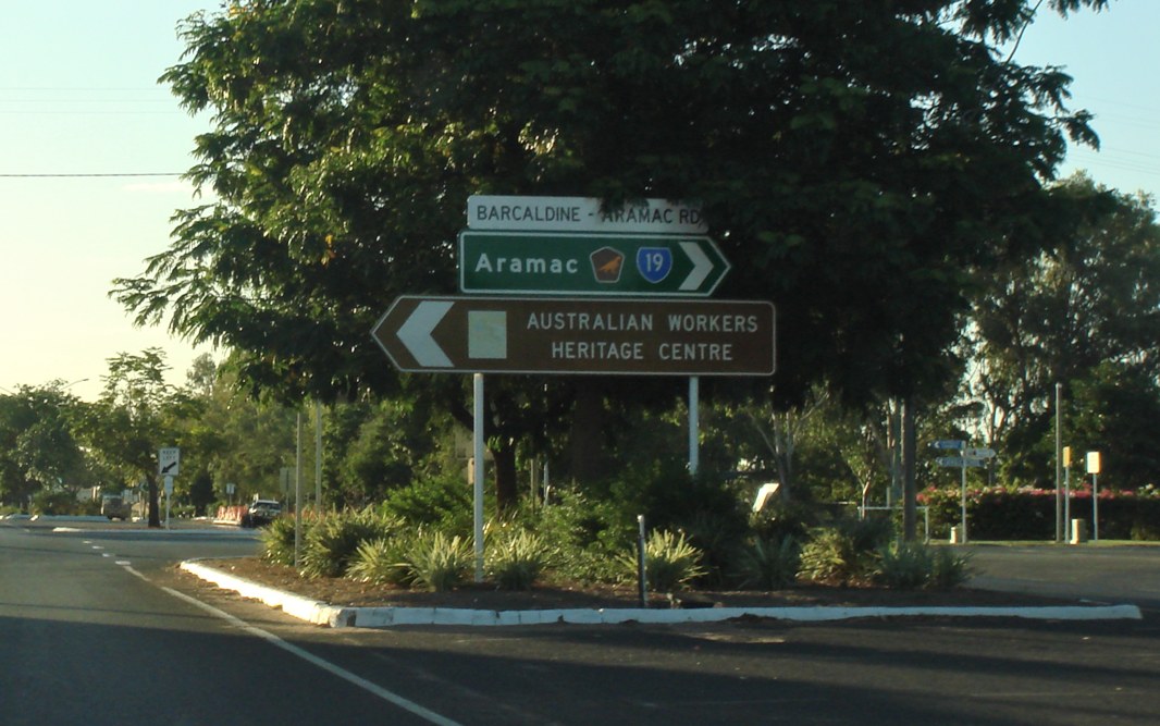
Barcaldine-Aramac Road:
Corner of Capricorn Hwy (A4) (Oak St) and Barcaldine-Aramac Rd (SR19) at Barcaldine, November 2016.
Image © Paul Rands |
|
 |
Barcaldine-Aramac Road:
Corner of Capricorn Hwy (A4) (Oak St) and Barcaldine-Aramac Rd (SR19) at Barcaldine, November 2016.
Image © Paul Rands |
 |
Capricorn Way:
Tourism based sign indicating A4 forms part of the Capricorn Way tourist route, Barcaldine, November 2016.
Image © Paul Rands |
|
 |
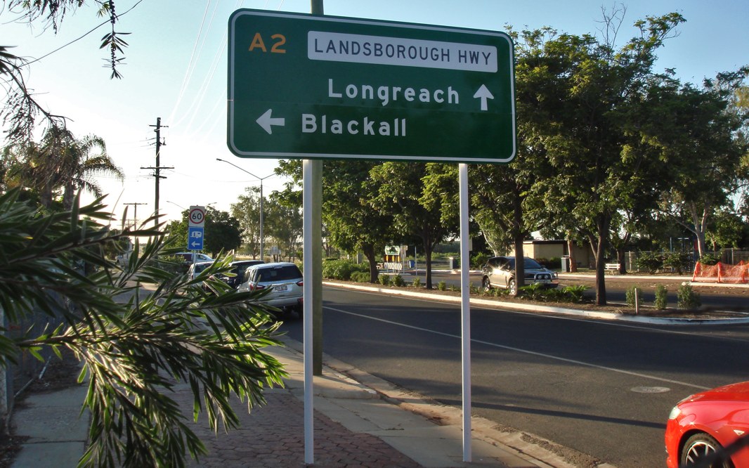
Advance DIrectional Sign:
AD sign on Capricorn Hwy (A4) approaching Landsborough Hwy (A2), November 2016. A4 ends at this junction.
Image © Paul Rands |
 |
Old & Current Hazard Board:
Old faded hazard board and current version underneath, corner of Capricorn Hwy (A4), Jacaranda Rd and Lancewood Dr at Barcaldine, November 2016.
Image © Paul Rands |
|
|
|
 |
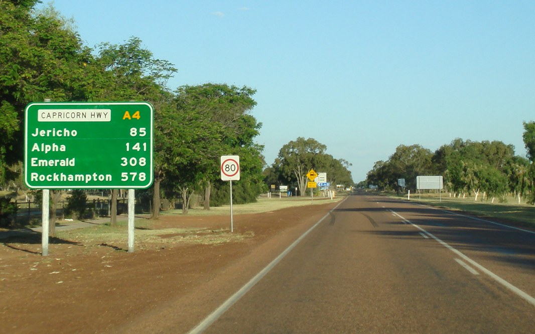
Reassurance Directional Sign:
Distance sign at Barcaldine, November 2016.
Image © Paul Rands |
|
|
|
 |
Road Conditions Sign:
Road conditions sign at Barcaldine, November 2016.
Image © Paul Rands |
|
|
|
1 Queensland
Government, Transport and Main Roads, Road Classification Map, Fitzroy
Region, September 2011
2 Queensland Government, Transport and
Main Roads, Road Classification Map, Central West Region, September 2011
3 Queensland Government, Cabinet and
Ministerial Directory, Media Statements, Heavy duty Capricorn Highway
upgrade, 11 April 2007
4 Queensland Government, Department of
Transport and Main Roads, In and around Fitzroy Region Local Links - April
2010
5 Queensland Government, Department of
Transport and Main Roads, In and around Fitzroy Region Local Links -
December 2010
6 Queensland Government, Department of
Transport and Main Roads, Operation Queenslander, Notification of Works,
Road Reconstruction - Fitzroy, Capricorn Highway – Rockhampton to Emerald
7 Queensland Government, Department of
Transport and Main Roads, In and around Fitzroy Region Local Links - April
2012
8 Queensland Government, Department of
Transport and Main Roads, Capricorn Highway-Rockhampton to Gracemere
Duplication
Last updated: 07-Jul-2020 15:40
This
site ©
Paul Rands. All rights reserved. Some portions © (copyright) by their
respective and credited owners. Permission must be obtained before using
any images from this site. For details, please email by clicking
here.

