|
|
|
|
|
Road Photos & Information: Queensland
 |
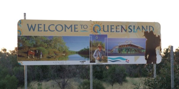
| Queensland Border welcome sign on the Mitchell Highway (A71) at Barringun. Image © Tim Cole. |
Queensland covers an area of 1 730 648 square kilometres on the north-eastern part of Australia 1, and Queensland's Department of Transport and Main Roads administers 34 000 km of Queensland's 182 200 km public road network, which is 20 per cent of the state's total road network and carries 80 per cent of traffic. 2
In Queensland, as is the case with all the other states in Australia, the roads are classified into different categories, and are also numbered for maintenance purposes and also navigation purposes.
Transport and Main Roads look after state-controlled roads only - the highways and other main connecting roads in Queensland. Transport and Main Roads don't look after roads in Queensland that are local roads. Local governments are responsible for the other roads within their boundaries - the local suburban streets within towns and smaller connecting roads between towns. 2
There is also the national highway network – the highways that the most crucial for transport around Australia. The federal government is responsible for funding any work on these roads. However, Main Roads manages the national highway network in Queensland on behalf of the federal government. That means, Transport and Main Roads plans, designs and supervises works on the national highway, but the federal government provides the funding. 2
For an official history on Queensland roads, click here.
Route Numbering is designed to aid motorists navigate, using route shields as guidance. Queensland currently uses both a hierarchical system and an alpha-numeric system for route marking. In the metropolitan area of Brisbane, Metroads are the most important arterial roads, while in rural areas the National Highways and National Routes are the major highways. State Routes are the secondary ways of travel and other important urban routes that the Metroads don't cover, while Tourist Drives provide links from the State, National or Metroad routes to tourist areas / attractions.
Queensland began converting to the alpha-numeric style of route marking in September 2000 with the introduction of M1 for the Pacific Motorway, and have since introduced several other alphanumeric routes in metropolitan Brisbane and country areas.
To check out the routes used in Queensland and photos of them, click on one of the section names below:
| M1 |  |
 |
|
| Alphanumeric Routes | National Highways | National Routes | State Routes |
| Alphanumeric routes are the newest form of route numbering in QLD. Roads are numbered with M, A and B prefixes indicating the importance / standard of the route. | The green and gold route markers indicate routes which are part of the National Highway System. They indicate the most direct routes between major cities. | The black on white markers indicate highways around Australia which are not part of the National Highway System but are still of some national significance. | The white on blue shields indicate urban and interregional routes. |
 |
 |
Decommissioned | |
| Metroads | Tourist Drives | Decommissioned Routes | |
| Used solely in the Brisbane metropolitan area to indicate main urban routes. They generally form the shortest routes from one side of the city to the other. | The white on brown Tourist Drive markers denote roads through areas of significant scenic or historic interest. | Routes that were once numbered, but are now not, perhaps due to alignment changes or the importance of a route has diminished. |
1 Geoscience Australia
2 Queensland
Department of Main Roads
Last updated: 27 Nov 2019 12:25
This site © Paul Rands. All rights reserved. Some portions © (copyright) by their respective and credited owners. Permission must be obtained before using any images from this site. For details, please email by clicking here.