|
|
|
|
|
 |
Carp Street, East Street, Tathra Road, Sapphire Coast Drive, Merimbula Drive, Market Street, Arthur Kane Drive & Toallo Street (Tourist Drive 11) |
Statistics:
Route Numbering:


General Information:
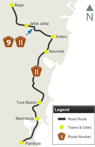
Tourist Drive 11 is a mostly undivided rural route, linking several coastal and farm communities together.
The route traverses farming, residential and commercial areas, and passes through several pockets of national park, and also features ocean and lake glimpses around Merimbula.
The section of the route between Bega and Kalaru (Carp St, East St & Tathra Rd) was once part of the Snowy Mountains Hwy (NR18).
Multiplexes along the route include:
History:
| Bega to Pambula | Pambula to Bega | |||
| Preview: | Description: | Preview: | Description: | |
 |
Distance Sign: Reassurance directional sign on Sapphire Coast Dr (TD11) at Kalaru, May 2011. Click here for a photo of this location from January 2010. Image © Paul Rands |
 |
Intersection Directional Sign: Image © Paul Rands |
|
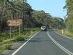 |
AD sign: Advance directional sign approaching Old Wallagoot Rd at Wallagoot, January 2010. Image © Paul Rands |
 |
Advance Directional Sign: Image © Paul Rands |
|
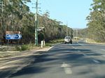 |
Old Wallagoot Road: Corner of Sapphire Coast Dr (TD11) and Old Wallagoot Rd, Wallagoot, January 2010. Image © Paul Rands |
 |
Intersection Directional Sign: Image © Paul Rands |
|
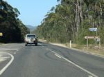 |
Wallagoot Lake Road: Corner of Sapphire Coast Dr (TD11) & Wallagoot Lake Rd, Wallagoot, January 2010. Image © Paul Rands |
 |
Advance Directional Sign: Image © Paul Rands |
|
 |
Wallagoot Lane: Sapphire Coast Dr (TD11) at Wallagoot Ln, Wallagoot, May 2011. Click here for a photo of this location from January 2010. Image © Paul Rands |
 |
Advance Directional Sign: Image © Paul Rands |
|
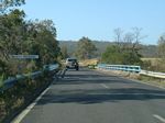 |
Moncks Crossing: Sapphire Coast Dr (TD11) at Moncks Crossing at Wallagoot, January 2010. Image © Paul Rands |
 |
Intersection Directional Sign: Image © Paul Rands |
|
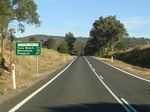 |
Distance Sign: RD sign on Sapphire Coast Dr (TD11) at Wallagoot, May 2011. Image © Paul Rands |  |
Advance Directional Sign: AD sign with top knot on Merimbula Dr (TD11) approaching the unnumbered section of Merimbula Dr, Reid St and Sapphire Coast Dr (TD11) at Merimbula, January 2010. Click here for a photo of this location by Paul Rands, also from January 2010. Image © Paul Rands |
|
 |
Bournda Road: Sapphire Coast Dr (TD11) at the Bournda Rd junction, Wallagoot, May 2011. Click here for another photo of this location from May 2011. Image © Paul Rands |
 |
Intersection Directional Sign: ID sign at the corner of Merimbula Dr (TD11), the unnumbered section of Merimbula Dr, Reid St and Sapphire Coast Dr (TD11) at Merimbula, January 2010. Image © Paul Rands |
|
 |
Bournda: Sapphire Coast Dr (TD11), as it winds its way through the Bournda area, May 2011. Click here for a photo of this location from January 2010. Image © Paul Rands |
 |
Intersection Directional Sign: ID sign at the corner of Merimbula Dr (TD11), the unnumbered section of Merimbula Dr, Reid St and Sapphire Coast Dr (TD11) at Merimbula, January 2010. Image © Paul Rands |
|
 |
Red Hill Road: Sapphire Coast Dr (TD11) at Red Hill Rd at Bournda, May 2011. Click here for a photo of this location from January 2010. This is the former route between Bournda and Tura Beach, which stayed unpaved up until and beyond the opening of the current route during the 1980s. Image © Paul Rands |
 |
Intersection Directional Sign: ID sign at the corner of Sapphire Coast Dr (TD11) and Main St, Merimbula, January 2010. Image © Paul Rands |
|
 |
Widgeram Road: Sapphire Coast Dr (TD11) at the junction with Widgeram Rd at Tura Beach, January 2010. Image © Paul Rands |
 |
Distance Sign: RD sign on Sapphire Coast Dr (TD11) at Merimbula, January 2010 Image © Paul Rands |
|
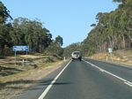 |
Supplemental Advance Directional Sign: Supplemental AD sign at Tura Beach approaching Tura Beach Dr, January 2010. Image © Paul Rands |
 |
Distance Sign: RD sign on Sapphire Coast Dr (TD11) at Merimbula, January 2010 Image © Paul Rands |
|
 |
Advance Directional Sign: AD sign approaching Tura Beach Dr at Tura Beach, May 2011. Click here for a photo of this location from January 2010. Image © Paul Rands |
 |
Advance Directional Sign: AD sign approaching Magic Mountain amusement park, Tura Beach, January 2010. Image © Paul Rands |
|
 |
Advance Directional Sign: Image © Paul Rands |
 |
Advance Directional Sign: Image © Paul Rands |
|
 |
Tura Beach Drive: Corner of Sapphire Coast Dr (TD11) and Tura Beach Dr at Tura Beach, May 2011. Click here for a photo of this location from January 2010. Image © Paul Rands |
 |
Tura Beach Drive: Corner of Sapphire Coast Dr (TD11) and Tura Beach Dr at Tura Beach, January 2010. Image © Paul Rands |
|
 |
Advance Directional Sign: Image © Paul Rands |
 |
Distance Sign: RD sign on Sapphire Coast Dr (TD11) at Tura Beach, January 2010 Image © Paul Rands |
|
 |
Advance Directional Sign: AD sign approaching Red Hill Rd at Tura Beach, May 2011. Click here for a photo of this location from January 2010. Image © Paul Rands |
 |
Sandy Beach Creek: Sapphire Coast Dr (TD11) as it crosses Sandy Beach Creek at Bournda, January 2010 Image © Paul Rands |
|
 |
Red Hill Road : Image © Paul Rands |
 |
Bournda Road: Sapphire Coast Dr (TD11) at the Bournda Rd junction, Wallagoot, January 2010. Image © Paul Rands |
|
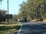 |
Advance Directional Sign: AD sign approaching Magic Mountain amusement park, Tura Beach, January 2010. Image © Paul Rands |
 |
Distance Sign: RD sign on Sapphire Coast Dr (TD11) at Wallagoot, January 2010 Image © Paul Rands |
|
 |
Intersection Directional Sign & Trailblazer: ID sign and TD11 trailblazer at the junction with Magic Mountain at Tura Beach, January 2010. Image © Paul Rands |
 |
AD sign: Advance directional sign approaching Old Wallagoot Rd at Wallagoot, January 2010. Image © Paul Rands |
|
 |
Entering Merimbula: Sapphire Coast Dr (TD11) as it enters the town of Merimbula, with Old Tathra Rd beyond the sign, January 2010. Image © Paul Rands |
 |
Old Wallagoot Road: Corner of Sapphire Coast Dr (TD11) and Old Wallagoot Rd, Wallagoot, January 2010. Image © Paul Rands |
|
 |
Advance Directional Sign: AD sign on Sapphire Coast Dr (TD11) approaching Berrambool Dr at Merimbula, May 2011. Click here for a photo of this location from January 2010. Image © Paul Rands |
 |
Advance Directional Sign: AD sign on Sapphire Coast Dr (TD11) approaching Tathra Rd (TD9 / TD11) at Kalaru, May 2011. Note the TD11 trailblazer pointing in the wrong direction. Image © Paul Rands |
|
 |
Intersection Directional Sign: Image © Paul Rands |
 |
Intersection Directional Sign: Corner of Sapphire Coast Dr (TD11) and Tathra Rd (TD9), Kalaru, January 2010. TD11 turns left at this location and duplexes with TD9. Image © Paul Rands |
|
 |
Merimbula Creek: Sapphire Coast Dr (TD11) as it crosses Merimbula Creek in Merimbula, January 2010. Image © Paul Rands |
|||
 |
Advance Directional Sign: AD sign with topknot approaching Merimbula Dr (TD11 and unnumbered) and Reid St, Merimbula, January 2010. Image © Paul Rands |
|||
 |
Intersection Directional Sign: ID sign facing Sapphire Coast Dr (TD11) at the junction with Merimbula Dr (TD11 / unnumbered) and Reid St in Merimbula, May 2011. Click here for a photo of this location from January 2010. Image © Paul Rands |
|||
 |
Intersection Directional Sign: Image © Paul Rands |
|||
 |
Lake Merimbula & Boggy Creek: Image © Paul Rands |
|||
 |
Fishpen Road & Arthur Kaine Drive: Image © Paul Rands |
|||
 |
Reassurance Directional Sign: Image © Paul Rands |
|||
 |
Intersection Directional Sign: Image © Paul Rands |
|||
 |
Advance Directional Sign: Image © Paul Rands |
|||
 |
Intersection Directional Sign: Image © Paul Rands |
|||
 |
Supplemental Advance Directional Sign: Image © Paul Rands |
|||
 |
Entering Pambula: Image © Paul Rands |
|||
 |
Advance Directional Sign: |
|||
 |
End Tourist Drive 11: Image © Paul Rands |
|||
 |
Advance Directional Sign: Image © Michael Greenslade |
|||
1 Roads and Traffic Authority, Schedule of Classified Roads and State & Regional Roads, January 2011
Last updated: 13-Aug-2020 13:45
This site © Paul Rands. All rights reserved. Some portions © (copyright) by their respective and credited owners. Permission must be obtained before using any images from this site. For details, please email by clicking here.