|
|
|
|
|
 |
Freemans Drive, Leggetts Drive, Lake Road, Allandale Street, Caledonia Street, Cessnock Road, Greta Street, Aberdare Road, Vincent Street, Allandale Road, Wine Country Drive, Bridge Street, Drinan Street, Clift Street (State Route 82) (Decommissioned) |
Statistics:
Route Numbering:


General Information:
State Route 82 is a rural route in the NSW Hunter Valley. It's primarily 2-lane undivided roadway, which passes through residential, commercial and farming areas. Part of the route from Freemans Waterhole to Mulbring formed an alignment of National Highway 1 during the 80s and 90s.
The route acts as a bypass of the greater Newcastle area and connects the Sydney-Newcastle Freeway with New England Highway.
Multiplexes along the route include:
History:

| Freemans Waterhole to Branxton | Branxton to Freemans Waterhole | |||
| Preview: | Description: | Preview: | Description: | |
 |
Black Intersection Directional Sign: Black ID sign at the junction with Wollombi Rd (TD33), September 2005. The TD33 duplex starts at this junction. Image © Paul Rands |
 |
Distance Sign: RD sign on Clift St (SR82) in Branxton. Click here for a photo from September 2005 of the previous sign. Image © Paul Rands |
|
 |
Broke Road: Corner of Wine Country Dr (SR82) and Broke Rd at Rothbury, September 2005. Image © Paul Rands |
 |
Intersection Directional Sign: ID sign at the Drinan St junction in Branxton, December 2008. SR82 turns left here. Image © Paul Rands |
|
 |
Intersection Directional Sign: Non-standard ID sign at the Drinan St junction in Branxton, September 2005. Image © Paul Rands |
 |
Intersection Directional Sign: ID sign at the Drinan St junction in Branxton, December 2008. SR82 turns right here. Image © Paul Rands |
|
 |
Advance Directional Sign: AD sign on Clift St (SR82) at Branxton approaching New England Hwy (NH15) and the unnumbered section of Clift St, September 2005. Image © Paul Rands |
 |
Distance Sign: RD sign for Tourist Drive 33 which duplexes the route between Branxton and Cessnock, December 2008. Image © Paul Rands |
|
 |
New England Highway & Clift Street: Intersection directional sign at the northern terminus of SR82, New England Hwy (SR82) and Clift St in Branxton, September 2005. Image © Paul Rands |
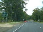 |
Distance Sign: Reassurance directional sign as SR82 leaves Branxton via Wine Country Dr, December 2008. Image © Paul Rands |
|
 |
New England Highway & Clift Street: Intersection directional sign at the northern terminus of SR82, New England Hwy (SR82) and Clift St in Branxton, September 2005. Image © Paul Rands |
 |
Advance Directional Sign: AD sign at North Rothbury for the Rothbury Riot Memorial, December 2008. More information on the riot can be found here. Image © Paul Rands |
|
 |
Entering North Rothbury: Wine Country Dr (SR82 / TD33) as it enters North Rothbury, December 2008. Image © Paul Rands |
|||
 |
Advance Directional Sign: AD sign at Rothbury approaching Broke Rd, December 2008. Image © Paul Rands |
|||
 |
Broke Road: Corner of Wine Country Dr and Broke Rd in Rothbury, December 2008. Image © Paul Rands |
|||
 |
Lovedale Road: Corner of Wine Country Dr and Lovedale Rd at Lovedale, December 2008. Image © Paul Rands |
|||
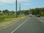 |
Entering Nulkaba: Wine Country Dr as it enters the town of Nulkaba, December 2008. Image © Paul Rands |
|||
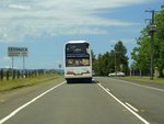 |
Entering Cessnock: Wine Country Dr as it enters the town of Cessnock, December 2008. Image © Paul Rands |
|||
 |
Advance Directional Sign: Intersection directional sign acting as an advance directional sign approaching Wollombi Rd (TD33) in Cessnock, December 2008. The TD33 duplex ends at this junction and SR82 turns left. Image © Paul Rands |
|||
 |
Advance Directional Sign: Intersection directional sign acting as an advance directional sign approaching Wollombi Rd (TD33) in Cessnock, December 2008. The TD33 duplex ends at this junction and SR82 turns left. Image © Paul Rands |
|||
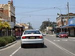 |
Cessnock CBD: Vincent St (SR82) Cessnock approaching the unnumbered section of Vincent St, Aberdare Rd (SR82) and South Av, December 2005. SR82 turns left at this junction. Image © Paul Rands |
|||
 |
Distance Sign: RD sign as Aberdare Rd (SR82) leaves Cessnock, December 2005. Image © Paul Rands |
|||
 |
Intersection Directional Sign: ID sign at the corner of Aberdare Rd and Colliery St in Aberdare, December 2008. SR82 turns right at this junction. Image © Paul Rands |
|||
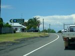 |
Intersection Directional Sign: ID sign at the corner of Cessnock Rd and Colliery St in Aberdare, December 2008. SR82 turns left at this junction. Image © Paul Rands |
|||
 |
Black Intersection Directional Sign: Black ID sign at the corner Allandale St and Caledonia St in Kearsley, December 2008. SR82 turns right at this junction. Image © Paul Rands |
|||
 |
Intersection Directional Sign: ID sign at the corner Allandale St and Caledonia St in Kearsley, December 2008. SR82 turns right at this junction. Image © Paul Rands |
|||
 |
Black Advance Directional Sign: Black AD sign on Lake Rd at Mulbring approaching Leggetts Dr (SR135), December 2008. Image © Paul Rands |
|||
 |
Leggetts Drive: Corner of Lake Rd (SR82) and Leggetts Dr (SR135 / SR82) at Mulbring, December 2008. SR82 turns right at this junction. Image © Paul Rands |
|||
 |
Distance Sign: RD sign on Leggetts Dr (SR82) with old Hunter Tourist Circuit shield at Mulbring, after the Leggetts Dr (SR135) junction, December 2008. Image © Paul Rands |
|||
 |
Advance Directional Sign: AD sign approaching Palmer St in Mulbring, December 2008. Image © Paul Rands |
|||
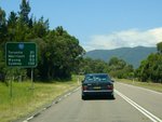 |
Distance Sign: RD sign on Leggetts Dr (SR82) at Mulbring, after the Palmer St junction, December 2008. Image © Paul Rands |
|||
 |
Intersection Directional Sign: ID sign at the junction with Sandy Creek Rd and Mt Vincent Rd at Mt Vincent, December 2005. Image © Paul Rands |
|||
 |
Entering Brunkerville: Leggetts Dr (SR82) as it enters the Brunkerville area, December 2008. Image © Paul Rands |
|||
 |
Advance Directional Sign: AD sign at Freemans Waterhole approaching Palmers Rd, December 2008. Image © Paul Rands |
|||
 |
Distance Sign: RD sign with remnant NH1 shield after the Palmers Rd roundabout at Freemans Waterhole, December 2008. Image © Paul Rands |
|||
 |
Advance Directional Sign: AD sign on Freemans Dr (SR82) approaching the interchange with the unnumbered section of Freemans Dr and Sydney-Newcastle Fwy (NH1) at Freemans Waterhole, December 2008. Click here for a photo from December 2005 of the previous sign. Image © Paul Rands |
|||
 |
Sydney-Newcastle Freeway & Freemans Drive: Freemans Dr (SR82) at the interchange with the unnumbered section of Freemans Dr and Sydney-Newcastle Fwy (NH1) at Freemans Waterhole, December 2008. This is the southern terminus of SR82. Note the incorrect NR1 shield on the ID sign. Image © Paul Rands |
|||
 |
Sydney-Newcastle Freeway & Freemans Drive: Freemans Dr (SR82) at the interchange with the unnumbered section of Freemans Dr and Sydney-Newcastle Fwy (NH1) at Freemans Waterhole, December 2008. This is the southern terminus of SR82. Image © Paul Rands |
|||
1 Roads & Traffic Authority, Schedule of Classified Roads and State & Regional Roads, 31 January 2011
2 Roads and Traffic Authority, Projects, Upgrade of Middle Creek and Pokolbin Creek bridges, December 2006
Last updated: 17-Dec-2019 0:55
This site © Paul Rands. All rights reserved. Some portions © (copyright) by their respective and credited owners. Permission must be obtained before using any images from this site. For details, please email by clicking here.