|
|
|
|
|

|
Five Islands Road, Flinders Street, Old Port Road, Military Road, Church Street, Illawarra Street & Northcliffe Drive (State Route 155) (Decommissioned) |
Statistics:
Route Numbering:

General Information:
State Route 155 is an arterial route located in the Illawarra, just over an hour's drive south of Sydney on the NSW Leisure Coast. It passes through residential, commercial and industrial areas, and is unique as its the only state route in NSW signposted with a loop.
The road types used along the route varying from six lane dual carriageway on Five Islands Road, constructed during the 1970s, to two-lane single carriageway roads along Flinders Street, Old Port Road, Military Road, Church Street and Illawarra Street, plus Military Road still utilises its original 1930s concrete surface. Northcliffe Drive consists of dual carriageways at Warrawong near the shopping centre and also through Berkeley and Kembla Grange, Northcliffe Drive does, however, use a single carriageway through parts of Warrawong and Lake Heights along the Lake Illawarra foreshores.
There is a fixed speed camera along the route at Warrawong along Northcliffe Drive, between Griffin Street and Kully Street. 1
History:

| Kembla Grange to Unanderra | Unanderra to Kembla Grange | |||
| Preview: | Description: | Preview: | Description: | |
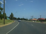 |
Eastbound at Kembla Grange: Heading towards the Southern Freeway (NR1) from the Princes Highway (SR60) on Northcliffe Drive. January 2006. Image © Paul Rands |
 |
Intesection Directional Sign: ID sign on Princes Hwy (SR60) at the Five Islands Rd (SR155) junction at Unanderra. June 2010. Image © Paul Rands |
|
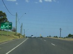 |
South Freeway AD Sign: Signage for the Southern Fwy (NR1) interchange at Kembla Grange on Northcliffe Dr. January 2006 Image © Paul Rands |
 |
Advance Directional Sign: AD sign on Five Islands Rd (SR155) approaching Southern Fwy (NR1) and Marley Pl, June 2010. Image © Paul Rands |
|
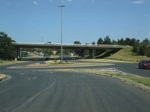 |
Southern Freeway Interchange: Eastbound on Northcliffe Drive through the Southern Freeway interchange at Berkeley. January 2006. Image © Paul Rands |
 |
Southern Freeway & Marley Place Junction: Corner of FIve Islands Rd (SR155), Southern Fwy (NR1) and Marley Pl at Unanderra, June 2010. Image © Paul Rands |
|
 |
Intersection Directional Sign: ID sign at the on ramp to the Southern Freeway (NR1) at Kembla Grange. December 2012. Image © Paul Rands |
 |
Southern Freeway & Marley Place Junction: Corner of FIve Islands Rd (SR155), Southern Fwy (NR1) and Marley Pl at Unanderra, June 2010. Image © Paul Rands |
|
 |
Southern Freeway Interchange: Eastbound on Northcliffe Drive through the Southern Freeway interchange at Berkeley. January 2006. Image © Paul Rands |
 |
Southern Freeway & Marley Place Junction: Corner of FIve Islands Rd (SR155), Southern Fwy (NR1) and Marley Pl at Unanderra, June 2010. Image © Paul Rands |
|
 |
Intersection Directional Sign: ID sign at the on ramp to the Southern Freeway (NR1) at Berkeley. December 2012. Image © Paul Rands |
 |
Advance Directional Sign: AD sign approaching Southern Fwy (NR1) and Glastonbury Av in Unanderra, September 2009. Image © Paul Rands |
|
 |
Eastbound at Berkeley: Eastbound on Northcliffe Drive at Berkeley, December 2012. Image © Paul Rands |
 |
Intersection Directional Sign: ID sign at the Southern Fwy (NR1) interchange at Unanderra. Image © Paul Rands |
|
 |
Northcliffe Drive: Eastbound on Northcliffe Drive, between King Street and Shellharbour Road at Warrawong, near the shopping centre. May 2007. Image © Paul Rands |  |
Intersection Directional Sign: ID sign at the Southern Fwy (NR1) interchange at Unanderra Image © Paul Rands |
|
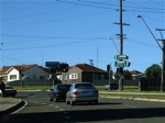 |
Northcliffe Drive / Shellharbour Road Intersection: Eastbound on the corner of Northcliffe Drive and Shellharbour Road at Warrawong, May 2007. These signals were setup in the early 1990s. Image © Paul Rands | 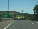 |
AD Sign: Advance directional sign on the southbound ramp from the Southern Fwy (NR1) as it connects to Five Islands Rd (SR155) at Unanderra. December 2006. Image © Paul Rands |
|
 |
Illawarra Street: Eastbound in Port Kembla on Illawarra Street, May 2007. Image © Paul Rands | 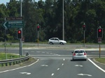 |
Five Islands Rd / Southern Fwy Interchange: Southbound off ramp at Unanderra. December 2006. Image © Paul Rands |
|
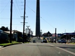 |
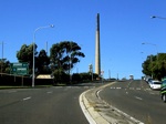
Church Street: Eastbound on Church Street in Port Kembla, May 2007. Note the Electrolytic Refining and Smelting Co (ER & S) chimney - it was 650 feet above ground level and has since been demolished. Building of the stack began in 1960 by Tileman and Co and consisted of concrete (9800 tons), bricks (220 000) and steel reinforcement (531 tons). The total weight of the stack was 14 000 tons.2 Image © Paul Rands |
 |
Glastonbury Avenue Roundabout: Looking southwest at Unanderra. December 2006. Image © Paul Rands |
|
 |
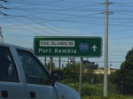
Advance Directional Sign : AD sign approaching Military Rd, Port Kembla , May 2007. Image © Paul Rands |
 |
ID Sign: Intersection directional sign on the Glastonbury Av roundabout at Unanderra. May 2007. Image © Paul Rands |
|
 |
Military Road : Military Rd junction in Port Kembla, May 2007. SR155 turns left at this junction. Image © Paul Rands |
 |
RD Sign: Looking southwest at Unanderra on Five Islands Road as you pass the distance sign after the Glastonbury Av roundabout. September 2009. Click here for a photo of the previous sign taken in December 2006. Image © Paul Rands |
|
 |
Old Port Road : Corner of Military Rd (SR155) and Old Port Rd (SR155) in Port Kembla, May 2007. Image © Paul Rands |
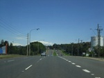 |
Typical Conditions: Looking southwest on Five Islands Road near the BHP Centenary Park at Unanderra. December 2006. Image © Paul Rands |
|
 |
Port Kembla : Old Port Rd as it passes through the heavy industrial area of the suburb. May 2007. Image © Paul Rands |
 |
Advance Directional Sign: Looking southwest at the advance directional sign for Springhill Road at Cringila. September 2009. Image © Paul Rands |
|
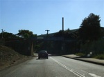 |
Railway Overpass : BHP Biliton internal railway overpass on Old Port Road (near old power house) at Port Kembla, May 2007. Image © Paul Rands |
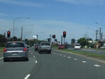 |
Springhill Road Intersection: Five Islands Road as it meets Springhill Road (SR155) at Cringila. December 2006. The SR155 duplex begins here. Image © Paul Rands |
|
 |
Flinders Street: Looking southwest on Flinders St (SR155) in Port Kembla North, near the fuel storage facility and coke ovens of the steelworks, May 2007. Image © Paul Rands |
 |
Lake Avenue Intersection: Looking east at the Lake Av intersection at Cringila. December 2006. Image © Paul Rands |
|
 |
Advance Directional Sign: AD sign for the Five Islands Rd junction at Port Kembla North. May 2007. Image © Paul Rands |
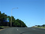 |
AD Sign: Advance directional sign approaching the junction of Five Islands Road (SR155), King Street (SR151) and Wattle Street at Port Kembla. May 2007. The SR151 duplex ends at this junction. Image © Paul Rands |
|
 |
Intersection Directional Sign: ID sign facing Flinders Street Port Kembla North, May 2007. Image © Paul Rands |
 |
Five Islands Road: Eastbound on Five Islands Road at Port Kembla. May 2007. Image © Paul Rands |
|
 |
Intersection Directional Sign: ID sign on the corner of Springhill Road and Five Islands Road at Cringila. Downer, December 2006. Image © Paul Rands |
 |
Home Street Intersection: Eastbound on Five Islands Road in Port Kembla at the Home Street intersection with former Wentworth Road road reservation behind the trees in right of shot. May 2007. Image © Paul Rands |
|
 |
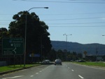
Advance Directional Sign: AD sign for the Glastonbury Av intersection and Southern Fwy interchange, at Unanderra. December 2006. Image © Paul Rands |
 |
AD Sign: Advance directional sign as Five Islands Road meets Old Port Road, Military Road (all 3 roads signposted as SR155) and Darcy Road. May 2007. Image © Paul Rands |
|
 |
Glastonbury Avenue AD Sign: Another advance directional sign for Glastonbury Avenue at Unanderra, December 2006. Image © Paul Rands |
 |
Entering Berkeley: Nortchliffe Dr (SR155) near Wollomai Cr as it enters the suburb of Berkeley, December 2012. Image © Paul Rands |
|
 |
Southern Freeway Interchange: Looking northwest through the Southern Fwy (NR1) interchange at Unanderra, December 2006. Image © Paul Rands |
 |
Holborn Street & Wilkinson Street: Northcliffe Dr (SR155) at the roundabout with Holborn St and Wilkinson St, Berkeley, December 2012. Image © Paul Rands |
|
 |
Intersection Directional Sign: ID sign at the junction of Five Islands Rd (SR155), Marley Pl & Southern Fwy (NR1) at Unanderra, September 2009. Image © Paul Rands |
 |
Bedford Street and Nolan Street: Northcliffe Dr (SR155) at Berkeley at the roundabout with Bedford St & Nolan St, December 2012. Image © Paul Rands |
|
 |
Intersection Directional Sign: ID sign at the junction of Five Islands Rd (SR155), Marley Pl & Southern Fwy (NR1) at Unanderra, September 2009. Image © Paul Rands |
 |
Advance Directional Sign: AD sign at Berkeley approaching the interchange with Southern Fwy (NR1), December 2012. This junction was once signalised. Image © Paul Rands |
|
 |
Intersection Directional Sign: ID sign on the on ramp to Southern Fwy (NR1) at Berkeley, December 2012. Image © Paul Rands |
|||
 |
Intersection Directional Sign: ID sign on the western roundabout with the Southern Fwy interchange at Kembla Grange, December 2012. Image © Paul Rands |
|||
 |
Advance Directional Sign: AD sign at Kembla Grange approaching Princes Hwy (SR60), December 2012. Image © Paul Rands |
|||
 |
Intersection Directional Sign: ID sign on Northcliffe Dr (SR155) at the junction with Princes Hwy (SR60) at Kembla Grange, December 2012. Image © Paul Rands |
|||
 |
Intersection Directional Sign: ID sign on Northcliffe Dr (SR155) at the junction with Princes Hwy (SR60) at Kembla Grange, December 2012. This is the southern terminus of SR155. Image © Paul Rands |
|||
1 Roads & Traffic Authority
2 Wollongong City Council
Last updated: 20:30:0 21/3/2016.
This site © Paul Rands. All rights reserved. Some portions © (copyright) by their respective and credited owners. Permission must be obtained before using any images from this site. For details, please email by clicking here.