| |
| |
 |
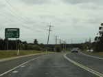
Advance Directional Sign :
AD sign at Anna Bay on Gan Gan Rd approaching Nelson Bay Rd (SR122), July 2012.
Image © Paul Rands |
|
 |
Intersection Directional Sign :
ID sign on the roundabout with Salt Ash Av and Richardson Rd at Salt Ash, July 2012.
Image © Paul Rands |
 |
Supplemental Advance Directional Sign :
Supplemental AD sign at Anna Bay approaching Jessie Rd & Port Stephens Rd, July 2012.
Image © Paul Rands |
|
|
|
 |
Advance Directional Sign :
AD sign at Anna Bay approaching Jessie Rd & Port Stephens Rd, July 2012.
Image © Paul Rands |
|
|
|
 |
Intersection Directional Sign :
ID sign at Anna Bay at the roundabout with Jessie Rd & Port Stephens Rd, July 2012.
Image © Paul Rands |
|
|
|
 |
Wildlife Sign :
Wildlife warning and hotline sign, Anna Bay, July 2012.
Image © Paul Rands |
|
|
|
 |
Trotter Road :
Intersection directional sign at Trotter Rd, Anna Bay, July 2012.
Image © Paul Rands |
|
|
|
 |
Entering Bobs Farm :
Entering the town of Bobs Farm, July 2012.
Image © Paul Rands |
|
|
|
 |
Divided Road Ahead :
Sign denoting distance to next stretch of divided road, Bobs Farm, July 2012.
Image © Paul Rands |
|
|
|
 |
Divided Road:
Restart of divided road conditions at Bobs Farm, July 2012.
Image © Paul Rands |
|
|
|
 |
Advance Directional Sign :
AD sign at Bobs Farm, approaching Marsh Rd, July 2012.
Image © Paul Rands |
|
|
|
 |
Marsh Road :
Corner of Nelson Bay Rd and Marsh Rd, Bobs Farm, July 2012.
Image © Paul Rands |
|
|
|
 |
Typical Conditions :
Typical divided road conditions, Bob Farm, July 2012.
Image © Paul Rands |
|
|
|
 |
Entering Salt Ash :
End of divided road as Nelson Bay Rd (SR122) enters the town of Salt Ash, July 2012.
Image © Paul Rands |
|
|
|
 |
Divided Road Ahead :
Sign denoting distance to next stretch of divided road, Salt Ash, July 2012.
Image © Paul Rands |
|
|
|
 |
Advance Directional Sign :
AD sign at Salt Ash, approaching Oakvale Dr and Lemon Tree Passage Rd, July 2012.
Image © Paul Rands |
|
|
|
 |
Supplemental Advance Directional Sign :
Supplemental AD sign at Salt Ash, approaching Oakvale Dr and Lemon Tree Passage Rd, July 2012.
Image © Paul Rands |
|
|
|
 |
Intersection Directional Sign :
ID sign on the roundabout with Oakdale Dr and Lemon Tree Passage Rd, Salt Ash, July 2012.
Image © Paul Rands |
|
|
|
 |
Advance Directional Sign :
AD sign at Salt Ash, approaching the roundabout with Richardson Rd and Salt Ash Av, July 2012.
Image © Paul Rands |
|
|
|
 |
Intersection Directional Sign :
ID sign at Salt Ash, on the roundabout with Richardson Rd and Salt Ash Av, July 2012.
Image © Paul Rands |
|
|
|
 |
Distance Sign:
Westbound RD sign after the Nelson Bay Road roundabout at Williamtown. August 2007.
Image © Paul Rands |
|
|
|
 |
Typical Conditions:
The average conditions along Cabbage Tree Road, mostly rural farmlets in this area between Williamtown and Tomago.
August 2007
Image © Paul Rands |
|
|
|
 |
Masonite Road Intersection:
Westbound through the Masonite Road intersection at Tomage. Masonite Road connects Tomago directly to Raymond Terrace. August 2007.
Image © Paul Rands |
|
|
|
 |
AD Sign:
Advance directional sign at Tomago as you approach the Old Punt Road roundabout, August 2007.
Image © Paul Rands |
|
|
|
 |
Distance Sign:
Westbound RD sign after the Old Punt Rd intersection at Tomago, August 2007.
Image © Paul Rands |
|
|
|
 |
Pacific Hwy Approach:
Westbound advance directional sign as you approach the Pacific Hwy at Tomago. August 2007.
Note the incorrect NH1 shield, it should be a black and white NR1 shield.
Image © Paul Rands |
|
|
|
 |
End SR122:
Western terminus for State Route 122, the Pacific Highway (NR1) at Tomago. This photo was taken before the upgrade to the intersection, August 2007.
Note the incorrect NH1 shield.
Image © Paul Rands |
|
|
|
