|
|
 |
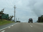
AD Sign:
Eastbound advance directional sign on Griffiths Road in Broadmeadow as you approach the Turton Road intersection.
May 2007.
Image © Paul Rands |
|
 |
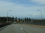
Stockton Bridge:
Nelson Bay Rd (SR121) at Stockton Bridge over the north arm of Hunter River at Stockton, 2009.
Image © Jamie Scuglia |
 |
Vine Street / Industrial Drive:
Westbound on Industrial Dr (SR124) approaching the Vine St (SR121) intersection in Mayfield.
August 2007.
Image © Paul Rands |
|
|
|
 |
Advance Directional Sign:
Westbound AD on Industrial Drive approaching the junction with Tourle Street in Mayfield.
August 2007.
Image © Paul Rands |
|
|
|
 |
Distance Sign:
Northbound RD on Tourle Street in Mayfield North.
August 2007.
Image © Paul Rands |
|
|
|
 |
Tourle Street Bridge:
Northbound over the Hunter River via the Tourle Street Bridge at Mayfield North. August 2007.
Image © Paul Rands |
|
|
|
 |
Tourle Street Bridge Deck:
Built in 1965, this is the deck of the Tourle Street Bridge as you travel northbound at Mayfield North, August 2007.
Image © Paul Rands |
|
|
|
 |
Cormorant Road:
Travelling southeast on Cormorant Road at Kooragang with the coal loader in the distance, August 2007.
Image © Paul Rands |
|
|
|
 |
Teal St / Cormorant Rd Roundabout:
Travelling southeast at Kooragang approaching the intersection of Teal Street and Cormorant Road, SR121 turns left here. August 2007.
Image © Paul Rands |
|
|
|
 |
Teal Street:
Looking northeast at Kooragang near Raven St, August 2007.
Image © Paul Rands |
|
|
|
 |
Crossing Cormorant Road & Railway:
Looking southeast at Kooragang as you cross Cormorant Road, August 2007.
Image © Paul Rands |
|
|
|
 |
Stockton Bridge:
View from the southern end of the Stockton Bridge, Kooragang, August 2007.
Image © Paul Rands |
|
|
|
 |
Greenleaf Rd Interchange:
Exit ramp to Greenleaf Road as you approach Stockton Bridge, August 2007.
Image © Paul Rands |
|
|
|
 |
Stockton Bridge:
Stockton Bridge looking east from Kooragang, 2009.
Image © Jamie Scuglia |
|
|
|
 |
Stockton Bridge:
Stockton Bridge looking east from Kooragang, 2009.
Image © Jamie Scuglia |
|
|
|
 |
Stockton Bridge:
SR121 becomes Nelson Bay Road here at the Stockton Bridge (opened 1971), note the handpainted sign, August 2007.
Image © Paul Rands |
|
|
|
 |
Stockton Bridge Deck:
Eastbound as you near the crest of the Stockton Bridge over the Hunter River, August 2007.
Image © Paul Rands |
|
|
|
 |
Stockton Bridge Deck:
Descending Stockton Bridge at Fern Bay. August 2007.
Image © Paul Rands |
|
|
|
 |
Nelson Bay Road:
A section of Nelson Bay Rd, which connects to Stockton Bridge at Stockton, built on reclaimed land, 2009.
Image © Jamie Scuglia |
|
|
|
 |
Advance Directional Sign:
Looking northeast on Nelson Bay Rd as you approach the intersection with Fullerton St at Fern Bay, August 2007.
Image © Paul Rands |
|
|
|
 |
Distance Sign:
Northbound on Nelson Bay Road at Fern Bay after the Fullerton Street junction.
August 2007.
Image © Paul Rands |
|
|
|
 |
Advance Directional Sign:
AD sign as you travel northeast at Fullerton Cove approaching Fullerton Cove Rd & Seaside Blvd. Note the coverplated B63 shield.
August 2007.
Image © Paul Rands |
|
|
|
 |
Fullerton Cove Rd & Seaside Blvd Intersection:
Approaching the roundabout as you head northeast on Nelson Bay Rd in Fullerton Cove.
August 2007.
Image © Paul Rands |
|
|
|
 |
Advance Directional Sign:
Northbound at Williamtown approaching the roundabout with Cabbage Tree Rd and Lavis Ln.
August 2007.
This sign shows SR121 duplexed with SR122, this is no longer the case, the route SR121 used to follow beyond the roundabout was Medowie Road.
Image © Paul Rands |
|
|
|
