Road Photos &
Information: New South Wales
| A36 |
|
City Road, King Street and Princes Highway (A36) |
Statistics:
- Length: 11 km
- Northern Terminus: Parramatta Road (A22) at Chippendale
- Southern Terminus: Princes Highway (A1) and President Avenue (A1) at Kogarah
- Suburbs, Towns & Localities Along Route: Chippendale, Darlington, Newtown, St Peters, Alexandria, Sydenham, Tempe, Wolli Creek, Arncliffe, Rockdale, Banksia and Kogarah
Route Numbering:
- Former:


- Road Authority Internal Classification: HW1 1
General Information:
A36 is a suburban arterial route linking the Sydney CBD with the city's inner-southern suburbs.
The route is a mix of divided and undivided multi-laned road and passes through mostly residental and commercial areas.
History:
- August 1920: Official opening of Princes Highway performed at Warragul in Victoria. The formation of the Princes Highway is from existing roads being renamed, after the visit to Australia in 1920 of the Prince of Wales (later to become King Edward VIII, and after abdicating, the Duke of Windsor).
- 1925: Work begins on widening Cooks River Road (later Princes Highway) from Cooks River bridge to the railway bridge at St Peters. 2
- 7 June 1926: The Princes Highway comes under a federal and state government £ for £ funding scheme, thus recognizing the importance of the highway as major route.
- 1927: Ruling put in place so that any new buildings along Princes Highway (King Street) in Newtown would be built further back from the road, so a wider alignment could be constructed. 3
- 1 July 1928: Princes Highway became a state highway. 4
- 1929: Widening and resurfacing of Princes Highway at Rockdale, Kogarah and Alexandria. 5
- 1938: Widening of Princes Highway at St Peters and Rockdale. 6
- 1939: By the middle of the year, 300 miles (or 50% of the then highway) had been paved with bitumous surface.
- 1951: Construction of reinforced concrete bridge over Muddy Creek at Rockdale. Widening of Princes Highway at Kogarah, between Kogarah Bay Creek and Park Road, for a distance of approximately 500m. 7
- 1953: Widening of Princes Hwy to 6 lanes between Catherine and Bay Streets, Rockdale. 8
- 1960: Pavement widening to provide a six-lane divided carriageway between Forest Road and Spring Street, Banksia, was commenced. 9
- 1961: A kerbed median was provided between May Street, St. Peters and Cook's River. 10
- 1962: Pavement widening to provide a six-lane divided carriageway with kerbed median between Forest Road and Spring Street, Banksia, was completed. 11
- 1964: An area formerly occupied by tram tracks in City Road (Princes Highway) between Cleveland Street and Carillon Avenue was reconstructed. Pavement widening to provide a divided six-lane carriageway between Banksia Avenue and Bay Street Rockdale, was completed. 12
- 1970: Reconstruction was completed between Bay Street and Catherine Street, Rockdale, together with the intersection of Harrow Road and the intersection known as Seven Ways. 13
- 1973: Completion of adjustments to the intersection at Gannon Street and Princes Highway, Tempe. 14
- 1976: Channelisation of the intersection of Princes Highway and The Seven Ways, Rockdale. 15

| |
| |
 |
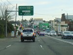
Advance Directional Sign:
AD sign on Forest Rd at Arncliffe approaching Princes Hwy (A36) and Wickham St, August 2013.
Image © Paul Rands |
|
 |
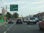
Advance Directional Sign:
AD sign at Chippendale, approaching Cleveland St, July 2013.
Image © Paul Rands |
 |
Intersection Directional Sign:
ID sign on the corner of Forest Rd, Princes Hwy (A36) and Wickham St at Arncliffe, August 2013.
Image © Paul Rands |
|
 |
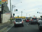
Cleveland Street:
Corner of City Rd (A36) and Cleveland St in Chippendale, July 2013.
Image © Paul Rands |
 |
Advance Directional sign:
AD sign on Railway Rd approaching Princes Hwy (A36) at Sydenham, October 2013.
Image © Spenser Tan |
|
 |
Reassurance Directional Sign:
Distance sign at Darlington, July 2013.
Image © Paul Rands |
| |
|
|
 |
Carillon Avenue:
Corner of City Rd (A36) and Carillon Av in Darlington, July 2013.
Image © Paul Rands |
| |
|
|
 |
Missenden Road:
King St (A36) at the Missenden Rd junction in Newtown, July 2013.
Image © Paul Rands |
| |
|
|
 |
Advance Directional Sign:
AD sign on King St (A36) in Newtown approaching Enmore Rd (A34), July 2013.
Image © Paul Rands |
| |
|
|
 |
Enmore Road / King Street Split:
King St (A36) at the Enmore Rd (A34) intersection in Newtown, July 2013.
Image © Paul Rands |
| |
|
|
 |
Lord Street & Sydney Park Road:
King St (A36), Newtown with the Lord St and Sydney Park Rd junction, July 2013. A36 becomes Princes Hwy (A36) at this junction.
Image © Paul Rands |
| |
|
|
 |
Advance Directional Sign:
AD sign approaching May St, Alexandria, July 2013.
Image © Paul Rands |
| |
|
|
 |
May Street:
Corner of Princes Hwy (A36) and May St, Alexandria, July 2013.
Image © Paul Rands |
| |
|
|
 |
Advance Directional Sign:
AD sign at St Peters, approaching Canal Rd, July 2013.
Image © Paul Rands |
| |
|
|
 |
Canal Road:
Corner of Princes Hwy (A36) and Canal Rd, St Peters, July 2013.
Image © Paul Rands |
| |
|
|
 |
Advance Directional Sign:
AD sign approaching Railway Rd in Sydnenham, July 2013.
Image © Paul Rands |
| |
|
|
 |
Intersection Directional Sign:
ID sign at Railway Rd in Sydnenham, July 2013.
Image © Paul Rands |
| |
|
|
 |
Entering Tempe:
Princes Hwy (A36) as it enters the suburb of Tempe, July 2013.
Image © Paul Rands |
| |
|
|
 |
Advance Directional Sign:
AD sign approaching West Botany St, Wolli Creek, August 2013.
Image © Paul Rands |
1 Roads & Maritime Services, Schedule of Classified Roads and Unclassified Regional Roads, August 2013.
2 Main Roads Board, Annual Report, 1925-26
3 Roads & Maritime Services
4 Main Roads Board, Annual Report, Volume 1, Number 1, September 1929.
5 Main Roads Board, Annual Report, 1929-30
6 Department of Main Roads, Annual Report, 1937-38
7 Department of Main Roads, Annual Report, 1951-52
8 Department of Main Roads, Annual Report, 1953-54
9 Department of Main Roads, Annual Report, 1959-60
10 Department of Main Roads, Annual Report, 1960-61
11 Department of Main Roads, Annual Report, 1961-62
12 Department of Main Roads, Annual Report, 1963-64
13 Department of Main Roads, Annual Report, 1969-70
14 Department of Main Roads, Annual Report, 1972-73
15 Department of Main Roads, Annual Report, 1976-77
Last updated: 02-Jan-2019 19:21
This site ©
Paul Rands. All rights reserved. Some portions © (copyright) by their
respective and credited owners. Permission must be obtained before using
any
images from this site. For details, please email by clicking
here.


