|
|
|
|
|
Statistics:
Route Numbering:
General Information:
Parkes Way is located along the northern foreshore of Lake Burley Griffin and is a major east-west route for traffic to and from the airport, Civic, and parts of Belconnen, Woden and Tuggeranong.
It's divided for its enitre length and travels via tunnel under the Australian National University (ANU).
Major routes Parkes Way connects to include Tuggeranong Parkway, William Hovell Drive, Commonwealth Avenue (A23), Anzac Parade and Moreshead Drive.
The road is named after Sir Henry Parkes, who was a legislator, federalist and one of the Founders of the Constitution. He became Premier of New South Wales in 1872, advocating union of the Australian colonies from 1867. He died 1896 before the first Federal Parliament. 1
History:
Click here for construction photos of the Kings Way / Parkes Way / Morshead Drive interchange.

| Russell To Glenloch Interchange | Glenloch Interchange to Russell | |||
| Preview: | Description: | Preview: | Description: | |
 |
Advance Directional Sign: AD sign approaching Kings Av interchange at Barton, October 2013. Image © Paul Rands |
 |
Parkes Way from Black Mountain: Image © Paul Rands |
|
 |
Kings Avenue: Parkes Way at Barton as it passes under Kings Av, October 2013. Image © Paul Rands |
 |
Distance Sign: Eastbound RD sign just after the Glenloch Interchange near Acton, December 2009. Image © Paul Rands |
|
 |
Lane Allocation Sign: Special lane allocation sign approaching the roundabout with Anzac Pde in Parkes, October 2013. Image © Paul Rands |
 |
Entering the North Canberra Region: Parkes Way near Acton, as you head into Civic, December 2009. Image © Paul Rands |
|
 |
Advance Directional Sign: AD sign at Campbell approaching Anzac Parade, February 2010. Image © Paul Rands |
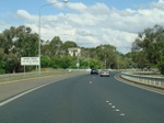 |
Clunies Ross Street Interchange: Eastbound at the Clunies Ross Street interchange at Acton, December 2009. Image © Paul Rands |
|
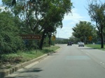 |
Intersection Directional Sign: ID sign for the car park for Commonwealth Park, February 2010. Image © Paul Rands |
 |
Advance Directional Sign: AD sign at Acton for the Edinburgh Avenue interchange, January 2014. Click here for a photo of this location from December 2009. Image © Paul Rands |
|
 |
Anzac Parade Roundabout: Signage as you exit the Anzac Parade roundabout at Campbell, February 2010. Image © Paul Rands |
 |
Supplemental Advance Directional Sign: Supplemental AD sign at Acton for the Edinburgh Avenue interchange, January 2014. Click here for a photo of this location from December 2009. Image © Paul Rands |
|
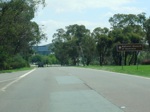 |
Advance Directional Sign: AD sign on Parkes Way at Campbell, February 2010. Image © Paul Rands |
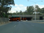 |
Approaching Acton Tunnel: Eastbound at Acton, approaching the tunnel under Australian National University (ANU), December 2009. Image © Paul Rands |
|
 |
Advance Directional Sign: Diagrammatic AD sign and conventional AD sign at Campbell approaching the Coranderrk St roundabout, February 2010. Image © Paul Rands |
 |
Acton Tunnel: Eastbound at Acton, at the entrance to the tunnel under Australian National University (ANU), January 2014. Click here for a photo of this location from December 2009. Image © Paul Rands |
|
 |
Coranderrk Street Roundabout: ID sign on the exit from Coranderrk St roundabout at Campbell, February 2010. Image © Paul Rands |
 |
Inside Acton Tunnel: Eastbound through the tunnel at Acton, December 2009. Image © Paul Rands |
|
 |
Advance Directional Sign: AD sign at Civic approaching Commonwealth Av (A23) interchange, February 2010. Note Telstra Tower in the distance, atop Black Mountain. Image © Paul Rands |
 |
Edinburgh Avenue Interchange: Eastbound at Acton at the Edinburgh Av interchange, January 2014. Click here for a photo of this location from December 2009. Image © Paul Rands |
|
 |
Commonwealth Avenue Interchange: Parkes Way at the Commonwealth Av (A23) interchange in Civic, February 2010. Image © Paul Rands |
 |
Edinburgh Avenue Interchange: Eastbound at Acton at the Edinburgh Av interchange, December 2009. Image © Paul Rands |
|
 |
Advance Directional Sign: AD sign at Civic, next to the Commonwealth Av bridge for the interchange with Lawson Cres and Edinburgh Av, February 2010. Image © Paul Rands |
 |
Black Intersection Directional Sign: Black ID sign on the off ramp from Commonwealth Av (A23) to London Cct and Parkes Way at Civic, October 2013. Image © Paul Rands |
|
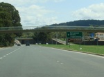 |
Lawson Crescent & Edinburgh Avenue Interchange: Westbound at Civic at the interchange with Lawson Cres and Edinburgh Av, February 2010. Image © Paul Rands |
 |
Eastbound at Civic: Heading east on Parkes Way as you pass under the footbridge that connects Marcus Clarke Street to Kuttabul Place and the west basin of Lake Burley Griffin, December 2009. Click here for a photo of the old sign that was in this place back in July 2006. Image © Paul Rands |
|
 |
Lawson Crescent & Edinburgh Avenue Interchange: Westbound at Civic at the interchange with Lawson Cres and Edinburgh Av, February 2010. Image © Paul Rands |
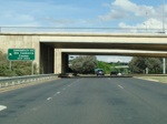 |
Commonwealth Avenue Interchange: Eastbound at Civic at the Commonwealth Avenue Interchange (Commonwealth Place), December 2009. Image © Paul Rands |
|
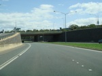 |
Lawson Crescent & Edinburgh Avenue Interchange: Westbound at Civic at the interchange with Lawson Cres and Edinburgh Av, February 2010. Image © Paul Rands |
 |
Commonwealth Avenue Interchange: Eastbound at Civic at the Commonwealth Avenue Interchange (Commonwealth Place), December 2009. Image © Paul Rands |
|
 |
Approaching Acton Tunnel: Westbound at Acton, approaching the tunnel under Australian National University (ANU), December 2009. Image © Paul Rands |
 |
Advance Directional Sign: Eastbound AD sign as you approach the roundabout with Coranderrk Street at Civic, October 2013. Click here for a photo of this location from December 2009 by Paul Rands. Image © Paul Rands |
|
 |
Acton Tunnel: Westbound at Acton, at the entrance to the tunnel under Australian National University (ANU), December 2009. Image © Paul Rands |
 |
ID Sign: Intersection directional sign on the corner of Parkes Way and Coranderrk Street, Civic, eastbound. October 2013. Click here for a photo of this location from December 2009 by Paul Rands Image © Paul Rands |
|
 |
Inside Acton Tunnel: Westbound through the tunnel at Acton, December 2009. Image © Paul Rands |
 |
ID Sign: Intersection directional sign on the corner of Parkes Way and Coranderrk Street, Reid, December 2009. Image © Paul Rands |
|
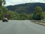 |
Advance Directional Signs: AD signs at Acton approaching the interchange with Clunies Ross St & Lady Denman Dr, February 2010. Image © Paul Rands |
 |
Advance Directional Sign: AD sign at Reid approaching the Anzac Avenue roundabout, December 2009. Image © Paul Rands |
|
 |
Advance Directional Sign: AD sign at Acton approaching the interchange with Clunies Ross St & Lady Denman Dr, February 2010. Image © Paul Rands |
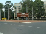 |
Intersection Directional Sign: ID sign at the Anzac Avenue roundabout at Reid, December 2009. Image © Paul Rands |
|
 |
Clunies Ross Street & Lady Denman Drive Interchange: Parkes Way at Acton, at the interchange with Clunies Ross St & Lady Denman Dr, February 2010. Image © Paul Rands |
 |
Intersection Directional Sign: ID sign at the Anzac Avenue roundabout at Campbell, January 2014. Image © Paul Rands |
|
 |
Distance Sign: RD sign at Acton after the interchange with Clunies Ross St & Lady Denman Dr, February 2010. Image © Paul Rands |
 |
Advance Directional Sign: AD sign approaching the Kings Avenue interchange at Russell, October 2013. Click here for a photo of this location from December 2009 by Paul Rands, plus a photo of the old sign approaching the former roundabout and a photo of the old ID sign on the former roundabout. Image © Paul Rands |
|
 |
Advance Directional Sign: AD sign approaching Glenloch Interchange at the base of Black Mountain, February 2010. Note the incorrect spelling of William. This has since been corrected. Image © Paul Rands |
 |
Kings Avenue: Eastbound at Russell at the Kings Avenue interchange, October 2013. Image © Paul Rands |
|
1 ACT Planning & Land Authority, Place Name Search, Parkes Way
2 Canberra Times, Page 4, 29 November 1961
3 National Library of Australia.
4 Canberra Times, Page 7, 4 April 1963
5 Canberra Times, Page 10, 16 October 1979
6 Department of Infrastructure, Transport, Regional Development and Local Government
7 Territory and Municipal Services, Roads and Transport, Major Construction Projects, Completed Projects, Parkes Way Widening
Last updated: 28-Jan-2017 9:29
This site © Paul Rands. All rights reserved. Some portions © (copyright) by their respective and credited owners. Permission must be obtained before using any images from this site. For details, please email by clicking here.